Nyhet!

Nu kan du dela dina bilder på Naturkartan! 📸

Les mer

Beste turstier i Falun

Falun

Naturkarten samler de turstiene i Falun som er mest populære blant våre brukere.

Bilder

Kart

62 Beste turstier i Falun

Fotturer

Vildmarksleden i Bjursås

  • Kommune: Falun
  • 6625.51 km fra deg
  • 35.0 km
  • Vanskelighetsgrad: Rød

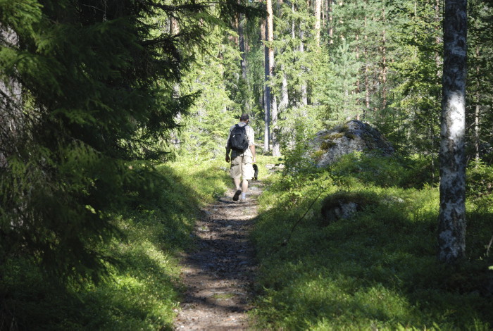
Wander the 35 km long Vildmarksleden, starting above Dössberget at the ellj, where you will experience a lot of animals and nature. The wilderness trail has been prepared by Falu municipality in collaboration with people from the resort. The basic idea was…
Fotturer

Lostigen

  • Kommune: Falun
  • 6662.81 km fra deg
  • 19.0 km
  • Vanskelighetsgrad: Blå

The trail rounds the relatively large lake Logärden and goes to several places near the water. A recommended starting point is Finngärdets fäbodar, where there is a larger parking area. The path is easy to walk with the exception of a steep climb up towards…

Fotturer

Bergsstigen

  • Kommune: Falun
  • 6647.29 km fra deg
  • 11.0 km
  • Vanskelighetsgrad: Rød

Essentially nature trail. Follows along the entire nature reserve's outskirts. Passes several views, including "Högsta punkten" and Lärkstugan. The trail also makes a detour to the Kolarkojan. All the joints start at Lugnets track center, at the ski stadium…

Fotturer

Jungfrubergsstigen

  • Kommune: Falun
  • 6647.29 km fra deg
  • 5.0 km
  • Vanskelighetsgrad: Blå

Start at Lugnet track center and start walking past the dam towards Junfruberget. The trail is easy going but has a lot of roots and stones throughout the trip on the part that goes on trails. At the highest point of the tour, a nice view of Lake Varpan is…

Fotturer

Vattnets väg till gruvan

  • Kommune: Falun
  • 6639.57 km fra deg
  • 37.5 km

Welcome to walk along paths and roads in Sweden's oldest, preserved system of waterways to a mine - with lakes, ponds, canals and ditches in the mountains northwest of Falu Gruva. Here you can see medieval hut sites, beautiful mountain manor houses, ponds a…

Fotturer

Bäverleden

  • Kommune: Falun
  • 6631.13 km fra deg
  • 7.0 km

The trail stretches over the top of Bjursberget with a wonderful view of the countryside and the lake Bjursen and Rogsjön. It passes some small marshes, which is why boots are recommended. Heavy increase the first third of the trail. Bjursås Sockenråd is re…

Fotturer

Kyrkbytjärn runt

  • Kommune: Falun
  • 6657.64 km fra deg
  • 3.0 km
  • Vanskelighetsgrad: Grønn

Kyrkbytjärn runt is a three kilometer long hiking trail in a beautiful environment. Here you walk through both dense deciduous forest and an open landscape with fields and pastures. For long stretches you also have a nice view of the tarn with its rich bird…

Fotturer

Sundbornsleden-Råbergsslingan

  • Kommune: Falun
  • 6653.42 km fra deg
  • 30.0 km
  • Vanskelighetsgrad: Rød

You can walk the entire Sundborn trail that starts at Bondes Gård in Sundborn (28 km) or choose Råbergsslingan (18 km) which is part of the Sundborn trail and starts from the bandy rink at the Karlsbyhedens Folkets Hus. The trails are marked with blue color…

Fotturer

Isala-Åg-leden

  • Kommune: Falun
  • 6654.44 km fra deg
  • 16.0 km

The Isala-Åg trail goes on ancient pastures and roads for the transport of charcoal to the cabin in Åg. The trail goes from Isala to Åg's mill on mostly easy-going trails. Up at Ågsberget it can be experienced a bit steeper. The idyll of Ågs Bruk with Åg's…

Fotturer

Stugstigen

  • Kommune: Falun
  • 6649.04 km fra deg
  • 5.0 km

Stugstigen is one of several marked trails within Lugnets Nature Reserve. It is easy to walk but with many climbs, so take it easy and enjoy the surroundings. You decide where you want to start your hike. The easiest hike is if you park your car at Sjulsarv…

Fotturer

Carl Larsson-leden

  • Kommune: Falun
  • 6648.32 km fra deg
  • 10.4 km

Carl Larsson lived in both Falun and Sundborn. As other Sundborn residents had done for hundreds of years before him, he often walked through the forest and over the mountain. He wrote: "That is how I often run and lie like a strap between my two homes." Hi…

Fotturer

Vandring längs Lurån

  • Kommune: Falun
  • 6640.69 km fra deg
  • 2.1 km

An excursion along the Lurån River is a great family adventure. It will be extra exciting if you come here in September or October when it is possible to watch trout that make their way up the river from Rogsjön to spawn. The easy way from the parking lot a…

Fotturer

Hälsans stig - Falun

  • Kommune: Falun
  • 6646.24 km fra deg
  • 9.4 km

Östanforsslingan is 4 km long and there is much to see along the way On Blindgatan, the artist Carl Larsson's town house and etching cottage are next to each other. At the Stenvalvsbron bridge, the old highway that went to northern Dalarna and to Röros in N…

Fotturer

Svärdsjöstigen

  • Kommune: Falun
  • 6654.25 km fra deg
  • 2.0 km
  • Vanskelighetsgrad: Grønn

Svärdsjöstigen is Svärdsjö's own "beach walk" that stretches two kilometers along Svärdsjön between Gruvbacken and Höganäsbadet. The trail is graveled and easy to roll with a stroller. There are no big hills here either, apart from a short climb up towards…

Fotturer

Sommarvägen och Hällvägen

  • Kommune: Falun
  • 6643.24 km fra deg
  • 14.5 km

Sommarvägen is a hiking trail that the village of Klockarnäs used to use to get to its Gammelfäbon, Nyssjön, Rotbo, Gryfs and Alderbacka mountain farms. From Alderbacka fäbod you can take the "Hällvägen" up to Falu municipality's highest point Spjärshälla (…

Beste turstier i Falun

Naturkarten samler de turstiene i Falun som er mest populære blant våre brukere.

Naturkartan

Åpne dette i appen