
-
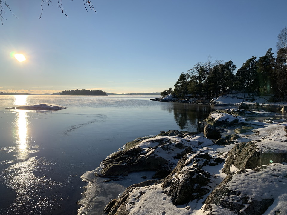
Sol och en antydan till is på Killingströmmens vatten.
Foto: Länsstyrelsen Stockholm -
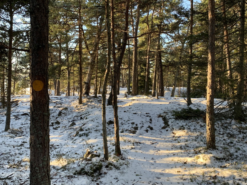
Stigen vindlar sig bland tallarna på halvön Killingen.
Foto: Länsstyrelsen Stockholm -
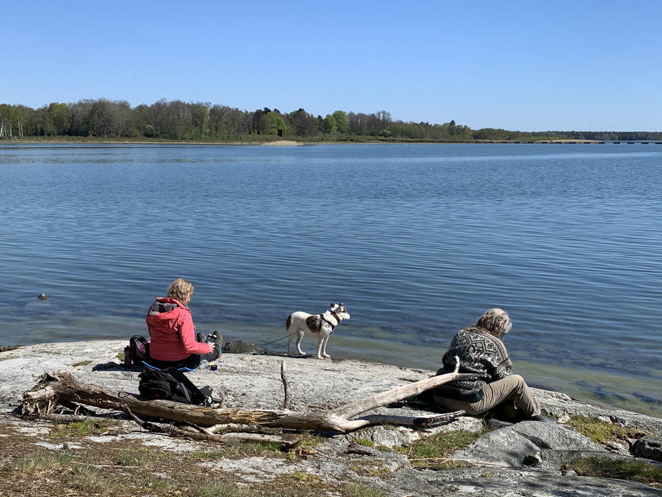
Fikapaus på Killingen. Hunden får följa med kopplad.
Foto: Länsstyrelsen Stockholm
Vandringsled Killingen runt, Sandemar
- Fotturer
- Fylke: Stockholms län
- 6862.80 km fra deg
Detaljer om stien
- Lengde 1.4 km
Handlinger
Beskrivelse
The trail around Killingen can be described as a lot of nature in a short distance. The varied path takes you across the flat beach meadows, then winds up on pine-clad rocks and down along the shores of Killingen. As the light changes from early morning to late evening, so do the landscape and colors. Enjoy the views and the scent of the pines, or take a dip in the bay.
To protect the bird life, access to the beach meadows is prohibited from 1/3 - 31/8. However, you are welcome to pass over the meadows out to Killingen: Follow the posts with orange trail markings and do not leave the path.
This trail is hilly and not adapted for accessibility.
Aktiviteter og fasiliteter
- Fotturer
Fakta
Protected since: 1997
Size: 390 hectares of which land 227 hectares
Character: mixed forest, meadow and pasture and wetland,
Municipality: Haninge
**Owners : Sandemars fideikomiss and Haninge municipality
Trustee: County Administrative Board
Form of protection : nature reserve
Other: Natura 2000 area Sandemar SE0110015
Veibeskrivelse
From the parking lot, follow the main trail towards the beach meadows. As you reach the beach meadows and cross the bridge across the canal, paths are marked with orange markers.
Forskrifter
In order to protect the Sandemar nature reserve, please respect the following rules.
Within the reserve, it is forbidden to:
- during the period of March 1 to August 31, traverse the area marked on the Sandemar reserve map as protected for birds (“Fågelskyddsområde” in Swedish),
- throughout the entire year, operate a boat or other watercraft within the area of Svärdnäsviken bay that is marked on the Sandemar reserve map,
- destroy or damage rock, soil or stone by drilling, cutting, blasting, carving, digging, painting or similar,
- break branches, fell or in any other way damage living or dead trees or bushes or damage the vegetation in general by digging up shrubs, herbaceous plants, grasses, mosses and lichens or remove fungi growing on wood,
- disturb wildlife (e.g. by climbing nesting trees, trapping or killing mammals, birds, reptiles or amphibians),
- bring dogs that are not on a leash,
- camp for more than two consecutive nights,
- make a fire outside of designated sites,
- park a motorhome or drydock a boat,
- put up a message board, placard, poster, sign or make inscriptions,
- operate motorised vehicles or bicycle off-road.
Rules 1-2 do not apply to landowners and their families, national or municipal officials on duty or maintenance staff working on behalf of the nature conservation administration that manages the area.
Kontakt
E-postadresse
Länsstyrelsen i Stockholm
Organisasjonens logotype

Jeg har vært her 5



Jeg ønsker å dra hit 5
Spørsmål og svar
Still et spørsmål til andre brukere av Naturkartan.
Omtaler
1 anmeldelse
- 5 :
- 4 :
- 3 :
- 2 :
- 1 :
Brukernes bilder
Ingen brukerbilder ennå. Bli den første til å dele!
