


Tre toppar vandringsled, Rättvik
- Fotturer
- Sirkulær slynge
- Fylke: Dalarnas län
- 6610.46 km fra deg
Detaljer om stien
- Lengde 7.5 km
- Tid 4 h
- Vanskelighetsgrad Rød – krevende
Handlinger
Beskrivelse
Aktiviteter og fasiliteter
- Fotturer
- Sirkulær slynge
Fakta
Start the hike at the lower parking lot of the slalom slope. A sign shows where the trail starts. The trail is a "round loop" so you choose which direction you want to hike. The trail is marked with orange color on trees and poles. The viewpoints are sometimes right next to the trail. Sturdy shoes are recommended as you sometimes walk on small paths. If you want to go for a shorter walk (just over half the round), you can finish at the top of the slalom hill and follow the path down the hill to the starting point.
Underlag
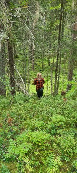
Hilly forest terrain.
Parkering
At the Rättviks Slalombacke warming hut.
Veibeskrivelse
From the center of Rättvik follow the signs towards Rättviksbacken (Slalomvägen). The trail starts at the lower parking lot of the slalom slope.
Kontakt
Adresse
+46 (0)248-700 00
E-postadresse
Rättviks kommun
Organisasjonens logotype

Jeg har vært her 31








Jeg ønsker å dra hit 61








Omtaler
3.6
5 anmeldelser
- 5 :
- 4 :
- 3 :
- 2 :
- 1 :
Spørsmål og svar
Still et spørsmål til andre brukere av Naturkartan.
Brukernes bilder
Del bildene dine fra stedet!

Lerdalshöjden var fin, i övrigt en oinspirerande vandring tyvärr. Mycket vandring i buskigt, halvuppväxt kalhygge. Ibland känslan av motionsspår. En besvikelse.