Gruvedrift/geologi

Dalarnas län

Bilder

Kart

20 Gruvedrift/geologi

Gruvedrift/geologi

Morfars ort (Erkers-fars ort)

  • Kommune: Avesta
  • 6696.26 km fra deg

Grandfars ort, or Erkers-fars ort as it is also called, is a mining village that goes about 80 meters straight into the mountain in the mining area Bensåsgruvorna. With good shoes and a flashlight, it is possible to get into the village. If you're lucky, yo…

Gruvedrift/geologi

Tombo gruva

  • Kommune: Smedjebacken
  • 6668.12 km fra deg

Hike on trails through forests and fields to Tombo mine. There are two paths from the forest road and the best car parking is at the turnaround. If you want to walk a hiking loop, from parking at the turnaround - the mine - parking along the forest road, it…

Gruvedrift/geologi

Flogbergets gruvor

  • Kommune: Smedjebacken
  • 6657.45 km fra deg

Flogberget mine is one of Sweden's few visitor mines. The mine is located high up with a mile-wide view of Lake Leran. Iron ore has been mined here since the 16th century, but it was in 1873 that mining started on a larger scale. Exciting for the visitor is…

Gruvedrift/geologi

Stollbergs gruvor Väster Silfberg

  • Kommune: Smedjebacken
  • 6654.23 km fra deg

The Stollberg mining area is an old mining area where you can look out over the expanse. Väster Silfberg, or Stollberg's mining field, is 5 km long and stretches from Schisshyttan in the north to Silfhyttan in the south. Here there are nice hiking trails, n…

Gruvedrift/geologi

Tunkarlsbo Fältspatsgruva

  • Kommune: Smedjebacken
  • 6679.82 km fra deg

Small mining area with former feldspar opencast mine that you reach via a short hike from the gravel road. In the area there are opencast mines where the forest has reclaimed the land. The area is entered at your own risk and parking is along the forest roa…

Gruvedrift/geologi

Kalkbrottet i Garpenberg

  • Kommune: Hedemora
  • 6691.74 km fra deg

The Garpenberg limestone quarry offers a dramatic setting with high rock walls and mighty boulders. Here it is easy to see the traces of mining. Even today, the impressive lime kiln from the 1860s still stands. Some plants thrive particularly well in the li…

Gruvedrift/geologi

Cedercreutz och Lustigkullagruvorna

  • Kommune: Smedjebacken
  • 6652.73 km fra deg

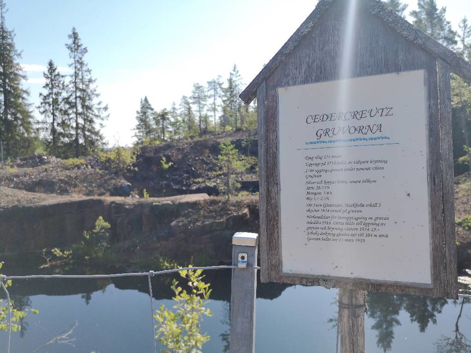
The Cedercreutz and Lustigkulla mines are an old mining area where you can look out over the expanses. The mining area can be reached by hiking from Smeleden, Schisshyttan or the Stollberg mining area. The Cedercreutz mine was closed in 1919 and in the area…

Gruvedrift/geologi

Nybergets gruvområde

  • Kommune: Smedjebacken
  • 6656.26 km fra deg

Mining area at Nyberget. The Nyberg field began to be mined in the 1600s and operations continued until 1965.  From Nyberget, a narrow-gauge railway ran via Kärrgruvan to Morgårdshammar where reloading to standard-gauge railway took place and from where the…

Gruvedrift/geologi

Koppargruvan Uvberget

  • Kommune: Smedjebacken
  • 6661.52 km fra deg

Small mining area that you can reach by hiking around Uvberget or by car on the way up to Uvberget's viewing tower. In the area there are small mining holes where the forest has reclaimed the land.

Gruvedrift/geologi

Humbobergsgruvan

  • Kommune: Smedjebacken
  • 6665.07 km fra deg

Mining area reached by hiking from Flatenberg or Humbobergsvägen. In the area there are seven mine holes with scrap stone, grounds and stone fence where the forest has reclaimed the land.

Gruvedrift/geologi

Skarviksberget gruvområde

  • Kommune: Smedjebacken
  • 6656.54 km fra deg

Skarviksbergets gruvområde är ett gammalt gruvområde som du når via vandring längs med Romboleden mellan Flogberget och Båren. I området finns ca 45 gruvhål (flertalet vattenfyllda) och ruiner där skogen har åter erövrat marken.

Gruvedrift/geologi

Malingsbo Gruva

  • Kommune: Smedjebacken
  • 6673.99 km fra deg

Gruvområde som du når via vandring längs med Himlastigen från Malingsbo Camping.  I området, som i folkmun kallas Jonssons gruva, så finns nio gruvhål med skrotsten där skogen har åter erövrat marken.

Gruvedrift/geologi

Ålsjögruvan

  • Kommune: Smedjebacken
  • 6657.93 km fra deg

Mining area at Stora Ålsjön, which you reach via Kärrgruvan and Nyberget. The Nyberg field began to be mined in the 1600s and operations continued until 1965.  From Nyberget, a narrow-gauge railway went via Kärrgruvan to Morgårdshammar where reloading to st…

Gruvedrift/geologi

Gruvorten Carls stoll

  • Kommune: Hedemora
  • 6691.92 km fra deg

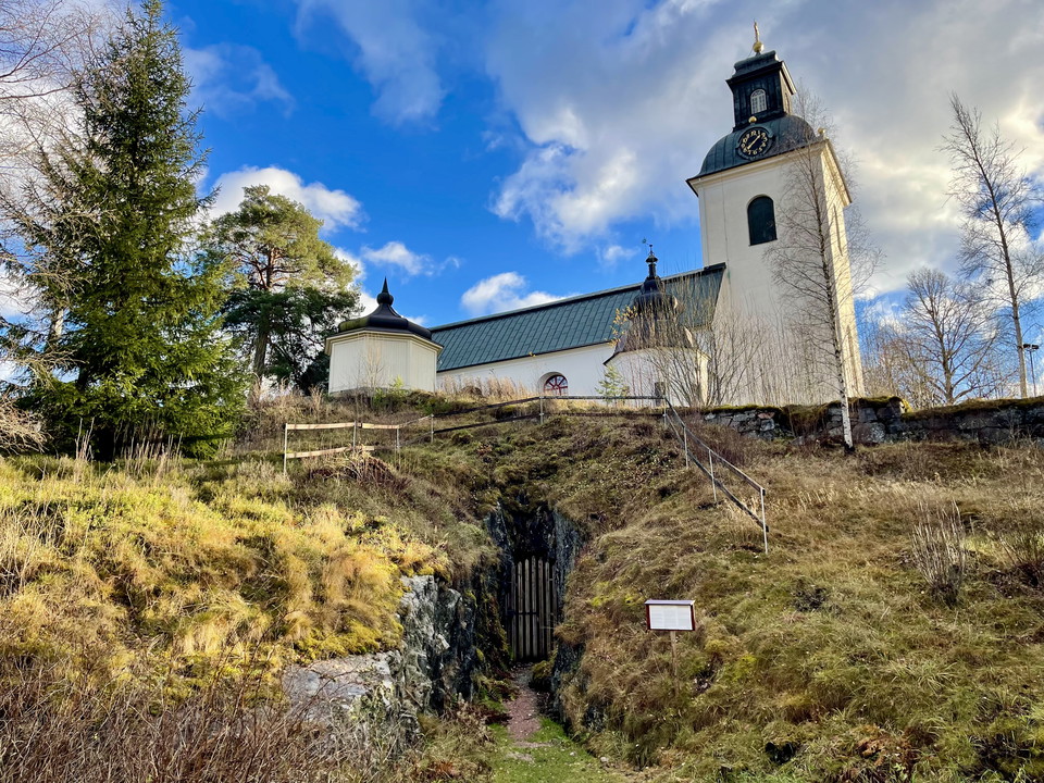
The Carls stoll mine goes straight into the rock under Garpenberg church and is open to visitors. Mining has been going on in the mine since at least the mid-18th century, probably even earlier. The shaft that goes down into the mine vertically is called He…

Gruvedrift/geologi

Båren gruvområde

  • Kommune: Smedjebacken
  • 6654.94 km fra deg

Litet gruvområde som du når via vandring från Båren. I området finns gruvhål där skogen har åter erövrat marken.

Naturkartan

Åpne dette i appen