
-
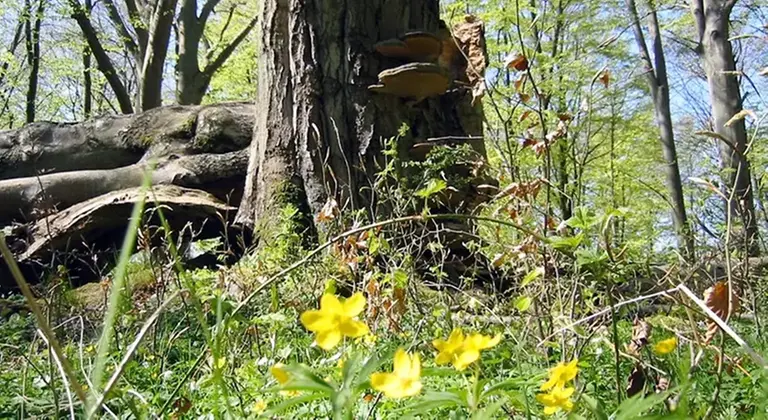
Foto: Ingegerd Erlandsson -
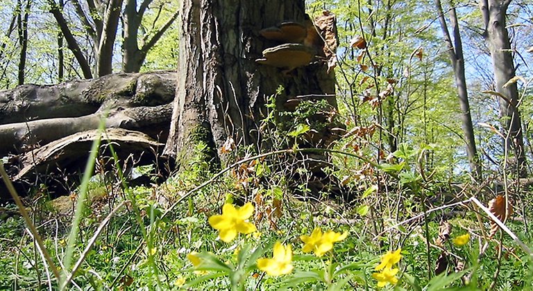
Foto: Ingegerd Erlandsson -
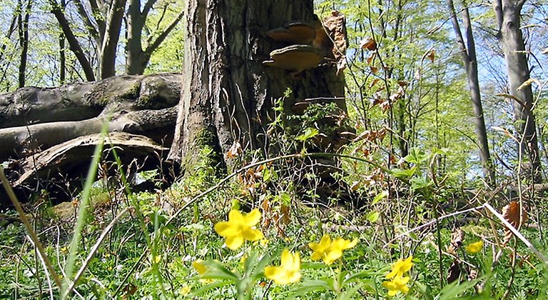
Foto: Ingegerd Erlandsson
Hjärthalla, Naturreservat
- Naturreservat
- Fylke: Blekinge län
Handlinger
Beskrivelse
The Hjärthalla nature reserve is a scenic and hiking-friendly area on one of Listerlandet's remaining mountains. Beech forest grows on the slopes and at the foot of the mountain there are species-rich natural pastures.
The varied nature provides a high biodiversity in the area. There are species of fungi and insects worthy of protection. A path leads up to the top of Hjärthalla, 60 metres above sea level, with views eastwards towards the vast agricultural landscape. The reserve is located on the southern part of Hjärthalla/Mörby backe.
Geological shaping over millions of years
Hjärthallaberget, which rises markedly above the plain, is one of the so-called residual mountains of varying height found on Listerlandet. The bedrock consists of Karlshamns granite, which is over 1000 million years old. When the last ice sheet melted 14,500 years ago, the highest coastline in the Baltic Ice Lake was formed, about 52 meters above sea level at Hjärthalla. Below this level, there are beach formations with gravel and shingle as well as sand deposits along the southwest slope.
Cultural-historical traces in the landscape
There are many traces of prehistoric activities in the reserve. There is a Stone Age settlement from the early Neolithic period, around 4,400 years ago. On the top of the mountain there is a stone settlement from the Bronze Age or early Iron Age, about 2,500 years ago. The rock formation has had a function both as a burial site and as a territory marker. Stone walls from the boundary demarcations of the parcel era, in the mid-19th century, are preserved. Cultivation cairns are remnants of older times' agriculture.
A rich plant and animal life
Hjärthalla is dominated by deciduous forest with mostly beech, both on nutrient-poor and nutrient-rich soils. In the more fertile parts below the slope, bluebells and yellow anemones bloom in spring. The fungus resin stick, which is a highly endangered species, grows on a blown-over beech.
Dead and dying wood is important for wood-dwelling insects, for example. Several species that are signs of old forests live in the forests. The variation between deciduous forests, swamp forests, buffer zones, shrublands and open natural pastures is a positive feature of the landscape for both flora and fauna and outdoor recreation. Riparian zones are a good habitat for many wild animals, but it is important that they are not allowed to overgrow.
Aktiviteter og fasiliteter
- Naturreservat
Fakta
Year of protection: 2007
Municipality: Sölvesborg
Characteristics: Beech forest, pastures
Area: 91 hectares
Landowners: Private and state
Manager: Blekinge County Administrative Board
Type of protection: Nature reserve and Natura 2000
Veibeskrivelse
You take off south from E22 at exit Sölvesborg C or Ö. Drive via Sölvevägen, south on Mjällbyvägen and Ljungaviksvägen towards Istaby. You follow the road and pass Mörby. Hjärthallaberget is on your right. Where the road makes a left turn, you turn right onto a smaller road loop. Along it on the right side is a small parking lot for 2-3 cars. From there, a marked path goes into the reserve, up towards the top.The nearest bus stop is Hjärthallen about 100 meters from the northeastern part of the reserve.
Forskrifter
You are welcome to visit Hjärthalla, but please note that it is not allowed to
- destroy or damage any fixed natural object or surface formation
- remove or damage cultural heritage remains such as stone walls
- felling or otherwise damaging living or dead standing or lying trees and bushes, or removing dead wood from woodlands
- capture or collect invertebrates in such a way as to damage or destroy their biotopes or reproductive habitats
- introducing plant and animal species alien to the area, or breeds/types genetically alien to the area
- bring an unleashed dog, other than for hunting or searching, or any other stray pet
- start a fire
- drive a motorized vehicle other than on the designated road to the reserve's parking area
- riding, driving a horse or cycling other than on roads and paths designated for this purpose
- camping, setting up a caravan or motorhome
- use a radio, tape recorder, CD player or similar device in a disturbing manner or otherwise cause disturbing noise.
Without permission from the county administrative board, you may not
- collect insects, mosses, lichens or woody fungi, or dig up plants
- carry out scientific research or survey activities involving sampling or installation of equipment
- use the area for competitions, exercises, camps or other similar activities
- erecting a board, sign, inscription, poster, fence or other similar device.
Kontakt
E-postadresse
Länsstyrelsen Blekinge
Organisasjonens logotype
Jeg har vært her
Jeg ønsker å dra hit 3

Spørsmål og svar
Still et spørsmål til andre brukere av Naturkartan.
Omtaler
0 anmeldelser
- 5 :
- 4 :
- 3 :
- 2 :
- 1 :
Brukernes bilder
Ingen brukerbilder ennå. Bli den første til å dele!
