
-
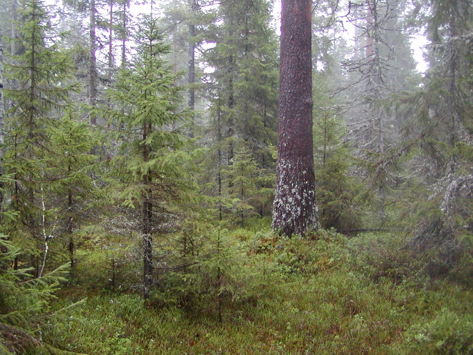
Kuva: Jonas Grahn
Daglösten
- Luonnonsuojelualue
- Kunta: Västerbottens län
Toiminnot
Kuvaus
Tall, thick pines around 300 years of age give Daglösten character. All the upright, dead, dry trees and stumps, as well as the dead trees that have fallen to the ground, also make the area special.
Birds such as the capercaillie, the hazel grouse, the black woodpecker and the three-toed woodpecker are found here.
Toimintaa ja tilat
- Luonnonsuojelualue
Reittiohjeet
The reserve is located 200 m north of Lake Kårängessjön, 18 km west of Bjuröklubb and approx. 10 km inland from the Gulf of Bothnia coast.
Yhteystiedot
Sähköpostiosoite
Länsstyrelsen Västerbotten
Organisaation logotyyppi

Huomaa, että osa näistä teksteistä on käännetty automaattisesti.
Olen ollut täällä 2

Haluan mennä tänne 4


Kysymykset & vastaukset (Q&A)
Esitä kysymys muille Naturkartan-käyttäjille.
Arvostelut
0 arvostelut
- 5 :
- 4 :
- 3 :
- 2 :
- 1 :
Käyttäjien kuvat
Käyttäjien kuvia ei ole vielä. Ole ensimmäinen, joka jakaa kuvan!
