
-
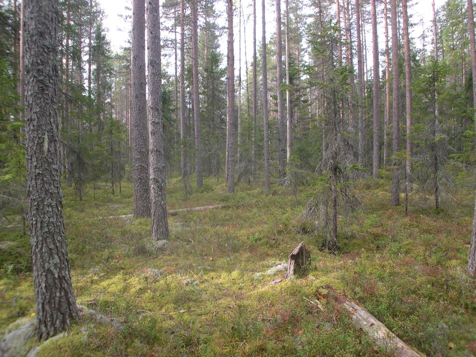
Kuva: Länsstyrelsen Västerbotten
Bjännberget
- Luonnonsuojelualue
- Kunta: Västerbottens län
Toiminnot
Kuvaus
In Bjännberget nature reserve just south-west of the village of Bjännberg in Umeå Municipality, lush spruce forests grow along the Stomraningsbäcken brook. The brook and its tributaries have formed exciting ravines in the sandy soil.
A large amount of soil and nutrients have collected close to the river, and water flows out between the slopes. As a result, the trees grow quickly and become tall and thick. The little false lily-of-the-valley, the large ferns and the tall alpine sow-thistle all thrive in this lush environment. In the spring, the flowering wood anemone can be seen on the slopes down towards Stomraningsbäcken brook.
Toimintaa ja tilat
- Luonnonsuojelualue
Reittiohjeet
Bjännberget is located at the village of Bjännberg 9 kilometers northwest of Hörnefors.
Yhteystiedot
Sähköpostiosoite
Länsstyrelsen Västerbotten
Organisaation logotyyppi

Huomaa, että osa näistä teksteistä on käännetty automaattisesti.
Olen ollut täällä 4

Haluan mennä tänne 10




Kysymykset & vastaukset (Q&A)
Esitä kysymys muille Naturkartan-käyttäjille.
Arvostelut
0 arvostelut
- 5 :
- 4 :
- 3 :
- 2 :
- 1 :
Käyttäjien kuvat
Käyttäjien kuvia ei ole vielä. Ole ensimmäinen, joka jakaa kuvan!
