
-
Promenad med start vid Orhem
Promenad med start vid Orhem, Guide till tystnaden
- Hiljaiset paikat
- Vaellusreitit
- Kunta: Stockholms län
- 6845.37 km päässä sinusta
Polun yksityiskohdat
- Pituus 4.9 km
Toiminnot
Kuvaus
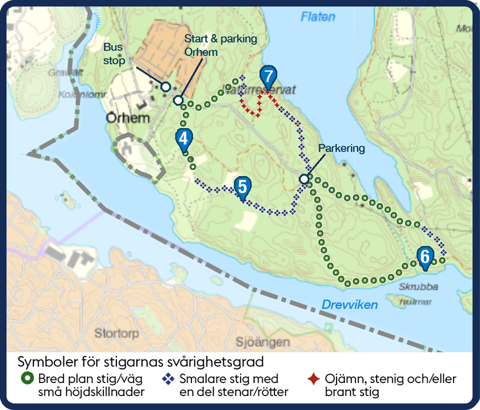
The first path, which is wide and easily accessible, leads to site 4, a nice spot in the deciduous forest. Then follow smaller paths to site 5 at the wetland. Continue on the smaller path that turns into a wide path down to site 6, with nice views by the water. Paths and roads to the north lead to the view at site 7, which is steep in places. The walk is 5 km. A minimum of 2.5 hours is recommended for a leisurely walk.
Toimintaa ja tilat
- Hiljaiset paikat
- Vaellusreitit
Yhteystiedot
Osoite
https://parker.stockholm/naturreservat/
Sähköpostiosoite
Johan Pontén
Organisaation logotyyppi

Olen ollut täällä 6



Haluan mennä tänne 18






Kysymykset & vastaukset (Q&A)
Esitä kysymys muille Naturkartan-käyttäjille.
Arvostelut
1 arvostelu
- 5 :
- 4 :
- 3 :
- 2 :
- 1 :
Käyttäjien kuvat
Käyttäjien kuvia ei ole vielä. Ole ensimmäinen, joka jakaa kuvan!


Ah balsam för själen. Njut!