Naturkartan-appen kan behöva uppdateras för vissa användare

Användare av Naturkartans app för Android rapporterar i sommar att appen är seg mm. Vi rekommenderar att man raderar appen helt från sin telefon i så fall och laddar ned igen! Då skall den fungera bättre. Den befintliga appen skall ersättas av en ny app efter sommaren. Den gamla appen laddar all data för hela landet lokalt i appen (för att klara offline-läge) men det innebär att den blir för stor för vissa telefoner - då behöver den raderas och laddas ned igen!

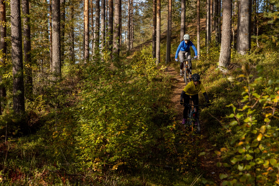
  • En trevlig etapp i vacker natur.
    En trevlig etapp i vacker natur.
    Foto: Philip Avesand/Visit Umeå

Tavelsjöleden etapp - Hamptjärnsstugan – Kullaskogen – Hissjö tur och retur

  • Mountainbike
von 5 Sternen

Details zum Weg

  • Länge 15.0 km
  • Zeit 2 h
  • Schwierigkeit Blau - mittel

Aktionen

Beschreibung

From Hamptjärnsstugan to the parking lot by road 363, the trail is fun and reasonably challenging for those who are used to cycling in the forest. Beginners can instead choose to cycle the gravel road on this stretch. On the west side of road 363, the trail is easy to cycle and follows Kullabäcken north through open pine forest.

When the trail leaves the pine forest and makes its way up to Rättberget's wind shelter, cycling becomes more difficult - both on the way up and on the way down. After Rättberget it is again easy cycling in open pine forest. There you pass Börsberget with some gravel road the last bit to Hissjön. Continue along the trail past Brännan. Parts of the route go along a power street with a stretch of about 600 meters consisting of sand road. Follow the trail all the way up to the junction with an orientation board. There you turn right to round Hissjön and enter the village.

Once in Hissjö, it's a good idea to take a dip at the swimming area, or a detour to Hissjö Handel. Back towards the connection Kullskogen you follow signs towards Umedalen (Piparböle) and where the trail passes Piparbölevägen is an information board that marks the transition. There you turn left back the same way to Hamptjärnsstugan.

Wettervorhersage (um 12:00 Uhr)

Laden...

Mit öffentlichen Verkehrsmitteln anreisen

Aktivitäten und Einrichtungen

  • Mountainbike

Fakten

15 km

Oberfläche

Abwechslungsreiche Wege, Kies, Sand, Stein und Asphalt.

Hügel

See description.

Vegetation

Schwierigkeit, meist grün, mit Partys aus Blau und Rot.

Kontakt

E-Mail-Adresse

Kontakta Visit Umeå

Bitte beachte, dass einige dieser Texte automatisch übersetzt worden sind.

Ich bin hier gewesen 1
Ich möchte hierher gehen

Fragen & Antworten

Stellen Sie eine Frage an andere Naturkartan-Nutzer.

Bewertungen

0 Rezensionen

von 5 Sternen

5 :
0.0%
4 :
0.0%
3 :
0.0%
2 :
0.0%
1 :
0.0%

Bilder von Nutzern

Es gibt noch keine Nutzerbilder. Sei der Erste, der eines teilt!

Naturkartan

Öffne dies in der App.