


Kaisepakte-Rovvidievvá
Wandern
- Landkreis: Länsstyrelsen Norrbottens län
- 7715.55 km von Ihnen entfernt
Details zum Weg
- Länge 38.0 km
Aktionen
Beschreibung
The trail is not signposted, and the markings in the form of cairns and paint are sparse. The hike passes through broad valleys with tangled vegetation in places. The differences in elevation are moderate, but the vegetation occasionally makes the hike very demanding. Count on at least two days for the tour, which requires a tent.
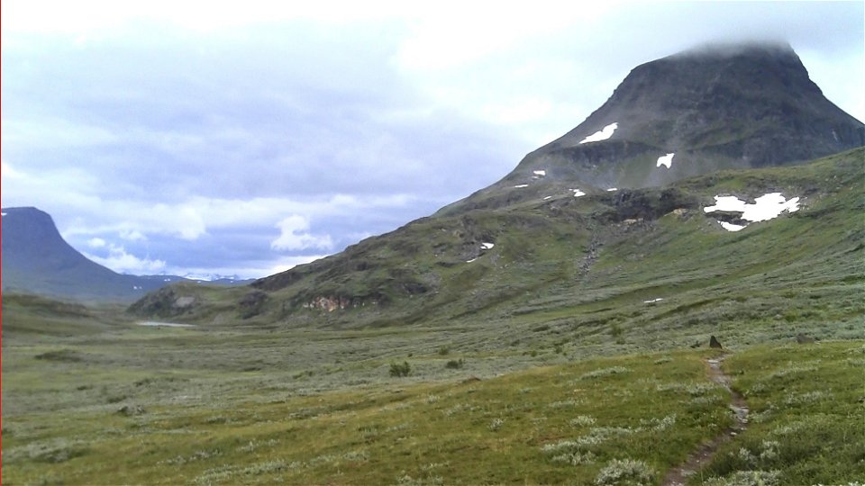
The hike starts in mountain birch forest at the station at Kaisepakte. The trail starts out steep and rocky. After the tree line, the hiking in the broad Bessesvággi valley becomes easier. Near a reindeer herders’ cabin, the trail involves some fairly easy wades. The stretch that follows contains a mix of bush-covered moors, small bogs and tangled willow brush. The trail is relatively untrodden. At a trail division, one branch turns southwards towards the Rautasjaure cabin, while the described trail continues towards the valley of the river Aliseatnu.
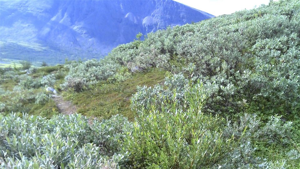
After the trail divide, a passage across the watercourse Nissonvaggejohka awaits. At high water, you may need to hike downstream some way to find a suitable wading spot. After wading, an arduous stretch follows. For about 10 km the path passes through tangled willow brush, mud and rocky stretches. There are few cairns and it is easy to lose the trail. At Vuopmegeahči there is derelict goahti hut, where a trail turns southwards towards the Mårma cabin.
After Vuopmegeahči it is easier to follow the trail. The stretch is beautiful and easy to hike. The path follows esker ridges across brush-covered moors. After Bieggaluoppal, the trail has plankways, so it is easy hiking despite the willow brush and wetlands. The trail crosses the King's Trail on a high plateau south of Gárddenvárri mountain. What remains is a descent on a quad bike road through birch forest to Rovvidievvá settlement, belonging to Gabna Sámi community.
There are good tent pitches in the area around lake Bessesjávri. There are also tent pitches at the pastures near Nissonvaggejohka and Vuopmegeahči.
Aktivitäten und Einrichtungen
-
Wandern
Oberfläche
Varied surface. Easily-hiked moor and plankways alternate with long stretches of tangled willow brush, mud and rocky ground.
Kommunikation
Kaisepakte lies about 70 km from Kiruna and about 25 km from Abisko Östra. A road (E10) leads here. The railway passes Kaisepakte but there is no longer a train stop. The nearest train station is at Abisko Östra.
Länstrafiken Norrbotten (bus and coach operator) website
Vy Tåg (train operator) website
SJ (train operator) website
Kiruna Lappland website
Kontakt
E-Mail-Adresse
Länsstyrelsen Norrbotten
Logotyp der Organisation
![]()
Bitte beachten Sie, dass einige dieser Texte automatisch übersetzt worden sind.
Fragen & Antworten
Stellen Sie eine Frage an andere Naturkartan-Nutzer.