Bästa vandringslederna i Torsby

Torsby

Naturkartan samlar de vandringslederna i Torsby som är populärast bland våra användare.

Billeder

Kort

49 Bästa vandringslederna i Torsby

Vandring

Fämtleden

  • Kommune: Torsby
  • 6532.66 km fra dig
  • 8.0 km
  • Sværhedsgrad: Rød

A hiking trail with beautiful scenery at the rapids of Fämtfallet, near Ambjörby. You will, among other things, go past the white water rapids of Fämtfallet, a 60 m deep canyon and some interesting industrial heritage sights. The path crosses the stream Fäm…

Vandring

7-torpsleden

  • Kommune: Torsby
  • 7.9 km
  • 2 t 30 min
  • Sværhedsgrad: Blå

The 7-torps trail in Lekvattnet has a long history. The trail mainly follows old paths created by the Forest Finns. The trail passes seven crofts, all with forest Finnish origin. You cross the national border between Norway and Sweden. Two crofts are locate…

Vandring

Nordvärmlandsleden

  • Kommune: Torsby
  • 6487.27 km fra dig
  • 52.0 km
  • Sværhedsgrad: Rød

Experience magnificent views from Långberget and Värmland’s highest mountain, Granberget, 700 meters above sea level. The trail starts in Ransby and continues up towards Ransbysätern. Along the way, you pass several mountain farm cottages, some of which are…

Vandring

Led Torprundan Hovfjället

  • Kommune: Torsby
  • 6534.91 km fra dig
  • 3.7 km
  • 1 t 30 min
  • Sværhedsgrad: Blå

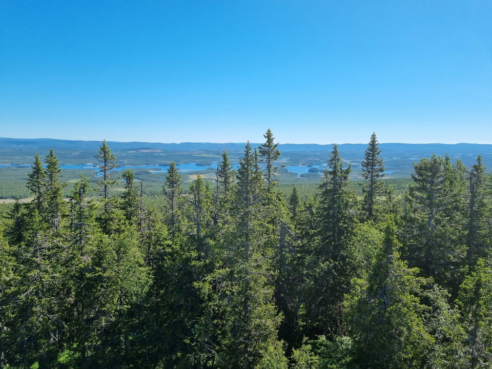
Torprundan is the shortest trail in Hovfjället nature reserve. The trail starts with a slope up to the top of Hovfjället. There is a viewing tower on the ski slope with views for miles. The trail takes you through lean pine forest on rocky outcrops, over la…

Vandring

Brattåsleden

  • Kommune: Torsby
  • 6534.98 km fra dig
  • 6.9 km
  • Sværhedsgrad: Rød

Explore Brattåsleden in Ambjörby with wilderness, a viewpoint, and a rich history. The 7 km long Brattåsleden starts from the information board opposite the Tempo Nordvärmland store in Ambjörby. The wilderness trail is really steep in places and can be cons…

Vandring

Led Hovfjällsrundan

  • Kommune: Torsby
  • 6534.91 km fra dig
  • 12.0 km
  • 5 min
  • Sværhedsgrad: Rød

Hovfjällsrundan takes you around the entire nature reserve. You have a nice view from Björnåsen in the eastern part and you pass several forest lakes. At Vadjebergen, the trail goes through a magical old-growth forest where the spruces are overgrown with be…

Vandring

Led Råkullsrundan

  • Kommune: Torsby
  • 6534.91 km fra dig
  • 8.0 km
  • 3 t
  • Sværhedsgrad: Rød

Råkullsrundan passes the top of Hovfjället with the viewing tower. The hiking trail continues through old natural forest. The terrain alternates between rocky areas with pine forests, marshes and spruce forests. If you are lucky, you may see capercaillie or…

Vandring

Hovfjällsleden

  • Kommune: Torsby
  • 6532.64 km fra dig
  • 26.3 km

You start at the top of Hovfjället and make your way through the nature reserve towards Valberget at Torsby Ski Tunnel and Sports Center. Follow the orange marked posts, be careful not to end up on the scooter trail. Please note that part of the trail is a…

Vandring

Led Horsstomyren

  • Kommune: Torsby
  • 6503.40 km fra dig
  • 6.5 km
  • Sværhedsgrad: Blå

The walk around Horsstomyren offers both old-growth forest and open mire in partly hilly terrain. Some stretches of the hiking trail are boarded. In wet weather, the tracks can be slippery. Orange color

Vandring

Granbergsrundan

  • Kommune: Torsby
  • 6492.64 km fra dig
  • 8.0 km
  • Sværhedsgrad: Blå

A hike to Värmland´s highest point with spectacular view. Granbergsrundan is a hiking trail that extends up and past Granberget, Värmland´s highest peak (700 meters above sea level), partially following the same route as the Nordvärmlandsleden. Please Note!…

Vandring

Led Björnåsrundan Hovfjället

  • Kommune: Torsby
  • 6535.25 km fra dig
  • 8.2 km
  • Sværhedsgrad: Rød

A varied hike in pine rocky ridges, old spruce forest, as well as marsh and swamp forest-like environments. A lovely view / resting place at Björnåsen and a cozy resting place at Dammen. Orange marking

Vandring

Led Storberget

  • Kommune: Torsby
  • 6504.02 km fra dig
  • 4.4 km

The trail passes the top of Storberget. The terrain up to the top is relatively steep in places. The nature is varied and some sections have wet parts. Orange color

Vandring

Led Fänstjärnsskogen

  • Kommune: Torsby
  • 6546.22 km fra dig
  • 3.1 km
  • Sværhedsgrad: Blå

Through young forest, on a path over a bog and up a steep section in older forest to the nature reserve. Circular trail in the reserve's fantastic and centuries-old old forest with silver pines and gnarled old pines. Footbridges and bridges can be slippery…

Vandring

Led Kampåsen

  • Kommune: Torsby
  • 6545.16 km fra dig
  • 2.6 km
  • Sværhedsgrad: Blå

Kampåsleden runs in hilly terrain through beautiful old natural forest. The forest is mostly spruce, but there are also many old pines and plenty of dead trees. Keep an eye out for three-toed woodpeckers and capercaillie! Orange color

Vandring

Tapioleden

  • Kommune: Torsby
  • 6511.74 km fra dig
  • 17.0 km

The trail goes past the farm Joppola, and connects to the Finnskogleden just before Fjälltorp. Then on to Abborrtjärnsberg and then turn off and go back to Mattila via Makkulaberget. Download the app "Vägvisare Mattila" to share exciting stories on your hik…

Bästa vandringslederna i Torsby

Naturkartan samlar de vandringslederna i Torsby som är populärast bland våra användare.

Naturkartan

Åbn dette i appen