Bästa cykellederna för cykel och mountainbike i Örebro

Örebro

Naturkartan samlar de cykellederna i Örebro som är populärast bland våra användare.

Billeder

Kort

21 Bästa cykellederna för cykel och mountainbike i Örebro

Cykling

Hemfjärden runt

  • Kommune: Örebro
  • 6701.18 km fra dig
  • 40.9 km

Difficulty level: Green Length: 38 km Vertical meters: 90 m Hemfjärden runt is the bike trail's bike trail here in Örebro. On the round there are many different sights such as nature reserves, historical sites and views out over Hjälmaren. Halfway on the to…

Cykling

Tysslingen runt

  • Kommune: Örebro
  • 6687.34 km fra dig
  • 26.0 km

Difficulty level: Green Length: 32 km Vertical meters: 40 m Experience the scenic landscape around the nutrient-rich plain lake Tysslingen. In the west, the trail follows the silhouette of Kilsbergen - "De Blå Bergen". Tysslingen is best known for the thous…

Cykling

Lången runt

  • Kommune: Örebro
  • 6692.04 km fra dig
  • 30.0 km

Difficulty level: Green Length: 29 km Vertical meters: 90 m Welcome to experience the interesting surroundings around Lake Lången. An exciting natural and cultural environment meets here. Stop and take part in the many sights you meet along the trail.

Cykling

Vattenslingan

  • Kommune: Örebro
  • 6700.20 km fra dig
  • 21.7 km

En lättcyklad slinga för hela familjen som börjar vid Örebro Slott och tar dig utmed Svartån till våra naturreservat Oset och Rynningeviken. Svårighetsgrad: Grön Start: Örebro slott Längd: 22 km Höjdmeter: 64 m

Cykling

Dyltaslingan

  • Kommune: Örebro
  • 6690.72 km fra dig
  • 38.0 km

The loop takes you through beautiful countryside via Ölmbrotorp to Dylta. Difficulty: Blue Length: 38 km Altitude: 231 m

Cykling

Hjälmaren runt

  • Kommune: Örebro
  • 6700.43 km fra dig
  • 149.4 km

Difficulty: Red Start and finish: Örebro Length: 150 km Altitude: 520 m Along the trail, a fun run is organized every year and the trail description follows the course of the race.

Cykling

Katrinelundsleden

  • Kommune: Örebro
  • 6700.33 km fra dig
  • 30.9 km

This tour is suitable for those who like to cycle on gravel roads. Difficulty: Blue Start: Örebro Castle Length: 28 km Altitude meters: 170 m

Cykling

Ånnaboda pumptrack

  • Kommune: Örebro
  • 6683.32 km fra dig

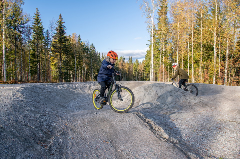
Ånnaboda pumptrack is made up of packed masses that are shaped into hills, curves and jumps. In a pumptrack, the idea is that with a few pedal strokes on the bike, you will be able to use your body weight and your technique to gather speed and power to ride…

Cykling

Kilsbergsrundan

  • Kommune: Örebro
  • 6684.68 km fra dig
  • 35.8 km

Difficulty: Blue Start: Örebro Castle Length: 41 km Altitude: 250 m The trail runs on both asphalt and gravel. The trail is not signposted.

Cykling

Kvismareleden

  • Kommune: Örebro
  • 6703.45 km fra dig
  • 13.0 km
  • Sværhedsgrad: Grøn

Signposted from the harbor area and follows Katrinelundsleden at the beginning and then splits at road 207.

Cykling

Vinöleden

  • Kommune: Örebro
  • 6719.58 km fra dig
  • 19.6 km

En 18 kilometer lång cykelled från Katrinelund till Hampetorp, som sedan skyltas vidare på bygatan på Vinön till den norra badplatsen. Leden är skyltad utifrån Örebro stad.

Cykling

Brevensleden

  • Kommune: Örebro
  • 6724.97 km fra dig
  • 20.0 km
  • 1 t 30 min
  • Sværhedsgrad: Grøn

Cycle path that starts in Lännäs where Vinöleden goes east and Brevensleden continues south to Brevens bruk. The trail connects Örebro via Katrinelunds- and Vinölederna with the southernmost part of the municipality and also to the Breven-Kilsmo MTB area.

Mountainbike

Adrenalin -MTB

  • Kommune: Örebro
  • 6680.85 km fra dig
  • 26.1 km

This trail connects to the transportation trail towards Lekeberg. The trail starts together with several other trails and turns directly left from the start and runs parallel to the campsite. Easy path at the beginning and later forest road and more lovely…

Mountainbike

Klockan -MTB

  • Kommune: Örebro
  • 6682.39 km fra dig
  • 35.5 km

Wonderfully entertaining trail that takes you down Kilsbergen and along its slopes. The nature is varied and sometimes dramatic and changes between dark spruce forest to light green hazel groves. Difficulty level: Red Length: 31 km Vertical meters: 540 m Si…

Mountainbike

Utkiken -MTB

  • Kommune: Örebro
  • 6683.02 km fra dig
  • 3.3 km

This is a trail for the new and the youngest. You are rewarded with an expansive view of Närkeslätten. Difficulty level: Green Length: 3 km Vertical meters: 68 m Signposted: Green, MTB 6

Bästa cykellederna för cykel och mountainbike i Örebro

Naturkartan samlar de cykellederna i Örebro som är populärast bland våra användare.

Naturkartan

Åbn dette i appen