Bästa vandringslederna i Norrbottens län

Norrbottens län

Naturkartan samlar de vandringslederna i Norrbottens län som är populärast bland våra användare.

Billeder

Kort

300 Bästa vandringslederna i Norrbottens län

Vandring

Vandringsled BD41 mellan Kebnekaise och Nikkaluokta

  • Kommune: Kiruna
  • 6397.82 km fra dig
  • 19.0 km

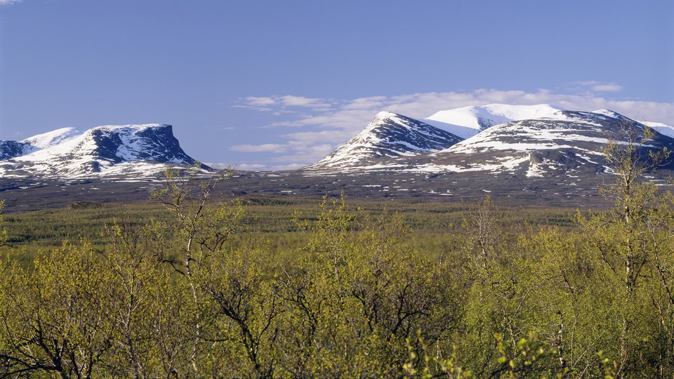
The hike begins above the tree line, but fairly soon you will again see the verdant mountain birch forest. Take the opportunity to turn back now and then to admire the beauty of the Kebnekaise massif. After a kilometre from Kebnekaise mountain station you c…
Vandring

Kungsleden, Nordkalottleden, Dag Hammarskjöldleden

  • Kommune: Kiruna
  • 6375.61 km fra dig
  • 14.0 km

The King’s Trail is Sweden's oldest and best-known hiking trail. It stretches from Abisko to Hemavan. The trail initially follows the impressive Abiskojåkka Canyon, which eventually gives way to a more calmly flowing stream through verdant mountain birch fo…

Vandring

Vandringsled BD26 mellan Abiskojaure och Alesjaure

  • Kommune: Kiruna
  • 6375.61 km fra dig
  • 21.0 km

From the Abiskojaure Cabins you hike via the bridge that crosses Kamajåkka back to the King's Trail, where you follow the signposts for Alesjaure. After a few kilometres you pass the national park boundary, and pitching a tent is again permitted. There are…

Vandring

Vandringsled BD31 mellan Alesjaure och Sälka

  • Kommune: Kiruna
  • 6374.34 km fra dig
  • 25.0 km

The stretch begins with easy hiking in a broad and verdant valley with abundant birdlife. At the Alesjaure Cabins you pass Aliseatnu River via a suspension bridge and the trail then follows the beautifully green meandering river. The trail crosses flat moun…

Vandring

Vandringsled BD40 mellan Singi och Kebnekaise fjällstation

  • Kommune: Kiruna
  • 6387.35 km fra dig
  • 14.0 km

At the Singi Cabins you leave the wide Tjäktjavagge (Čeakčavággi) Valley and follow the trail towards the dramatic Láddjuvággi. At the same time you leave the King’s Trail, which continues southwards towards Vakkotavare and on to Hemavan. After a gentle cli…

Vandring

Vandringsled BD38 mellan Sälka och Singi

  • Kommune: Kiruna
  • 6381.28 km fra dig
  • 12.0 km

The hike between Sälka and Singi is stunningly beautiful. Tjäktjavagge (Čeakčavággi) widens out at the same time as a number of cross-valleys give new panoramas to the west and east. The trail is flat and easy to hike, and crosses verdant grass and brush mo…

Vandring

Vandringsstig Njakajaure, Abisko nationalpark

  • Kommune: Kiruna
  • 6378.57 km fra dig
  • 5.0 km

This loop offers changing scenery in the form of birch forest, bogs, moors and a small lake. Follow the orange trail marks (and the King´s Trail) nearly three kilometres to "Marmorbrottet". It is a high, yellowish-white rock composed of dolomite, a limeston…

Vandring

Vandringsled BD62 mellan Saltoluokta och Sitojaure

  • Kommune: Jokkmokk
  • 6418.17 km fra dig
  • 19.0 km

From Saltoluokta Mountain Station the trail rises steeply through pine forest. There are several parallel paths and paths that branch off. It is easy to take the wrong path, so pay attention to the trail markings, which consist of signposts and orange colou…

Vandring

Vandringsstig Kanjonen, Abisko nationalpark

  • Kommune: Kiruna
  • 6378.64 km fra dig
  • 1.2 km

This trail is "a must" if you are in Abisko National Park. The beautiful canyon is one of the reasons this area became a protected area. From the naturum Abisko Visitor´s centre, you follow the yellow trail marks. There are at least three alernative ways to…

Vandring

Kungsleden, Vandringsled BD65 mellan Aktse och Pårtestugan

  • Kommune: Jokkmokk
  • 6413.90 km fra dig
  • 23.0 km

The stretch is long, demanding and varied, and you are walking in Sarek National Park practically the whole time. The stage includes a boat transport, and hiking both on bare mountain and in virgin coniferous forest. From the Aktse Cabin, a 1 km plankway le…

Vandring

Vandringsled BD63 mellan Sitojaure och Aktse

  • Kommune: Jokkmokk
  • 6422.08 km fra dig
  • 11.5 km

The stage begins with boat transport across the lakes Gasskájaure and Gåbddåjávrre. You can pre-book boat transport with Sitojaure båttransport, +46 (0)73-079 96 03, +46 (0)70-277 66 88. If hiking from the south, please call to book your boat shuttle when y…

Vandring

Vandringsled BD66 mellan Pårtestugan och Kvickjokk

  • Kommune: Jokkmokk
  • 6409.59 km fra dig
  • 17.0 km

You hike through montane forest for the whole stretch. The trail is mostly easy to walk and gradually descends towards Kvikkjokk. There are rockier sections at the beginning of the hike, and for a few kilometres after the trail leaves Lake Stuor Dáhta. This…

Vandring

Vandringsstig Kårsafallen, Abisko nationalpark

  • Kommune: Kiruna
  • 6378.42 km fra dig
  • 4.5 km

Follow the purple trail marks. You pass through the King´s trail starting portal and the Sami artist decorated tunnel under the road E10. After crossing Abiskoeatnu on the smaller road next to E10, the trail turns south and follows Abiskoeatnu. Here, the t…

Bästa vandringslederna i Norrbottens län

Naturkartan samlar de vandringslederna i Norrbottens län som är populärast bland våra användare.

Naturkartan

Åbn dette i appen