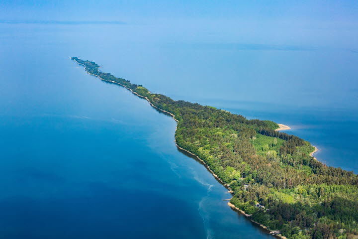
Hindens rev
Celowniki
- Województwo: Västra Götalands län
- 6611.03 km od Ciebie
Akcje
Opis
Day excursion out into Lake Vänern
Hindens Rev is a five-kilometre peninsula extending straight out into Lake Vänern. It is 25-100 metres wide and 21 metres above Lake Vänern at its highest point. The height drops towards the tip and it ultimately disappears under the surface of the water, and reappears on the Dalsland side, where it is known as Hjortens Udde. When the water level is very high, five elongated islands are formed, known as “Killingarna”. A one-way hike to the promontory takes roughly 50 minutes.
Activities
The ridge is also a popular destination for excursions and tourism, especially for hiking. Walking along Hindens Rev is a peaceful activity. The trail is 5 kilometers one way and winds through roots and stones, eventually disappearing among cliffs and water at Hindekraket. Fishing and birdwatching are also popular in the summer, while in winter, the area is ideal for long-distance ice skating.
Things to Keep in Mind
The trail to the ridge can be challenging in some places, especially depending on the season and weather, as water levels fluctuate. Wear sturdy shoes and be cautious of adders and ticks, which thrive in the area.
The Nature Reserve
Hindens Rev is part of the Hindens Udde–Svalnäs Nature Reserve and has been protected since 1986. Pine, rowan, birch, aspen, and several protected plant species grow here.When the water rises, five elongated islands appear, known as “Killingarna.” Hindens Rev is of national interest for nature conservation and outdoor life and is therefore uninhabited.
Birdlife - Dunlins and Snow Buntings
In spring and autumn, the reef is a passage for many migratory birds, especially cormorants, loons, ducks, and waders. In late April and early May, eiders may be spotted resting offshore. Though usually found in saltwater, a small number pass through Vänern. In winter, birdlife is sparser, but with luck, snow buntings or twites may be spotted foraging for seeds. If you prefer sandy beaches, head to Svalnäsbadet at the base of the reef, known as Vänern’s Riviera.
Geology and History
Hindens Rev is a terminal moraine and part of the Middle Swedish End-Moraine Zone, formed over 10,000 years ago during the last Ice Age.
As the edge of the inland ice remained stationary here, long ridges of stone were formed by material transported by the ice from the north. These formations, known as terminal moraines, are especially visible along coasts, where they rise above the surrounding landscape.
Hindens Rev is a nature reserve – please treat it with care. Remember to bring your trash with you if you plan to picnic or stay for a while.
How to get here:
Public Transport: With Västtrafik’s on-demand transport service (Närtrafik), you can travel from any address to rural destinations. Närtrafik operates between selected addresses within the defined area (see map). Book your trip at least one hour before departure. The journey costs the same as a regular single ticket and you can buy it with Västtrafik To Go app or from the driver with card.
For more infromation visit www.västtrafik.se/en
By Car/Bike: From Lidköping, drive toward Örslösa. Turn right at the sign for "Hindens Rev Naturreservat", keep right at the curve in Söne, then turn left again at the next sign for the reserve and keep right at the church bend. Follow the road to the parking lot in the forest grove – you will pass the entrance to Svalnäs beach.
Działania i udogodnienia
-
Att göra
-
Celowniki
Kontakt
Adres
Kontaktperson angående drift av leden: Simon Jonsson, simon.jonsson@vanern.org
För frågor om ledens sträckning, boenden, restauranger m.m. utmed leden kontakta Kristinehamns turistbyrå! 0550 881 87
Adres e-mail
Kristinehamns Turistbyrå
Logotyp organizacji

Należy pamiętać, że niektóre z tych tekstów zostały przetłumaczone automatycznie.
Pytania i Odpowiedzi
Zadaj pytanie innym użytkownikom Naturkartan.


