
Tveta motionsspår
- Bieganie
- Blisko parkingu
- Blisko transportu publicznego
- Województwo: Stockholms län
- 6824.10 km od Ciebie
Akcje
Opis
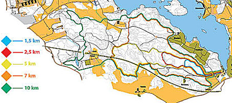
Track blue is 1.5 km long and has a gravel surface. The track is easy and has lights that turn on the runner. Remember to turn off the light when you are done.
Track red is 2.5 km and has gravel as a surface. The route is easy and has lighting that is turned on by the runner. Remember to turn off the light when you are done.
Track yellow is 5.0 km long with varied surfaces. It is described as medium difficulty and has no lighting.
The orange trail is 7 km long with varied terrain. It has no lighting.
The green track is 10.0 km long and has a varied surface. It is described as medium difficulty and has no lighting.
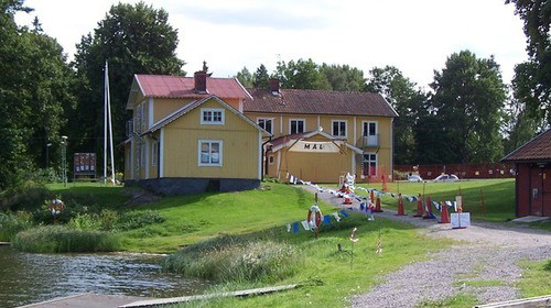
All exercise tracks start at Tveta Friluftsgård. Södertälje-Nykvarn Orientation is responsible for the operation.
Działania i udogodnienia
- Bieganie
Dostępność
- Blisko parkingu
- Blisko transportu publicznego
Wskazówki dojazdu
By car: Highway E4 or E20 to Södertälje. Road 509 towards Järna/Nykvarn, about 3 km outside Södertälje.
By bus: 784, 785 and 789 from Södertälje Centrum, get off at the Tvetaberg stop.
Kontakt
Adres e-mail
Södertälje kommun
Logotyp organizacji

Byłam tu 1

Chcę tu iść 3

Pytania i Odpowiedzi
Zadaj pytanie innym użytkownikom Naturkartan.
Opinie
0 recenzji
- 5 :
- 4 :
- 3 :
- 2 :
- 1 :
Zdjęcia użytkowników
Nie ma jeszcze żadnych zdjęć użytkowników. Bądź pierwszym, który je udostępni!
