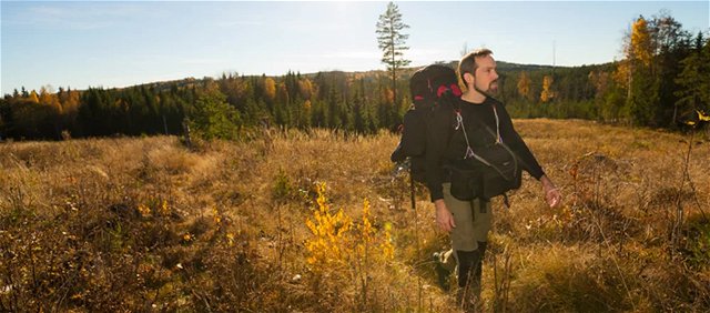
Fakta om Bergslagsleden
Bergslagsleden är en 28 mil lång vandringsled genom hela Örebro län. Den är uppdelad i…
Wędrówki piesze
On Stage 8 you will pass several shingle fields, formed when the waves of the Yoldia Sea increased in strength all the way from Russia and washed over the edge of Kilsbergskanten. You also pass Rusakulan, which is the best viewing point on Kilsbergen. Follow the marked path to the top and you will have an uninterrupted view of the whole of Närke, including no fewer than 21 church towers. The trail also passes the ruins of cottages and stone walls at the village of Kilsbergsbyn at Tomasboda. Via Amboberget you can cut across northwards to Stage 7. Sample the delights of the enchanted Norra Trolldalen valley, with its steep sides and the stream at the bottom. At Lockhyttan you will find our Vinterhagen resting place, with a wind shelter, fireplace and toilet.
Length: 14 km
Time: 4 h
Difficulty level: 3
Activities: Swimming, cycling
Surface: Predominantly forest path and forest road.
Altitude: 60 m above sea level
Fresh water: Access to fresh water is available on the outside of Mogetorp's hostel. In Blankhult there is drinking water on the west side of the main building. There is also a cold spring at the rest area Vinterhagen, which is about halfway on the stage. We recommend that you boil this water.
Accommodation:
To Mogetorp, the bus runs several times a day along highway 50 (Örebro-Nora). Blankhult can be reached from Klockhammar, which has a bus service to Örebro in the morning and evening on weekdays. From Klockhammar you can follow the gravel road up to Blankhult, just over 2.5 km.
You can also book local traffic to and from Blankhult, the nearest stop will be Garphyttan. https://www.lanstrafiken.se/reseplanering/flextrafik-och-nartrafik/nartrafik-i-orebro-lan/
Johan Karlström

Należy pamiętać, że niektóre z tych tekstów zostały przetłumaczone automatycznie.
Zadaj pytanie innym użytkownikom Naturkartan.