
-
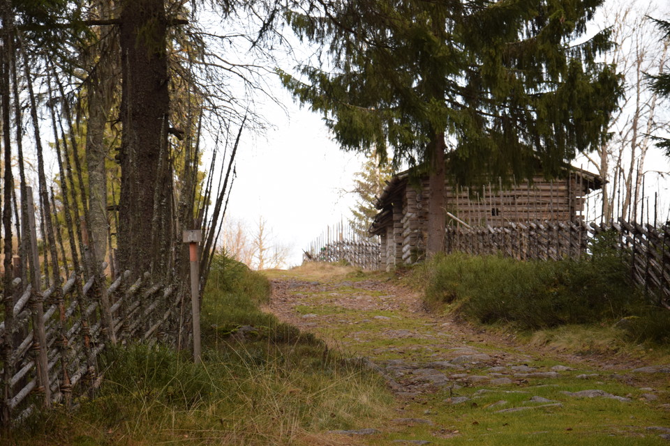
Siljansleden, Ärteråsens fäbod. Foto Bosse Bifrost
Siljansleden, Rättvik kommun
- Wędrówki piesze
- Województwo: Dalarnas län
- 6585.87 km od Ciebie
Szczegóły dotyczące szlaku
- Długość 340.0 km
- Trudność Niebieski - średni
Akcje
Opis
The Siljan Trail is a hiking trail in the forests around Siljan and Lake Orsasjön. The trail mainly follows old shepherd's huts, along lakes, over bogs and up mountains. Many of the pastures are high and beautifully situated, where there are height differences of over 400 meters. In many places, the uphill effort is rewarded by breathtaking views of Siljan and the surrounding area.
The trail is marked with orange paint and signposts with the design developed for the Siljan Trail. Rest and camp sites are organized at appropriate distances. The trail runs largely in uninhabited terrain and for longer trips it is necessary to be well equipped.
Działania i udogodnienia
- Wędrówki piesze
Pobrane pliki
Kontakt
Adres
+46 (0)248-700 00
Adres e-mail
Rättviks kommun
Logotyp organizacji

Byłam tu 5


Chcę tu iść 20

Pytania i Odpowiedzi
Zadaj pytanie innym użytkownikom Naturkartan.
Opinie
0 recenzji
- 5 :
- 4 :
- 3 :
- 2 :
- 1 :
Zdjęcia użytkowników
Nie ma jeszcze żadnych zdjęć użytkowników. Bądź pierwszym, który je udostępni!
