
-
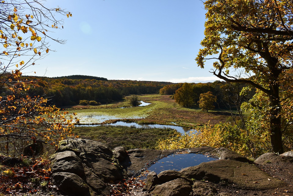
Foto: Emelie Säll
Natthall utsiktsplats, Klippan
- Gezichtspunt
- Nabij parkeerplaats
- Regio: Skåne län
- 6781.93 km van u vandaan
Acties
Omschrijving
It is perhaps the most beautiful place in Rönneådalen. A place you will always long to return to. From a cliff that plunges steeply towards the river valley, you can see how the watercourse meanders between lush meadows and forests. A peaceful and not a little magical place with beautiful views.
If you listen carefully, you may be able to hear the giants, who live inside the mountain among the huge boulders by the path.

Activiteiten en faciliteiten
- Gezichtspunt
Toegankelijkheid
- Nabij parkeerplaats
Routebeschrijving
GPS coordinates: 56.0100, 13.3745
The best access point for those arriving by car is the parking lot in Anderstorp's juniper forest. From there it is about 25 minutes walk along Skåneleden to Natthall. You can also arrive near the Eketorp farm on the other side of Rönneådalen where Skåneleden goes down into the valley, over the bridge and continues up to the top of Natthall. Drive past Djupadal in the direction of Torraröd and after Eketorp you enter a beech forest where it is possible to park the car adjacent to a forest road on the left. You then go back along the road and enter the pasture above the river where you see Skåneledens marking.
For those who are a little more familiar with the landscape, it is also possible to park in the parking lot near Djupadal's mill. Then you can follow the paved road over the bridge towards Anderstorp and after a few hundred meters turn left on a small gravel road, follow the forest edge on the left side and you will come down on Skåneleden where the bridge over Rönneå is. Also take the opportunity to visit the area near Djupadalsmöllavid Rönneå and Snällerödsbäcken! Coordinates: 56.0194, 13.3859
The bridge over Rönneå is in poor condition and can be slippery in the wet.
Contact
E-mailadres
Destination Rönne å och Ringsjön
Organisatie-logotype

Ik ben hier geweest
Ik wil hierheen 1

Vragen en antwoorden
Stel een vraag aan andere Naturkartan gebruikers.
Beoordelingen
0 beoordelingen
- 5 :
- 4 :
- 3 :
- 2 :
- 1 :
Afbeeldingen van gebruikers
Er zijn nog geen afbeeldingen van gebruikers. Deel als eerste!
