
-
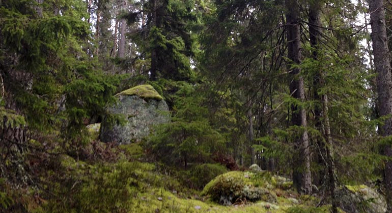
Getryggsområdet.
Foto: Kjell Store
Getryggsområdet, Naturreservat
- Naturreservat
- Fylke: Örebro län
Handlinger
Beskrivelse
The nature reserve Getryggsområdet's hilly and blocky terrain has made the area inaccessible to humans. The coniferous forest has remained largely untouched for the last 100 years. The reserve is a small wilderness core with exciting nature.
Hilly coniferous forest area
The Getrygg area is a small, broken landscape with boulder-rich moraines and with the presence of crevice valleys where small ponds and marshes occupy the valley bottoms. A small ridge crosses the area from north to south. The forest is old and heavily covered with hanging lichen. The oldest conifers reach ages of up to 250 years. The deciduous element in the form of birch, aspen, willow and rowan is striking, especially the abundance of old, flat-crowned aspens with boreholes.
Hole builders and hanging lichens
Woodpeckers of various kinds and hole-dependent bird species occur abundantly in the area, of the former can be mentioned woodpecker, three-toed woodpecker and gray woodpecker, and of the latter sparrow owl and pearl owl. Another hole-dependent animal species seen here is the marten. Of the flora, it is mainly fungi, lichens and mosses that are of interest and the reason for the creation of the reserve. Among other things, the hanging lichens hard-pressed by forestry occur here, such as twig lichen, variegated thorn lichen and violet-grey thorn lichen, which grow on old trees or rock walls.
Traces of mining
The forests of Bergslagen bear witness to older land use, especially after the production of charcoal in milas. The Getrygg area is no exception. A coal seam is the name given to the remains of a coal seam. The coal bed is usually a circular, slight elevation of the ground, about 5-8 meters in diameter. The soil in the coal bed is black with coal.
Aktiviteter og fasiliteter
- Naturreservat
Fakta
Municipality: Ljusnarsberg
Year established: 2003
Area: 47 hectares
Landowner: Private
Manager: County Administrative Board
Reserve creator: County Administrative Board
Veibeskrivelse
The reserve is located northeast of Kopparberg, just north of county road 233 between Kopparberg and Kloten. From highway 60 at Kopparberg it is 11 km to the reserve's parking lot at county road 233. From the parking lot at the county road you walk a smaller 1.5 km long forest road north to the reserve. In the reserve there is an approximately 2 km long marked trail.
Forskrifter
In the nature reserve it is forbidden to:
- break branches, cut down or otherwise damage living or dead standing and fallen trees and bushes
- capture and collect invertebrates in such a way that their biotopes or reproductive environments are damaged or destroyed
- bring an unleashed dog or other stray animal, except for hunting with a hound or for searching
- put up a board, poster, placard, sign or make inscriptions or carvings on tree trunks, boulders or rocks
- set up orientation controls; or
- organize marked trails
- camping
- drive a motor vehicle or ride a bicycle other than on the road
Kontakt
E-postadresse
Organisasjonens logotype
Jeg har vært her
Jeg ønsker å dra hit 1

Spørsmål og svar
Still et spørsmål til andre brukere av Naturkartan.
Omtaler
0 anmeldelser
- 5 :
- 4 :
- 3 :
- 2 :
- 1 :
Brukernes bilder
Ingen brukerbilder ennå. Bli den første til å dele!
