
-
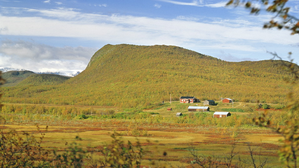
Kummavuopio.
Foto: Tomas Utsi -
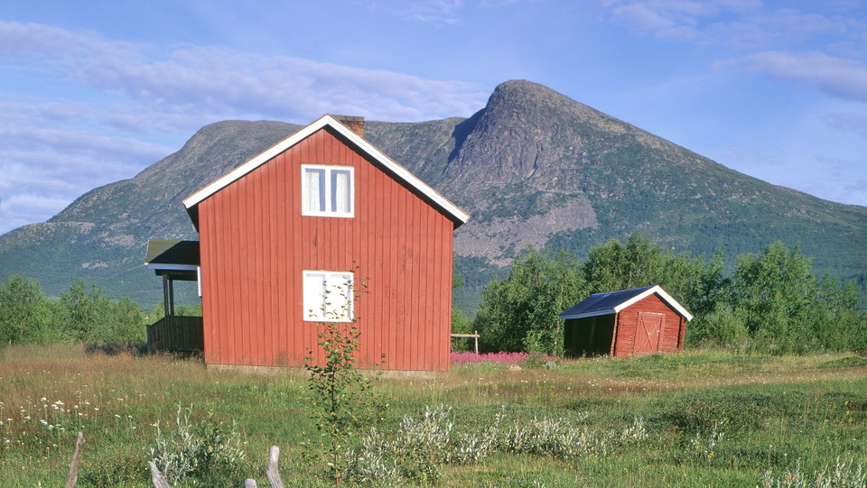
Láimoluokta.
Foto: Tomas Utsi
Kummavuopio-Láimoluokta
- Fotturer
- Fylke: Norrbottens län
- 6418.72 km fra deg
Detaljer om stien
- Lengde 90.0 km
Handlinger
Beskrivelse
This is a long hiking trail through vast areas with few hikers. The trail is extremely sparsely marked, and the paths are unclear in places. The relatively flat terrain can make navigation difficult, especially in poor visibility. There are two stopover cabins along the trail, but no overnight cabins apart from a wilderness camp. Therefore, the tour requires mountain experience, orienteering skills, a tent, and that you are self-sufficient in food and equipment.
The hike starts in mountain birch forest in Kummavuopio. You have a good view of Pältsan mountain and the Norwegian mountain range to the north, which remain in view for a long time during the hike. The trail now and then follows a reindeer fence all the way to Lake Rostojávri. At a south-easterly inlet in the lake, you pass Rostoeatnu River via a suspension bridge.
A fishing camp, Rostujávri Wilderness Camp, lies a few kilometres west of the bridge on the shore of the lake. From the big lake and onwards, short stretches of the trail cross boulder strewn land.
In the valley between the summits Goagdá and Ittivaara, the view of Pältsan and the Norwegian summits disappears. The continued hike offers fairly easy hiking all the way to the Talma Sámi community’s settlement of Vuoskkojávri.
The surroundings alternate between barren mountain moors, flat grass plains and marshes which are not too wet or difficult to cross. After Vuoskkojávri the trail continues through mountain birch forest. You pass a reindeer fence and a stream. After that, the trail rises above the tree line and then follows the slope of Gáivárri mountain. The hike ends in a downhill slope through birch forest as far as Láimoluokta Sámi settlement.
The fords that you wade are not difficult under normal conditions.
There are good tent pitches along the whole route.
Distances: Kummavuopio-Hurvejåkka stopover cabin, 10 km Hurvejåkka stopover cabin-Kamasjaure stopover cabin, 51 km Kamasjaure stopover cabin-Vuoskojávrri, 14 km Vuoskojávrri-Láimoluokta, 13 km
Duration: 4-6 days
Aktiviteter og fasiliteter
- Fotturer
Underlag
Easily-hiked surface on the mountain moors, while it can be more difficult in hollows where osier grows.
Kommunikasjon
There is a hiking trail from Keinovuopio to Kummavuopio (10 km). Keinovuopio lies about 90 km from Karesuando. There is a road (the E8) and the easiest way there is to drive.
You can also take the bus from Kiruna to Karesuando (180 km). From Finnish Karesuvanto, continue by bus or taxi to Keinovuopio. Keinovuopio has a footbridge connection to the E8.
Länstrafiken Norrbotten website (bus and coach operator)
Eskelisen Lapin Linjats website (Finnish bus operator)
Kontakt
E-postadresse
Länsstyrelsen Norrbotten
Organisasjonens logotype

Jeg har vært her
Jeg ønsker å dra hit 11


Spørsmål og svar
Still et spørsmål til andre brukere av Naturkartan.
Omtaler
0 anmeldelser
- 5 :
- 4 :
- 3 :
- 2 :
- 1 :
Brukernes bilder
Ingen brukerbilder ennå. Bli den første til å dele!

Hello! Do you know how can I get to the beginning of this trail? Seems there is no road and I can't find also a boat connection:) I will be very grateful for all advices:)
Thank you, but there is no public transport connection as there is no road there 😕
See above: Get here by public transport
Hello Iga! It can be tricky to find but if you are travelling with public transport, take a bus from Kiruna to Karesuando. From Karesuvanto on the Finnish side, take a bus or taxi to Keinovuopio. There is a hiking trail from Keinovuopio to Kummavuopio (10 km). There is a foot bridge i Keinovuopio in connetion to E8. From there, follow the road through the village towards Kummavuopio. Happy hiking!
I want to start hiking from Láimoluokta - maybe you know how to get there? Even if I finish in Láimoluokta seems it's impossible to come back :(
Yes, it is a bit tricky to find suitable transport for that stretch of the hike. You could try asking the local acitivites companies if they can arrange for transport. Best of luck! https://outbackabisko.com/
https://activitiesinabisko.se/
Or by helicopter: https://www.kallaxflyg.se/privat/