
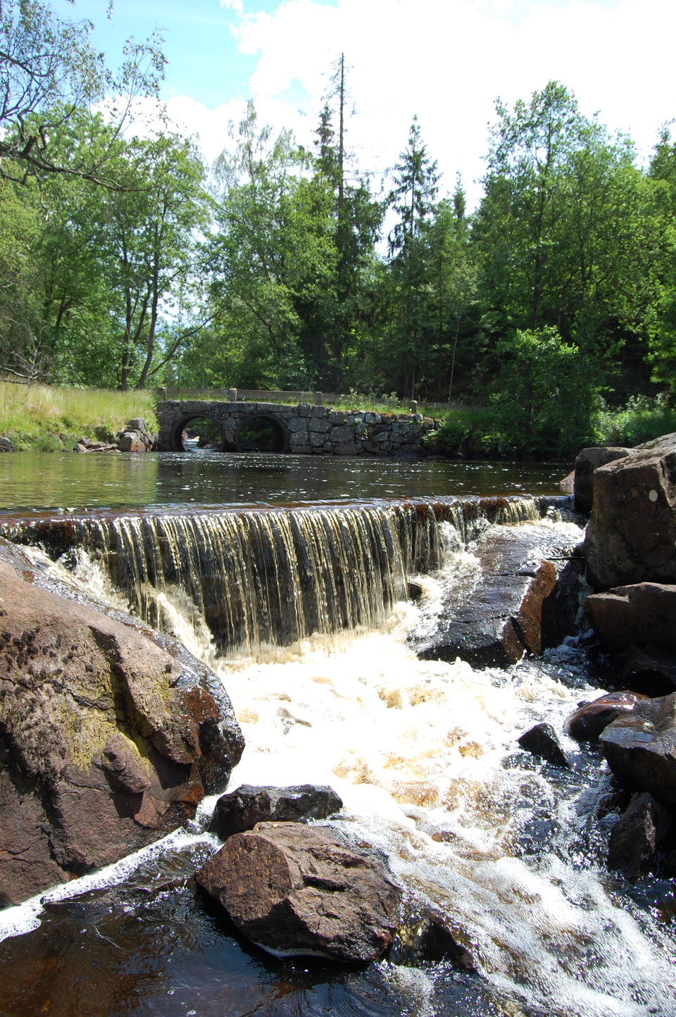
Lahults Kvarndamm, Rydöbruk
- Attraksjon
- Kulturelt miljø
- Rasteplass
- Badeplass
- Badstue
- Benkeplate
- Interessant sted
- Fylke: Hallands län
- 6718.94 km fra deg
Handlinger
Beskrivelse
Latitude: 56.95991, Longitude: 13.13639
At the start of the 19th century, the mill weiron the River Klubbån in Rydöbruk was thesite of a mill owned by the local farmers. Astime went on, a turbine was built, capable ofdriving a sawmill, together with a stone logshoot to convey timber. The log shoot can stillbe seen. It extends for 11 km, starting in theMjälarsjöarna lake system, passing throughthe River Gammelsboån, Lake Sandsjön andthe River Klubbån, before ending at the factory millpond in Rydöbruk. These days, themill weir on the River Klubbån is a popularspot for picnics, swimming and hikes.
Flotation chute Latitude: 56.95991, Longitude: 13.13639
This stone trough was built to transport timber and stretches for 11 kilometres. It startsin the Mjälarsjöarna lakes and runs along theRiver Gammelsboån, through Lake Sandsjön,along the River Klubbån, before ending itsjourney at the factory dam in Rydöbruk. Itstill survives.
The Castle at HögadahlLatitude: 56.95991, Longitude: 13.13639
The residence of Squire Petersson, which hecalled ‘Slottet’, the Castle. A beautiful terracedgarden surrounded the house and you canstill see the remains of the stone walls.
Aktiviteter og fasiliteter
- Kulturelt miljø
- Rasteplass
- Badeplass
- Badstue
- Attraksjon
- Benkeplate
- Interessant sted
Kontakt
Adresse
Telefon: 0345-182 14 Kontaktcenter: 0345-180 00
E-postadresse
Lena Hagman Bogren
Organisasjonens logotype
Jeg har vært her
Jeg ønsker å dra hit 1

Spørsmål og svar
Still et spørsmål til andre brukere av Naturkartan.
Omtaler
0 anmeldelser
- 5 :
- 4 :
- 3 :
- 2 :
- 1 :
Brukernes bilder
Ingen brukerbilder ennå. Bli den første til å dele!
