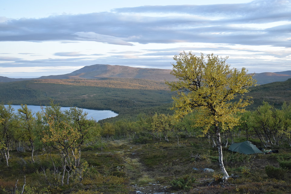
Beste turstier i Vilhelmina

Vilhelmina

Naturkarten samler de turstiene i Vilhelmina som er mest populære blant våre brukere.

Bilder

Kart

53 Beste turstier i Vilhelmina

Fotturer

Marsliden - Marsfjällskåtan eller Marsfjällets topp

  • Kommune: Vilhelmina
  • 6402.28 km fra deg
  • 15.6 km

There are signs on the main road in Marsliden directing you to the parking lot and trailhead. At first you walk through mountain spruce forest - it is well tracked and easy to walk but pretty soon it gets steeper. In the forest you can see species such as T…

Fotturer

Klimpfjäll (Soldalen) – Borgafjäll, Lapplandsleden

  • Kommune: Vilhelmina
  • 6382.44 km fra deg
  • 39.1 km

From Soldalen it is 9 km up to the vast moor and tar systems at Slipsiken. There are many nice places to camp here, but be aware that the wind can be strong. The plateau where Korpån flows down into the valley about 9 km from Slipsikstugan is a good camping…

Fotturer

Fatmomakke - Marsfjällskåtan - Blerikstugan - Fatmomakke

  • Kommune: Vilhelmina
  • 6395.88 km fra deg
  • 34.9 km

Leden utgår från parkeringen i Fatmomakke. Vandringen går till att börja med genom fjällnära granskog. Här kan du se arter som torta, linnea och gullris. Det är lite småbackigt i början men efter ca 2 km kommer du till bron över Svartbäcken. Forsen under br…

Fotturer

Kittelfjäll - Blerikstugan

  • Kommune: Vilhelmina
  • 6402.87 km fra deg
  • 11.7 km

The trailhead is on the opposite side of the road from the parking lot below the hotel in Kittelfjäll. The hike starts easily and soon you come to the bridge over Vojmån. Here there is the possibility of fine fishing if you buy a fishing license from Bergsj…

Fotturer

Åtnikstugan - Klimpfjäll (Soldalen), Lapplandsleden

  • Kommune: Vilhelmina
  • 6363.18 km fra deg
  • 40.6 km

On the way up from Vojmån and Åtnikstugan, the view towards Remdalen and Fjällfjällens high Durrenpik awaits from Årjielgietje. When the trail enters the Norgefararleden trail, you are met by fine ridge formations from Åtnikstugan towards Klimpfjäll. The ne…

Fotturer

Matsdal - Storknoppen - Vaellientjahke

  • Kommune: Vilhelmina
  • 6413.99 km fra deg
  • 1.5 km

Matsdal - Storknoppen - Vaellientjahke Storknoppen och Vaellientjahke bjuder på storslagna utblickar mot dalgången med den meandrande Matsdalsbäcken samt Södra och Norra Gardfjällsmassiven. Redan när den branta stigen genom granskogen från Matsdal efter någ…

Fotturer

Kanan - Bullerfallet

  • Kommune: Vilhelmina
  • 6407.87 km fra deg
  • 1.9 km

The hiking trail to Bullerfallet is signposted from the parking lot in Kanan. In the dense vegetation around the Matsdalsån delta, it can sometimes be difficult to see the path. In the flat terrain, the bridges are sometimes washed away during the spring fl…

Fotturer

Atjiken – Torpet, Urskogsleden

  • Kommune: Vilhelmina
  • 6426.39 km fra deg
  • 18.1 km

The hike can start at Atjiken after road 1077 or at Torpet in the eastern part of the Marsfjället nature reserve. If you start at Atjiken, you walk through old spruce forest that is characteristic of this area. After about 2 km you pass a bridge and can now…

Fotturer

Gränssjö – Åtnikstugan, Lapplandsleden

  • Kommune: Vilhelmina
  • 6364.68 km fra deg
  • 21.8 km

The terrain is wet at first, but then becomes relatively easy to walk. Two thirds of the stage is in mountain birch forest. At the top of Njeeretjahke you can see all the way back to Norra Storfjället and a little further along the road you can see towards…

Fotturer

Fatmomakke - Marsfjällskåtan - Marsfjällets topp

  • Kommune: Vilhelmina
  • 6397.83 km fra deg
  • 12.5 km

The trail starts from the parking lot in Fatmomakke. The hike starts through mountain spruce forest. Here you can see species such as Torta, Linnea and Goldenrod. It is a little hilly at the beginning but after about 2 km you come to the bridge over the bla…

Fotturer

Kittelfjäll - Björnkullen - Grönfjäll

  • Kommune: Vilhelmina
  • 6404.29 km fra deg
  • 11.5 km

The trail between Kittelfjäll and Grönfjäll is an easy hiking trail through spruce and mountain birch forest with beautiful views of Kittelfjället, Grönfjället and Klippfjället. To the south, the slightly rounder Henriksfjället rises in front of the steep p…

Fotturer

Marsfjällstoppen topptur

  • Kommune: Vilhelmina
  • 6406.89 km fra deg

From Marsfjällskåtan you can follow the marked trail that goes up to Marsfjällstoppen. From Djupbäckens rest shelter you can climb Marsfjället without a marked trail if the weather permits.

Fotturer

Kittelfjället topptur

  • Kommune: Vilhelmina
  • 6403.00 km fra deg

Kittelfjället bjuder på fantastiska vyer över naturreservatets fjällmassiv, söderut mot det intilliggande Marsfjällets naturreservat och vid klart väder västerut ända till Norge. Kittelfjället är populärt för sin fina lössnöåkning. Vintertid finns skidlift…

Beste turstier i Vilhelmina

Naturkarten samler de turstiene i Vilhelmina som er mest populære blant våre brukere.

Naturkartan

Åpne dette i appen