
Beste turstier i Kristianstad
Kristianstad
Naturkarten samler de turstiene i Kristianstad som er mest populære blant våre brukere.
Bilder

Kart
88 Beste turstier i Kristianstad


Linnérundan
- Kommune: Kristianstad
- 6820.81 km fra deg
- 6.0 km
- Vanskelighetsgrad: Grønn
Linnérundan is dedicated to Carl Linnaeus, who visited the wetlands around Kristianstad just over 250 years ago. Here you can still experience parts of the landscape that Linnaeus described. Start at naturum Vattenriket. Cross the bridge to Tivolibadet and…

Skåneleden SL6 Vattenriket: Åhus - Nyehusen
- Kommune: Kristianstad
- 6835.97 km fra deg
- 16.0 km
- Vanskelighetsgrad: Grønn
The route offers a varied natural experience close to the sea. Along much of the coast, pine forests grow on the lean and sandy soils. The pine forest is open and the ground is covered with thick mats of lichens and mosses. In the open areas, sandwort, heat…
Bökestad
- Kommune: Kristianstad
- 13 km
Trail between Bökestad - Brotorpet.varying terrain. More than 50% on nature trail.
Rebbetuaröd
- Kommune: Kristianstad
- 6.51 km
Trail between Rebbetuaröd - Agusa. Varying terrain. More than 50% on natural trail. Previous experience not necessary.

Skåneleden SL6 Vattenriket: Ekenabben- Åhus
- Kommune: Kristianstad
- 6825.73 km fra deg
- 31.5 km
- Vanskelighetsgrad: Grønn
Från Ekenabben går leden vidare söderut. Fågelintresserade kan göra en avstickare till besöksplats Håslövs ängars fågelrika marker. Leden fortsätter mot besöksplats Hercules där vandraren får uppleva våtmarksmiljöer med rik natur. Har du tur får du se svart…

Skåneleden SL6 Vattenriket: Kristianstad - Norra Lingenäset
- Kommune: Kristianstad
- 6819.24 km fra deg
- 11.0 km
- Vanskelighetsgrad: Grønn
The northern part of the stage runs through the Näsby Fields nature reserve with open meadows, shrub and reed areas, swamp forests, beach meadows and broadleaf forests. In the spring, you will be greeted by a lovely scent of flowering wild garlic, before yo…
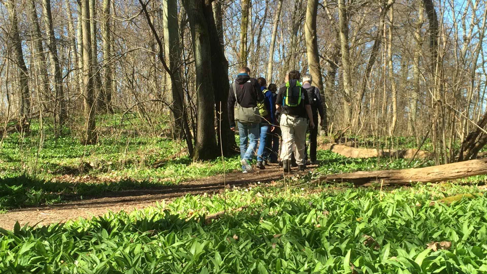
Blåmarkerad slinga, Lingenäset
- Kommune: Kristianstad
- 6819.24 km fra deg
- 2.6 km
- Vanskelighetsgrad: Grønn
The blue-marked loop, also known as the southern Lingenäs round, offers wonderfully varied nature. Here you walk through swamp forest, pasture and deciduous forest. In May, you can smell the wild garlic flowers along the path. Enjoy the spring chorus of bla…

Skåneleden SL6 Vattenriket: Norra Lingenäset - Österslöv
- Kommune: Kristianstad
- 6819.66 km fra deg
- 12.0 km
- Vanskelighetsgrad: Grønn
From Österslöv's bathing place and "pod" shelter, the trail takes you on towards Kristianstad along the old embankment. On the route you walk along the eastern shore of Råbelövssjön. Here the plain meets the mountain range and on the other side of the lake…

Skåneleden SL6 Vattenriket: Österslöv - Arkelstorp
- Kommune: Kristianstad
- 6821.89 km fra deg
- 9.0 km
- Vanskelighetsgrad: Grønn
From Arkelstorp, the trail heads south on the old embankment towards Österslöv. The walk along the former railway between Kristianstad - Immeln gives a glimpse of the old days when the trains went across and across. The line was completed in 1885 and then r…

Skåneleden SL6 Vattenriket: Lerjevallen - Arkelstorp
- Kommune: Kristianstad
- 6820.38 km fra deg
- 8.1 km
- Vanskelighetsgrad: Blå
Lerjevallens outdoor area is located about 20 km north of Kristianstad at Lerjesjön. There are several shelters with barbecue areas, picnic tables, toilets, swimming areas and drinking water. The trail starts and ends at the old ski slope. The days of skiin…

Skåneleden SL6 Vattenriket: Naturum - Ekenabben
- Kommune: Kristianstad
- 6822.65 km fra deg
- 4.0 km
- Vanskelighetsgrad: Grønn
Vattenrikets besökcenter, naturum ligger mitt i staden Kristianstad och mitt i Biosfärområde Kristianstads Vattenrike. På pålar mitt ute i vattnet, helt i trä med ovanliga vinklar och vrår, ligger det som nod mellan stad och natur. Det är också här etappen…
Beste turstier i Kristianstad
Naturkarten samler de turstiene i Kristianstad som er mest populære blant våre brukere.
