
-
-
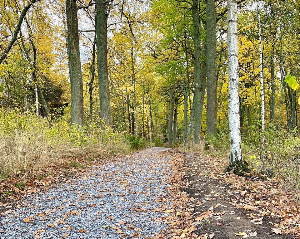
Grusad led till rastplats på Kärsön.
Foto: Mats Larshagen
Lovö Kärsö - Ledstråk till rastplats
- Fotturer
- Gå
- Rullestoltilgjengelig
- Barnevognstilgjengelig
- Fylke: Stockholms län
- 6829.51 km fra deg
Detaljer om stien
- Lengde 0.8 km
Handlinger
Beskrivelse
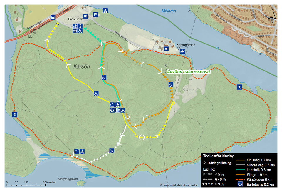
A trail with tactile elements for the vision impaired. The trail is 0.8 km (marked in blue on the map) and goes from the information centre at Brostugan to the picnic area at the middle of Kärsön.
At the picnic area, you'll find a covered shelter, a fire pit and a wheelchair-accessible outdoor dry toilet. There is also a barefoot trail for those who'd like to take off their shoes and socks and feel nature underfoot.
There is a grilling area nearby, on the south side of the island. From the picnic area, continue down the forest road 150 m and then turn right. There you will find a fantastic view over Lake Mälaren.
This nature reserve is managed by the National Property Board (Statens fastighetsverk, SFV), skogsbruk@sfv.se.
Aktiviteter og fasiliteter
- Gå
- Fotturer
Tilgjengelighet
- Rullestoltilgjengelig
- Barnevognstilgjengelig
Bakker
The sign at the information point at Brostugan shows the slope of the trail in the terrain. The first 300 meters from the information point are slightly uphill (about 0-9% slope), the trail is then relatively flat until the rest area.
Veibeskrivelse
You can get to the trail from the information centre at Brostugan. The parking lot is about 100 m from the information centre. The closest bus stop is Brostugan, which is located by the Nockebybron bridge. For current timetables, see www.sl.se.
Please note that there is no pedestrian crossing over Drottningholmsvägen road. Instead, follow the pedestrian and cycling path under the road, at the base of Nockebybron bridge.
Forskrifter
In order to protect the Lovö nature reserve, please respect the following rules.
Within the reserve, it is forbidden to:
- dig, cut, drill or in any other way damage bedrock, soil or stone,
- fell or damage living or dead trees or bushes,
- damage vegetation by digging up plants,
- bring unleashed dogs,
- ride horses on designated hiking trails,
- camp for more than two consecutive nights in a tent, motorhome, caravan or similar,
- moor a boat for more than two consecutive nights at the same beach (this rule does not apply to piers and marinas),
- put up permanent posters, signs or similar.
Kontakt
E-postadresse
Länsstyrelsen i Stockholm
Organisasjonens logotype

Jeg har vært her 2

Jeg ønsker å dra hit 3


Spørsmål og svar
Still et spørsmål til andre brukere av Naturkartan.
Omtaler
0 anmeldelser
- 5 :
- 4 :
- 3 :
- 2 :
- 1 :
Brukernes bilder
Ingen brukerbilder ennå. Bli den første til å dele!
