
-
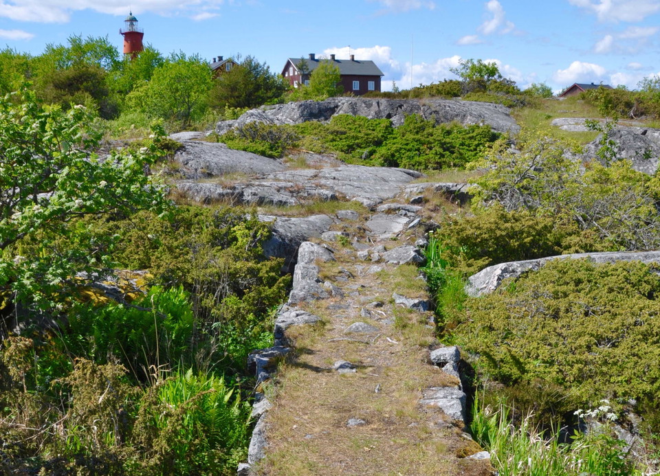
Stigen från hamnen upp mot fyren.
Kuva: Länsstyrelsen Stockholm -
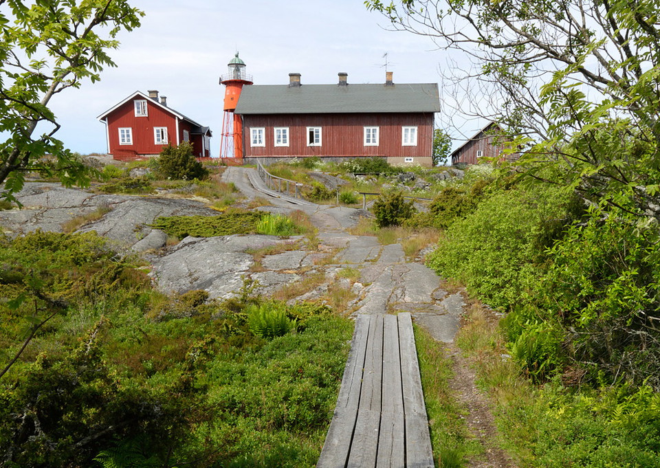
Stigen upp mot fyrbyn.
Kuva: Länsstyrelsen Stockholm -
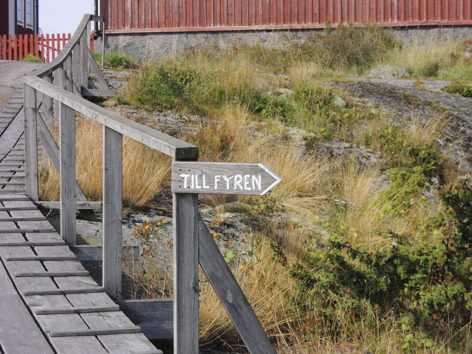
Mot fyren - runda fyrbyn på den norra sidan.
Kuva: Länsstyrelsen Stockholm -
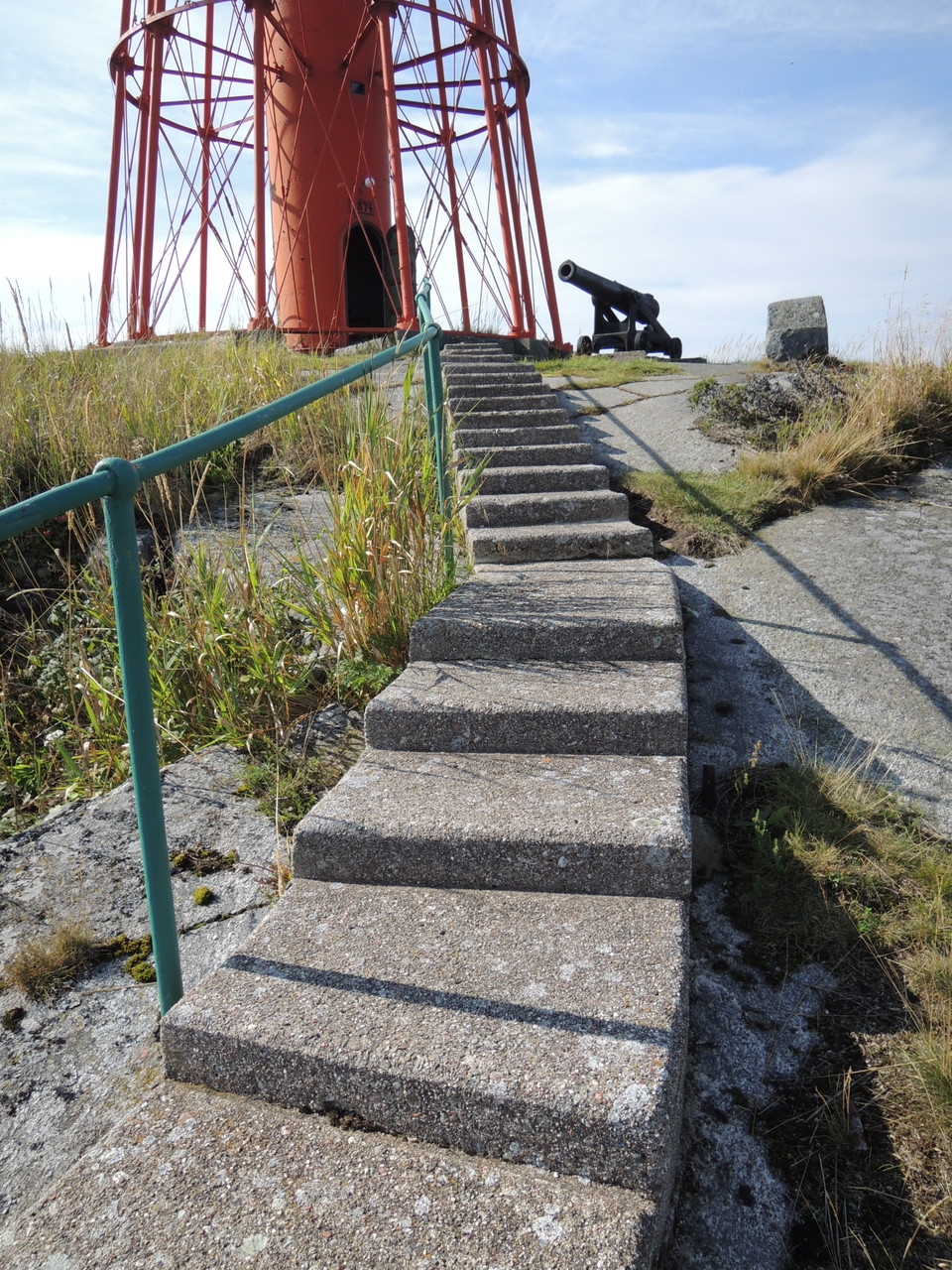
Trappan upp mot fyren.
Kuva: Länsstyrelsen Stockholm -
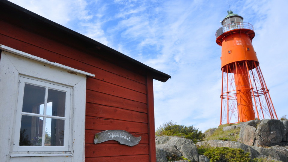
Informationsboden nedanför fyren.
Kuva: Länsstyrelsen Stockholm
Stig mot fyr och informationsbod, Svenska Högarna
- Vaellusreitit
- Kunta: Stockholms län
- 6899.62 km päässä sinusta
Polun yksityiskohdat
- Pituus 0.6 km
Toiminnot
Kuvaus
Polkua pitkin Västermanshamnen majakkaan asti, ohitat kirjanvaihtajan asunnot ja aukion laitakaupungit. Näytä huomioon asukkaita ympäri neljän kylän pohjoispuolella. Jos jatkat majakan alapuolella etelään, tulet tietokauppaan.
Toimintaa ja tilat
- Vaellusreitit
Faktat
Suojellut vuodesta 1976 lähtien, laajennettu vuonna 2020
Koko: 60971 hehtaaria josta maata 104 hehtaaria
Luonne: saaristo, meriympäristöt, kulttuuriympäristö
Kunta: Pohjois
Maanomistajat: Valtio ja Edward Sjöbloms -säätiö
Hallinto: lääninvaltuusto
Muut: Natura 2000 -alue Ruotsin pinot SE0110096
Reittiohjeet
Saaristoon pääsee vain omalla veneellään, taksilla tai tilausveneellä.
Asetukset
In order to protect the Svenska Högarna nature reserve, please respect the following rules. Areas A - C are defined on the map in the original reserve proclamation (in Swedish).
Within the reserve, it is forbidden to:
- during the period of February 1 - August 15, traverse or stay within Area A, as marked on the map (see Appendix 1B of the proclamation, "Område A" in Swedish),
- during the period of April 1 - July 31, traverse or stay within Area B, as marked on the map (see Appendix 1B of the proclamation, "Område B" in Swedish),
- during the period of May 1 - June 30, traverse or stay within Area C, as marked on the map (see Appendix 1B of the proclamation, "Område C" in Swedish),
- operate a boat, ship or other watercraft within the area marked on the map in Appendix 1C of the proclamation ("Område med båt- och fiskeförbud, föreskrift C4 & C7" in Swedish),
- operate a boat, ship or other watercraft at a speed higher than 5 knots within the area marked on the map, Appendix 1C of the proclamation ("Område med fartbegränsning, föreskrift C5" in Swedish),
- anchor a boat or ship in the area marked on the map, Appendix 1C of the proclamation ("Områden med ankringsförbud, föreskrift C6" in Swedish),
- fish within the area marked on the map, Appendix 1C of the proclamation ("Område med båt- och fiskeförbud, föreskrift C4 & C7 " in Swedish),
- dig, cut, carve, drill, paint, move boulders or in any other way damage rock, soil, stone or the seabed,
- break branches, fell or in any other way damage living or dead trees and bushes,
- damage the vegetation by digging up plants, mosses or lichens or remove attached algae or mussels;
- damage or disturb wildlife, e.g. by climbing trees, trapping, stalking or killing mammals, birds, reptiles or amphibians,
- bring dogs or other pets ashore that are not on a leash,
- make an open fire or use a grill outside of designated sites;
- put up a sign, poster or similar,
- camp for more than two consecutive days in the same place outside of designated campsites,
- moor a boat or ship, by right of public access ("Allemansrätten"), for more than two consecutive days at the same beach or pier (this rule does not apply to landowners and tenants),
- discharge waste water, oil and water ballast or other liquid or solid waste from boats or ships,
- wash boats or ship hulls,
- idle a motor or use an electric generator while moored at a pier,
- use a sound system, musical instruments or similar in a disruptive manner,
- take off or land by aircraft,
- disembark with more than 10 people without prior permission from the reserve management authority,
- without prior permission from the County Administrative Board, carry out research activities that may disturb wildlife, such as collecting or trapping organisms (e.g. ring-marking birds) or using sonar or other sound-generating technology.
Yhteystiedot
Sähköpostiosoite
Länsstyrelsen i Stockholm
Organisaation logotyyppi

Huomaa, että osa näistä teksteistä on käännetty automaattisesti.
Olen ollut täällä
Haluan mennä tänne
Kysymykset & vastaukset (Q&A)
Esitä kysymys muille Naturkartan-käyttäjille.
Arvostelut
0 arvostelut
- 5 :
- 4 :
- 3 :
- 2 :
- 1 :
Käyttäjien kuvat
Käyttäjien kuvia ei ole vielä. Ole ensimmäinen, joka jakaa kuvan!
