Tältplats havskajak - Kälkerön

  • Teltapaikka
  • Melonta
/5 tähteä

Toiminnot

  • Reittiohjeet

Kuvaus

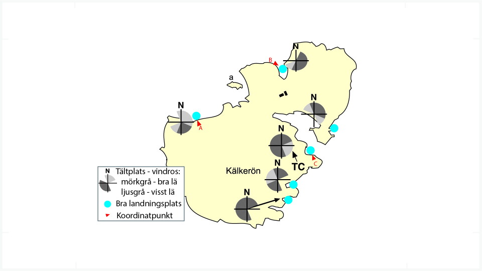
A most beautiful and varied island. Dramatic rocks but also lots of thickly wooded parts. You must see the vertical southwest wall - why not take a swim and jump from it, the water is 12 metres deep. Lots of pleasure boats in the southeast bay, but the rest of the island is often left to the kayakers.

Good landings and camping ground on several spots, just make your choice according to the wind. Sheep and sometimes cows are grazing the island, show them consideration and watch out for their droppings...

WGS84

Point A: 58.074583, 11.560633

Point B: 58.077383, 11.570317

Point C: 58.072933, 11.572283

Sääennuste (klo 12.00)

Ladataan…

Tule tänne julkisilla liikennevälineillä

Toimintaa ja tilat

  • Melonta
  • Teltapaikka

Yhteystiedot

Sähköpostiosoite

Svenska Kanotförbundet

Olen ollut täällä

Haluan mennä tänne

Arvostelut

—

0 arvostelut

/5 tähteä

5 :
0.0%
4 :
0.0%
3 :
0.0%
2 :
0.0%
1 :
0.0%

Kysymykset & vastaukset (Q&A)

Esitä kysymys muille Naturkartan-käyttäjille.

Käyttäjien kuvat

Jaa kuvasi paikasta!

Naturkartan

Avaa tämä sovelluksessa