
-
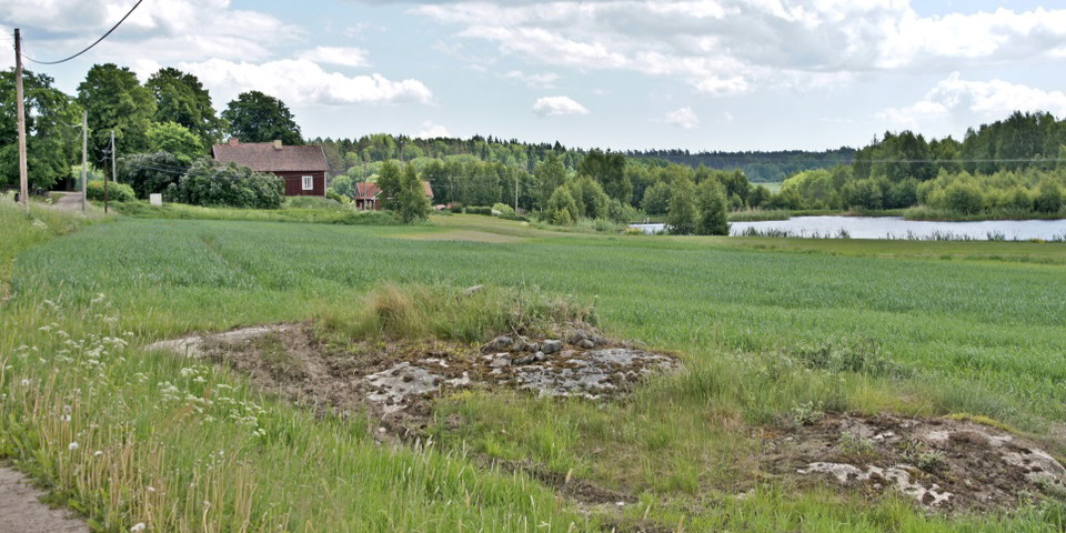
Kuva: Christian Grässer
Livstens hamn - Livstens-leden
- Pyhiinvaeltajapalvelut
- Ääni
- Kunta: Stockholms län
- 6826.24 km päässä sinusta
Toiminnot
Kuvaus
Just before we leave the small forest road and turn right on the way back to Frösundagården and the church, we look out over the small lake where Livsten's Viking harbor was probably located. A small remnant of the mighty waterway that Långhundraleden once constituted and which in the 16th century was still a waterway between Uppsala and Saltsjön via Trälhavet.
The farm by the lake is called Helgö - a name that should probably be interpreted as "the holy island". It was to this island that Livsten built one of his bridges. The place has somehow been perceived as sacred, holy or healing.
It may have a parallel in Helgö in Ekerö parish, which was very important for trade before Birka was built. Helgö is very strategically located on a branch of the Långhundraleden, which in Livsten's time was a very important transport and communication route. Perhaps the farm of today was also located on an island, or possibly a peninsula, when it was first built.
Footnote: The Old Iron Age is counted from about 500 BC to 400 AD. Late Iron Age from 400 AD to about 1050 AD. Viking Age c. 800-1050 AD.
Toimintaa ja tilat
- Pyhiinvaeltajapalvelut
- Ääni
Yhteystiedot
Osoite
Telefon: 08-587 850 00 Besök: Kulturhuset, Allévägen 1, Vallentuna
Sähköpostiosoite
Vallentuna kommun
Organisaation logotyyppi

Olen ollut täällä
Haluan mennä tänne
Kysymykset & vastaukset (Q&A)
Esitä kysymys muille Naturkartan-käyttäjille.
Arvostelut
0 arvostelut
- 5 :
- 4 :
- 3 :
- 2 :
- 1 :
Käyttäjien kuvat
Käyttäjien kuvia ei ole vielä. Ole ensimmäinen, joka jakaa kuvan!
