YTTRE BODANE
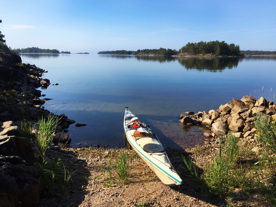
Magnificent paddling waters open up twenty kilometres
south of Tösse and about four kilometres from the E 45 towards Yttre Bodane.
The Vänern archipelago with its many islands is part of the Yttre Bodane nature
reserve, offering great opportunities for swimming and sunbathing on smoothly
rounded and flat rocks. Paddling routes inside the archipelago largely follow
an old cargo-boat route. For a fine day trip you can follow the navigable
channel up to the islands of Trollön and Gåsön in the north of the archipelago
and back. The boat ramp is about 300 metres from the car park of the nature
reserve, so it is good to bring a kayak trolley. At the car park there is a
barbecue site, toilet, refuse bin and information sign. Yttre Bodane also
offers good hiking trails starting from the car park. You meet plant and
wildlife while walking among ancient monuments in the form of cairns from the
Bronze Age.
Places to Visit for Kayakers
Svegön is an island with a beautiful beach.
In the 1800s a tailor and shoemaker lived and worked here, but the island has
been inhabited since the Bronze Age. There is a meeting house on the island
which is open to the public. It has a small kitchen where visitors can cook
their own meals and enjoy their dinner. If you want to stay on the island
overnight, you need to be a member of the Segelsällskapet Åmålsviken
association.
On the
island of Sandön you
will find remnants of the old cement works and Åmål’s sand pit. In the past
boats from other parts of Vänern moored here to collect sand. The island has a
dwelling house from the mid-nineteenth century where you can stay over in the
summertime. The house has 4 beds and a gas stove and can be booked for a single
night. If you would like to make a reservation, email amal-sandon@hotmail.com
and the administrator at the Åmål’s Motorbåtsällskap association will be happy
to help you.
Storön: In the mid-nineteenth century a
soldier was tired of the life on the mainland and decided to move to Storön
island where he built himself a house. The house is still there and was
recently renovated by the Öfolket association. The house is open to visitors
all year round and available for overnight stays. It also has simple kitchen
facilities. For more information, visit www.ofolket.se.
Fogden
lighthouse: A barn survives here and the foundation of a dwelling house that
was also the bailiff’s lighthouse in the mid-nineteenth century.
Rolfkärrs Stugby: A cabin village with a kiosk
that is open in the daytime during the summer. There is a nice sandy beach.
Rotesund, northern part: There are remains here
of the loading dock and the railway that came from the mines up in the
mountains. On land you can still see markings painted on the rock to guide the
cargo boats.
Information
«Drinking
water is avaliable at: Örnäs camping for a tiny fee. Drinking water is also
avaliable at Rolfkärrs Stugby.
« Waste
bins are located on: Svegön, Sandön, Björkön, Storön, Gåsön and
Tössebäcken. There are no garbage cans in Yttre Bodane.
« Free
extended parking at: Näsviken, Tössebäcken, Örnäs camping (24h), Måkeberg.
At Yttre Bodane, staying overnight is not allowed for camper/caravans.
« Emergency number: 112