
-
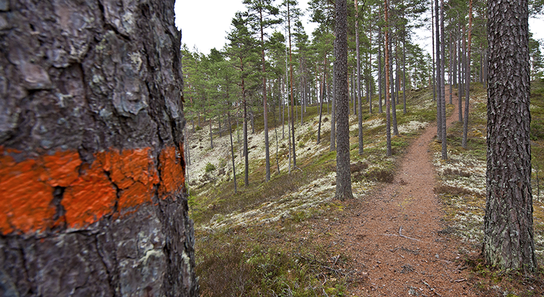
Vandringslederna på Brattforsheden är markerade med orange färg på träden. -
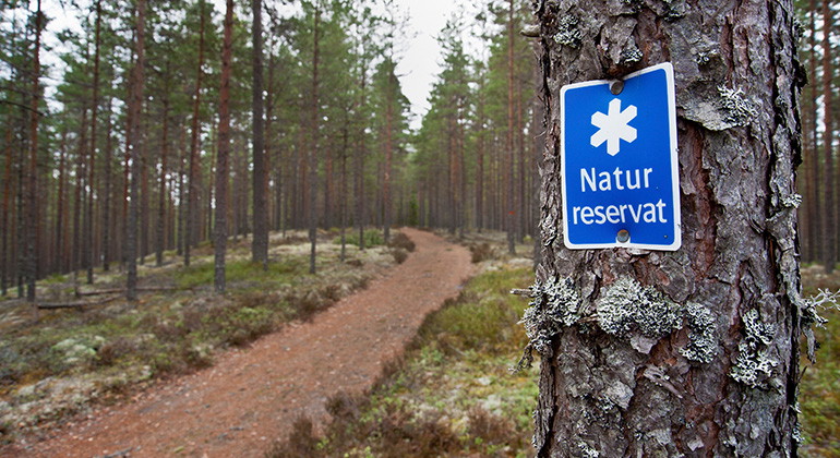
Vandringsled på Brattforsheden.
Foto: Mikael Solebris -
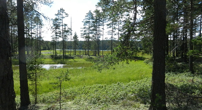
Längs flera av vandringslederna kan du komma nära sjöar och våtmarker.
Foto: Lars Furuholm -
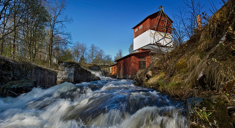
Den gamla järnhyttan vid Brattfors.
Foto: Mikael Solebris -
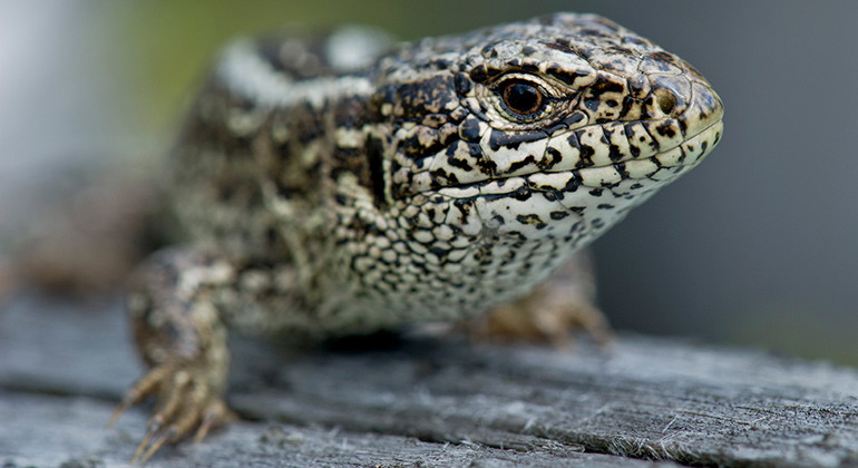
Har du tur kan du få se en sandödla.
Foto: Mikael Solebris -
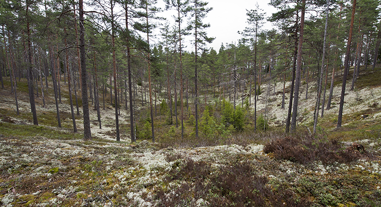
På Kittelfältet kan du se stora dödisgropar, spår efter inlandsisen. -
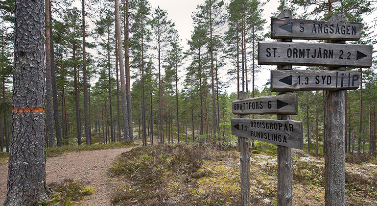
Flera vandringsleder går över Kittelfältet. -
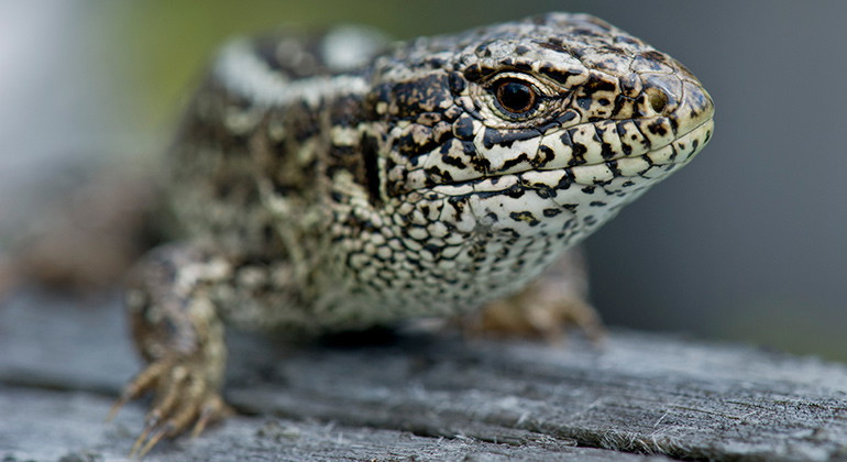
Sandödla. Foto Mikael Solebris. -
Skog intill sjö. Foto Lars Furuholm.

Brattforsheden, Naturvårdsområde
- Naturværdi
- Amt: Värmlands län
Handlinger
Beskrivelse
Meandering streams, pits from the Ice Age, steep ridges and ravines. Brattforshedens nature conservation area has five different nature reserves with completely different habitats - all equally exciting. Here you can visit Brattfors fire field, Geijersdalsmossen, Kittelfältet, Lungälvsravinerna, Svartåns nature reserve and Krigsflygfält 16 Brattfors with exciting military history and special nature.
Photos in the slideshow: Värmland County Administrative Board, unless otherwise stated.
Before your visit
In Brattforshedens nature conservation area there are several shelters where you can cook and spend the night. Firewood is continuously replenished at the fireplaces, but bring your own firewood if you want to be absolutely sure that you can make a fire. Never cut down trees if firewood is missing.
As the ground is often very dry, you may only make fires at designated places, i.e. built-up fireplaces or barbecue areas that are also marked on the map.
You should be aware that mobile phone coverage is poor in many parts of the area.
Less wood at the fireplaces
From 2023, resources have been reduced for the management of the nature reserves, which means that we have reduced the supply of firewood. Since we are now putting out less firewood, it is extra important that you as a visitor burn carefully and bring your own firewood if you want to be sure to be able to grill. Please note that fires may only be lit in the designated fireplaces and that it is forbidden to take dead or live branches from the forest.
Hiking trail under construction
Hiking trails between Långtjärn and Malmtorget have been removed in the fall of 2023. This applies to the southernmost part of the Svartåleden trail and parts of the Paradiseden loop. Therefore, be a little extra careful if you go hiking in this area as there are no markings and signs at the moment.
Hike among species-rich pools, lush ravines and hilly pine forest
Brattforsheden has many fine hiking trails, with a total length of 75 kilometers. The trails are marked on trees and posts with the color shown on the map (orange, yellow, blue and green).
Remains from the past
People have lived and moved in this area since the Bronze Age, perhaps even earlier. Traces of Stone Age settlements have been found at lakes Mången, Alstern and Lungen. Among other things, you can see large grave rocks from the Bronze Age. There are also trapping pits that bear witness to ancient hunting of wild animals and a large number of charcoal pits - remains from several hundred years of charcoal production.
In the southern part of Brattforshedens nature conservation area is the cultural reserve Krigsflygfält 16 Brattfors. It is a valuable cultural landscape characterized by the military mobilization during the Second World War, 1939-1945. Here you can also enjoy the special nature with many unusual species of insects, birds and fungi.
Unusual animals and plants
Much of the land at Brattforsheden is sandy. There grows a dry and lean pine forest called heath pine forest. Heather, lingonberry, reindeer lichen and Icelandic lichen grow on the ground in the pine forest. If you are lucky, you may see some of the birds that live here: black grouse, capercaillie, greater crossbill, double-crested cormorant, tufted titmouse, redstart and gray flycatcher.
Many rare and endangered species have been found on Brattforsheden that are adapted to forests with open gaps and sand dunes without vegetation. These include sand lizard, nightjar, woodlark, marsh fritillary, woodlouse, various fungi and a large number of insect species. Historically, this type of open forest habitat was often created by natural forest fires. But today's effective firefighting and forestry practices have made forests more closed and dark than before. This makes it harder for animals and plants to thrive here. Today, however, bright habitats are being recreated for the threatened species through various nature conservation measures in the area.
The environment is wetter in the areas along the meandering rivers Svartån and Lungälven. There are several unusual species that live in the water, on the banks and in the surrounding damp ravine forests.
Aktiviteter og faciliteter
- Naturværdi
Fakta
Established: 1984
Size: 11 400 hectares of which land area approximately 10 000 hectares
Landowners: Company, Municipality, Church, Private and State
Manager: County Administrative Board in Värmland County
Rutevejledning
Brattforshedens nature conservation area is located in the municipalities of Filipstad, Karlstad and Hagfors in Värmland County. Road 63 between Karlstad and Filipstad runs right through the area. There are signs to the reserves and rest areas, and you can get here by bus. Värmlandstrafik line 400 between Karlstad and Kristinehamn, goes via Filipstad and Brattforsheden. The stops Tullen, Geijersvägen, Brattfors, Källorna and Mangenbaden are located along the 63.
Regler
**In Brattforshedens nature conservation area, special regulations and restrictions apply to the right of public access.
In the nature conservation area it is forbidden to:
- drive off-road vehicles including snowmobiles,
- drive motorized vehicles other than on designated roads (according to signs),
- set up caravans or other vehicles for overnight stays other than in a specially designated place,
- light an open fire other than in a specially prepared and designated place. Note, however, that a total fire ban may be issued if necessary.
- letting dogs loose in bathing areas or other facilities, on trails or paths, and in specially protected areas according to separate reserve decisions
- damage vegetation, for example by felling or otherwise damaging living or dead trees
- picking (other than single individuals of) lichens and mosses
- driving a motorboat other than in lakes Alstern, Lungen and Mången. In the parts of the specified lakes affected by the order, it is forbidden to drive a boat at a speed higher than seven (7) knots.
Kontakt
E-mailadresse
Maila Länsstyrelsen Värmland
Organisationens logotype
Jeg har været her 6


Jeg vil gerne derhen 4

Spørgsmål og svar
Stil et spørgsmål til andre Naturkartan-brugere.
Anmeldelser
0 anmeldelser
- 5 :
- 4 :
- 3 :
- 2 :
- 1 :
Brugernes billeder
Der er endnu ingen brugerbilleder. Vær den første til at dele et!
