
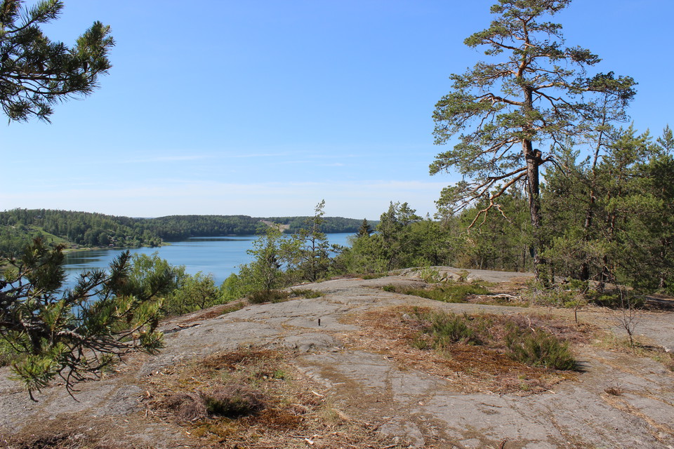

Vandrarleden
- Vandring
- Parkering i nærheden
- Amt: Uppsala län
- 6797.61 km fra dig
Ruteoplysninger
- Længde 3.0 km
Handlinger
Beskrivelse
Aktiviteter og faciliteter
- Vandring
Tilgængelighed
- Parkering i nærheden
Fakta
Vandrarleden etablerades redan på 1960-talet av Friluftsfrämjandet i Bålsta och har sedan dess underhållits med hjälp av ideella krafter.
Overflade
Path in hilly terrain.
Kommunikation
You can get to Bålsta station by train or bus. From the station it is about 1.5 kilometers to walk to the starting point of the trail Here you will find a map showing how to walk
Rutevejledning
The hiking trail is located on the north side of the E18 highway at the height of the Draget industrial area. The starting point of the trail is in Håbo municipality and the trail in Upplands-Bro municipality.
If you are coming from Bålsta, turn left at the roundabout in Dragets industrial area, follow the road (Dragrännan) and pass under the highway. There is the possibility to park on a small gravel lot on the right side of the road just before you reach the first house.
Kontakt
E-mailadresse
Upplandsstiftelsen
Organisationens logotype

Jeg har været her 18






Jeg vil gerne derhen 31







Anmeldelser
—
3 anmeldelser
- 5 :
- 4 :
- 3 :
- 2 :
- 1 :
Spørgsmål og svar
Stil et spørgsmål til andre Naturkartan-brugere.
Brugernes billeder
Del dine billeder fra stedet!

Väldigt mycket backar, konstant upp eller ner. Inte på något sätt lämplig för rörelsehindrade. Jag uppskattade den lilla leden väldigt mycket och älskade utsiktsplatsen. Går gärna där igen!