
-

Sårjåsjaurestugan.
Foto: Henrik Micael Kuhmunen/Laponiatjuottjudus -
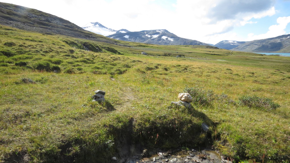
Foto: Henrik Micael Kuhmunen/Laponiatjuottjudus
Stáddájåhkå-norska gränsen, Nordkalottleden
- Vandring
- Amt: Norrbottens län
- 6345.11 km fra dig
Ruteoplysninger
- Længde 10.5 km
Handlinger
Beskrivelse
The trail passes through osiers until the long suspension bridge across Stáddájåhkå stream. Just before the bridge, the trail turns off towards Lake Pieskahaure, while the trail to Lake Sårjåsjaure continues across the stream. Here you leave Padjelanta/Badjelánnda National Park. The trail leads up towards Lake Sårjåsjávrre. The trail crosses brushy moor, and eventually leads across a grassland plateau. The view of the lake and surrounding mountain summits is breathtaking. At the low sandy beach lies the little STF cabin Sårjåsjaure. The hike to the Norwegian border continues along the shore and then across grassland south of the lake. There are wet areas without plankways, and in places the trail is difficult to follow even though there are a number of marker cairns.
The trail is maintained by Laponiatjuottjudus.
Duration: 3-4 hours
Aktiviteter og faciliteter
- Vandring
Overflade
Easily-hiked surface across brushy moor and grasslands, with no major changes in altitude.
Kontakt
E-mailadresse
Länsstyrelsen Norrbotten
Organisationens logotype

Jeg har været her 3


Jeg vil gerne derhen 5

Spørgsmål og svar
Stil et spørgsmål til andre Naturkartan-brugere.
Anmeldelser
0 anmeldelser
- 5 :
- 4 :
- 3 :
- 2 :
- 1 :
Brugernes billeder
Der er endnu ingen brugerbilleder. Vær den første til at dele et!
