Naturkartan på ny teknisk plattform

Naturkartan har bytt teknisk plattform. Driftstörningar kan förekomma på webb och i app under inkörningsperioden. Rapportera problem till emil@outdoormap.com.

Læs mere
  • Foto: Alex Regnér
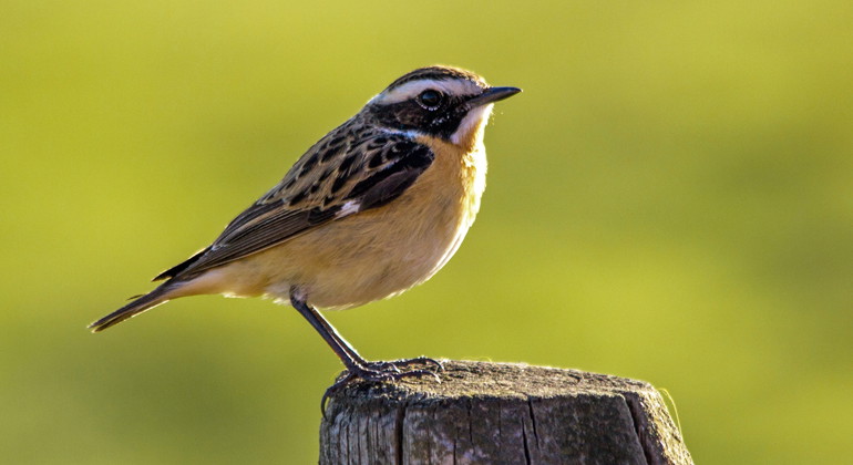
  • Buskskvätta.
    Buskskvätta.
    Foto: Alex Regnér
  • Foto: Alex Regnér
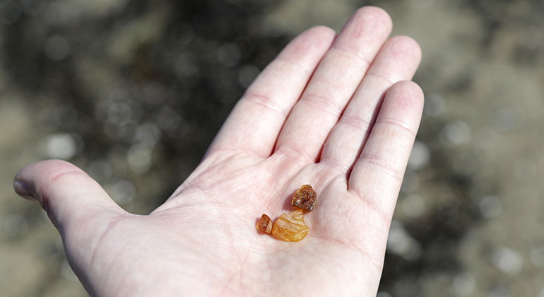
  • Bärnstensfynd på stranden i Skanör-Höll.
    Bärnstensfynd på stranden i Skanör-Höll.
    Foto: Alex Regnér
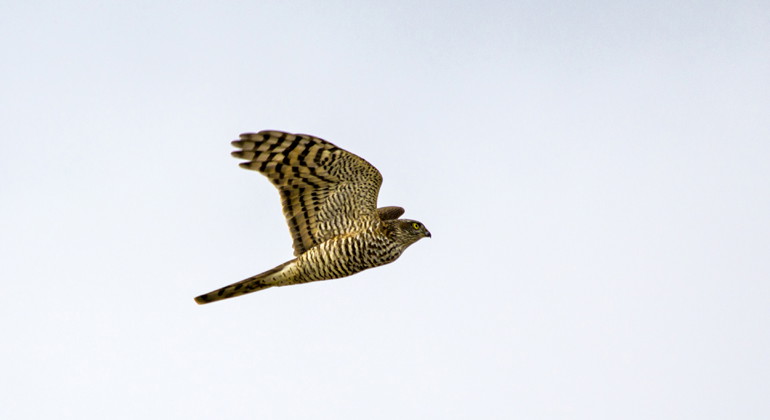
  • Sparvhök.
    Sparvhök.
    Foto: Alex Regnér
  • Foto: Sanna Persson
  • Foto: Sanna Persson
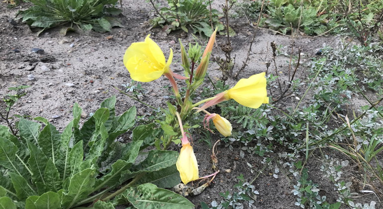
  • Jättenattljus.
    Jättenattljus.
    Foto: Sanna Persson
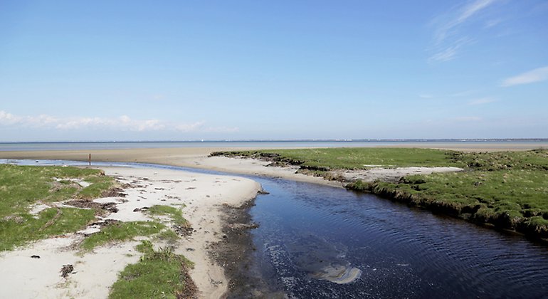
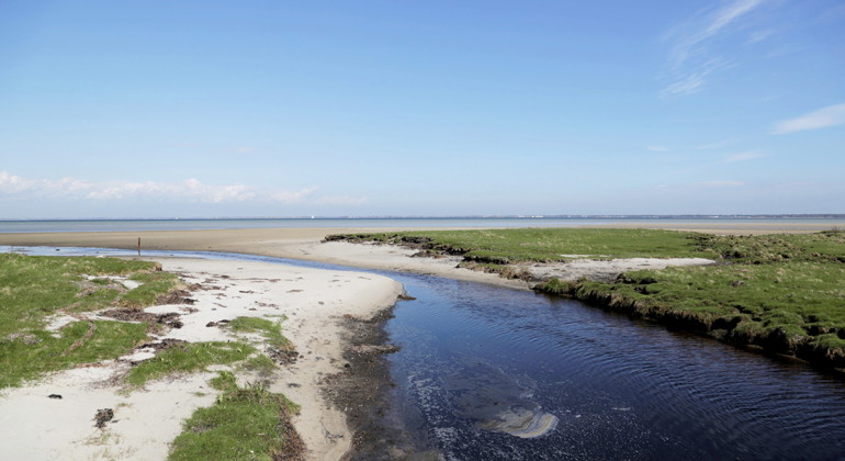
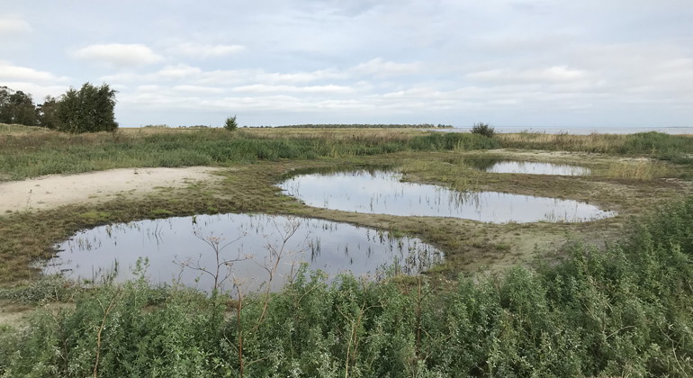
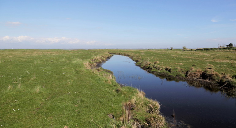
  • Vattendraget Bredeväg var en gång en viktig transportled för mindre pråmar.
    Vattendraget Bredeväg var en gång en viktig transportled för mindre pråmar.
    Foto: Alex Regnér

Skanör-Höll, Naturreservat

  • Naturreservat
ud af 5 stjerner

Handlinger

Beskrivelse

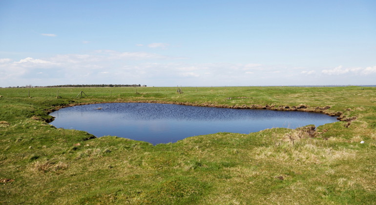
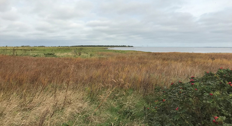
The Skanör-Höll nature reserve is located northeast of Skanör. The reserve, which lies along the western shore of Höllviken, is a very well-preserved and characteristic remnant of the coastal grazing landscape that once stretched along Skåne's low-lying coastal areas. The land has never been fertilized and is home to a distinctive, grazing flora and a very rich bird life.

Ancient grazing landscape

Skanör-Höll was set aside as a reserve in 1995 to preserve the grazed coastal meadows. The coastal meadows have been grazed for centuries and are a remnant of the ancient grazing landscape that once stretched along the west coast of Skåne. In the grazed part of the reserve, species such as blue clover, large marsh marigold, meadow rattle, beach wormwood and Danish scurvy herb grow. In the ungrazed southern part of the reserve, the rare plant Danish iris has been found.

Rich bird life

The coastal meadows together with the shallow seabeds create a favorable environment for many bird species. Many geese, waders and gulls can be seen in the area, and during the migration period the reserve is a popular resting place for a wide range of migratory birds. Among other things, many birds of prey can be seen flying over the reserve on their way south.

Sites of cultural and historical interest

The reserve also stretches along the Bredeväg watercourse towards Skanör. Bredeväg is the old shipping route to Skanör, which was in use until the port of Skanör was built at the end of the 19th century. Heavier goods were transferred from ships anchored in Höllviken to small barges, which were then towed up Bredeväg and into Skanör. The same route was used to move the animals out to the coastal pastures. Along Bredeväg and the shore lands, you can see clear seaweed embankments. These were once built as fences and used to form the boundary between the inland and outland areas of Skanör.

The fishing huts

For a long time, the people of Skanör have anchored their small boats in the calm waters along Höllviken beach. In the southern part of the reserve there is a cluster of so-called fishing hides on the beach. The fishing huts and small boats in the bay are now used for fishing for domestic use.

Outdoor life

The marked trail that runs through the reserve is Skåneleden, but it is also possible to roam freely along the water. If you visit the area in the fall, keep your eyes open for amber among the seaweed, as these are often carried ashore by the storm waves. There is a parking lot adjacent to the reserve and the nearest bus stop is Skanör Stefan Löfvings V.

Remember to take your rubbish home.

Skanör-Höll is one of nine nature reserves around the Falsterbo peninsula. There are good outdoor recreation opportunities in the area, including hiking, bird watching and swimming. The Skåneleden trail (SL5 Öresund, stages 20 and 21) takes you around the entire peninsula. Remember that the reserves have different regulations, so check what is allowed where you are!

In English

Welcome to Skanör Höll Nature Reserve

At Knösen, the northern point of the Falsterbo peninsula, the open landscape meets the sea. Cattle have grazed along the coast for more than a thousand years, creating species-rich flowering meadows with their soft muzzles. In autumn, it is time to go on a treasure hunt along the shore. Among the seaweed swept in by stormy waves, pieces of amber are waiting to be found.

The coastal meadows are the remains of a landscape that once covered large parts of the west coast of Skåne. The land has never been fertilized and contains a diverse flora with species such as yellow-rattle, sea wormwood, common scurvygrass and saltmarsh rush. In the southern part of the reserve you find the protected species blue iris.

The shipping lane Bredeväg flows between the seaweed enclosures in the center of the reserve. In the Middle Ages, this was an important transport route, where small barges took goods from ships in the bay up to Skanör and returned laden with barrels of herring. The horse-drawn barges along Bredeväg did not disappear until the harbor was built in the late 19th century. The seaweed enclosures are special features in the costal landscape, separating fields from grazing cattle. Today, the entire peninsula is pastureland.

In spring and autumn, the shallow aquatic areas and shores are important resting places for birds. The extensive reed belts in the reserve, with sea-club rush and soft shallow bottoms, are visited annually by ducks, geese and waders. Another autumn treat is the sight of birds of prey stretching out across the sea.

Regulations

Within Skanör-Höll Nature Reserve it is forbidden to:

  • dig, drill, paint, or in any other way damageboulders or living or dead trees or shrubs,
  • deliberately disturb wildlife,
  • dig up plants,
  • camp or park caravans, camper, or similar,
  • park other than in designated areas,
  • anchor boats outside the area marked on the appendix 1 ,
  • light fires other than in designated places,
  • bring unleashed dogs between March 1 until August 20, with the exception for dogs used for retrieving during hunting,
  • put up notice boards, placards, posters, signs, or similar, or make inscriptions.

Please note that the regulations for the Falsterbo Peninsula aquatic area - Falsterbohalvöns havsområde nature reserve - also apply to the aquatic area in Skanör-Hölls Nature Reserve.

Within Falsterbohalvöns havsområde Nature Reserve it is forbidden to:

  • wind or kitesurf throughout the whole year within areas on the map marked with red or green stripes, and during the period 1 March - 1 July within the area indicated by red dots,
  • operate watercraft at speeds exceeding 5 knots within the areas on the map marked with red stripes or red dots,
  • operate watercraft at speeds exceeding 10 knots within the areas on the map marked with blue squares or green stripes,
  • operate or launch water scooter, jet ski or similar watercraft in areas outside general navigable waterways. The rules do not forbid launching of water scooter or jet ski in Skanör harbor for the shortest route towards general navigable waterway no. 205 Drogden-Blenheim SJÖFS 1988:5, or launching in the Falsterbo channel for continued journey on general navigable waterway no. 206, SJÖFS 1988:5.

Vejrudsigt (kl. 12.00)

Indlæser...

Kom hertil med offentlig transport

Aktiviteter og faciliteter

  • Naturreservat

Fakta

Established: 1995

Size: 141 hectares

Municipality: Vellinge

Administrator: County Administrative Board of Skåne

Protection type: Nature reserve and Natura 2000

Rutevejledning

Walk, cycle, take public transport or drive here. Map and directions via Google maps or coordinates (WGS84).

Regler

**Within the area, special rules and restrictions apply to the right of public access.

For example, it is forbidden to:

  • make fires outside designated areas
  • having an unleashed dog during the period March 1 - August 20
  • camping
  • setting up a caravan/mobile home
  • anchor boats outside the area marked with special hatching on the map to the decision (Appendix 1)
  • kitesurf, windsurf and operate watercraft according to map appendices 1a-1f.

Appendix 1, Skanör-Höll (on anchoring) Pdf, 43.5 kB, opens in new window

Map appendices 1a-1f, Falsterbo Peninsula marine area (prohibition of watercraft, wind- & kitesurfing) Pdf, 2.8 MB.

It is important to note that this is only a selection of the rules.

Full regulations for visitors

In addition to regulations and prohibitions in other laws and regulations, it is forbidden to:

  1. digging, drilling, painting or otherwise damaging boulders, living or dead trees and shrubs
  2. deliberately disturbing wildlife
  3. dig up plants
  4. camping or setting up a caravan, camper van or similar
  5. park other than in designated places
  6. anchor boats outside the area indicated with special hatching on the map to the decision (Appendix 1)
  7. make a fire except in designated places
  8. bring an unleashed dog during the period March 1 - August 20, with the exception of dogs used as retrievers for hunting
  9. affix a board, poster, poster, sign, inscription or similar device

Bilaga 1, Skanörs Höll Pdf, 43.5 kB.

Please note that the Skanör-Höll nature reserve is partly located within a larger nature reserve, Falsterbohalvöns havsområde, where the following regulations also apply. The italicized regulations are those that affect Skanör-Höll geographically:

In addition to regulations and prohibitions in other laws and regulations, it is forbidden to:

  1. windsurfing or kitesurfing throughout the year in the areas indicated by red or green shading on the attached maps, appendices 1a-1f, and during the period March 1-July 1 in the area indicated by solid red color,
  2. operate craft at sea at a speed exceeding 5 knots within the areas marked with red shading or solid red on the attached maps, Annexes 1a-1f
  3. operate craft at sea at a speed exceeding 10 knots in the areas indicated by blue-red marking or green shading on the attached charts, Annexes 1a-1f
  4. drive or launch personal watercraft, jet skis or similar craft other than in public fairways. The regulation does not prevent the launching of jet skis or personal watercraft in the port of Skanör for the shortest route to the public fairway No. 205 Drogden-Blenheim SJÖFS 1988:5 or launching in the Falsterbo Canal for continued travel in this public fairway; No. 206, SJÖFS 1988:5.

Kartbilagorna 1a-1f, Falsterbohalvöns havsområde Pdf, 2.8 MB.

Kontakt

Adresse

Under LÄNKAR kommer du till aktuell reservatssida på Länsstyrelsens webbplats, med fördjupande information som kartor, broschyrer och hänvisning till relevanta aktörer. Här finns även en rapportfunktion för dig som vill lämna uppgifter om naturreservaten som vi förvaltar.

E-mailadresse

skane@lansstyrelsen.se

Jeg har været her 3

Jeg vil gerne derhen 1

Spørgsmål og svar

Stil et spørgsmål til andre Naturkartan-brugere.

Anmeldelser

0 anmeldelser

ud af 5 stjerner

5 :
0.0%
4 :
0.0%
3 :
0.0%
2 :
0.0%
1 :
0.0%

Brugernes billeder

Der er endnu ingen brugerbilleder. Vær den første til at dele et!

Naturkartan

Åbn dette i appen