
-

-
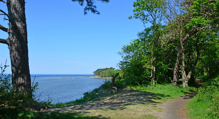
Foto: Mats Sjöberg -
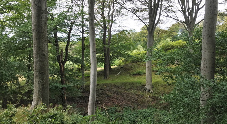
Foto: Sanna Persson -
Foto: Maria Sandell -
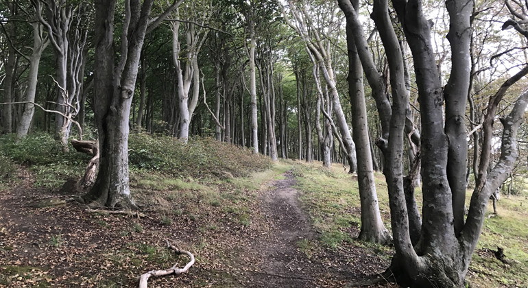
Foto: Sanna Persson -
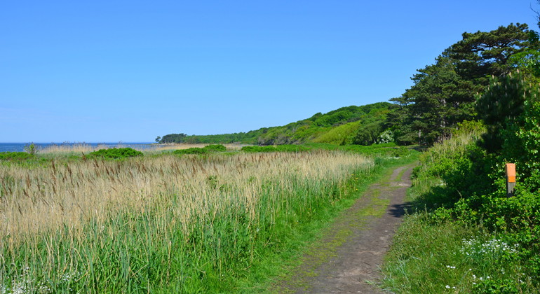
Foto: Mats Sjöberg -
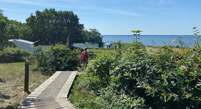
Skåneleden utmed kusten.
Foto: Carina Zätterström -
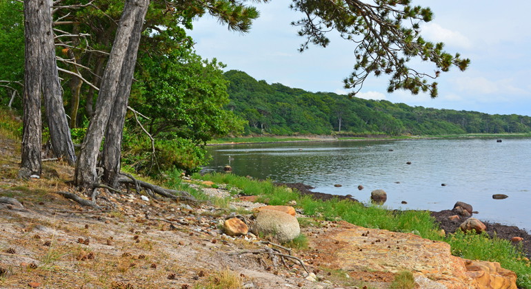
Foto: Mats Sjöberg -
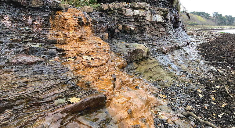
Landborgen.
Foto: Carina Zätterström -
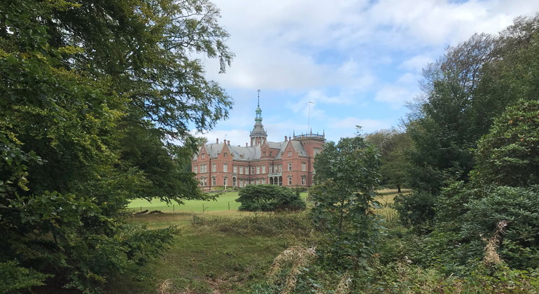
Kulla Gunnarstorps slott.
Foto: Sanna Persson -
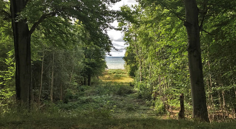
En av tre utsiktsgator (vistor).
Foto: Sanna Persson -
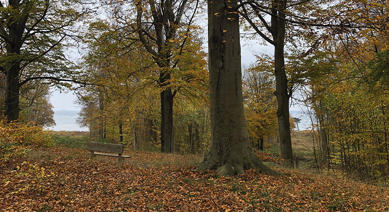
En annan av de tre utsiktsgatorna (vistorna).
Foto: Carina Zätterström -
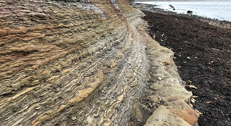
Landborgens kant mot havet.
Foto: Carina Zätterström -
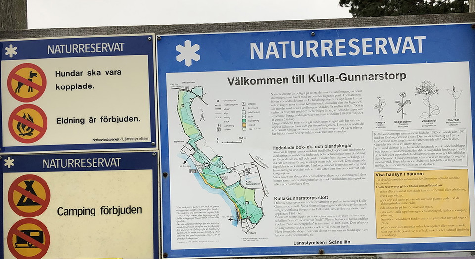
Eldning förbjuden i reservatet.
Foto: Carina Zätterström -
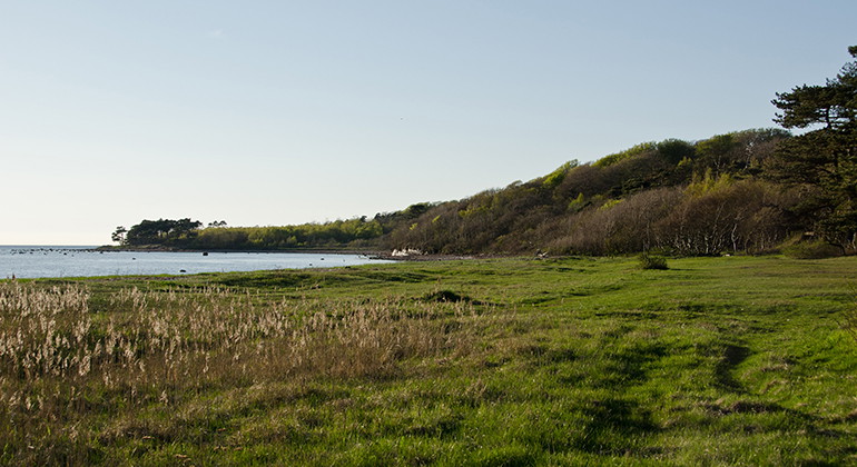
Foto: Maria Sandell -
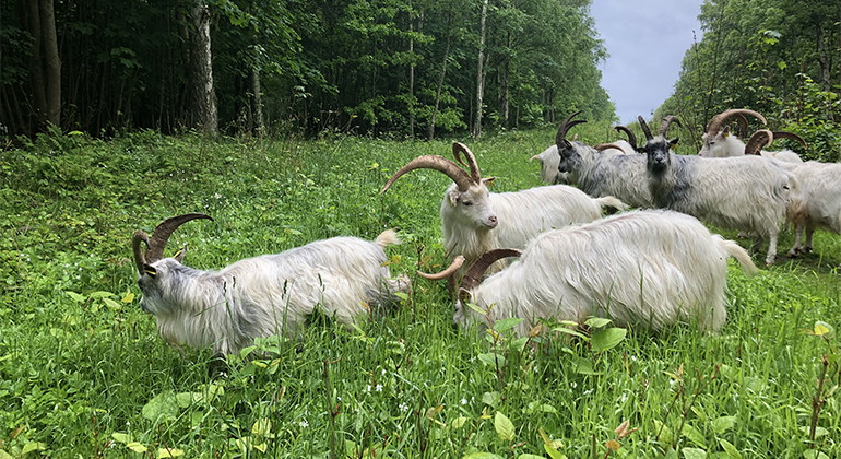
Getter tuktar parkslide.
Foto: Carina Zätterström -
Foto: Carina Zätterström -
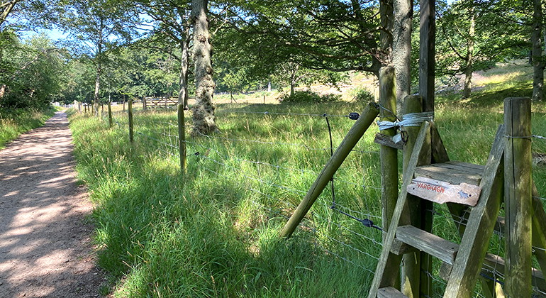
Foto: Carina Zätterström -
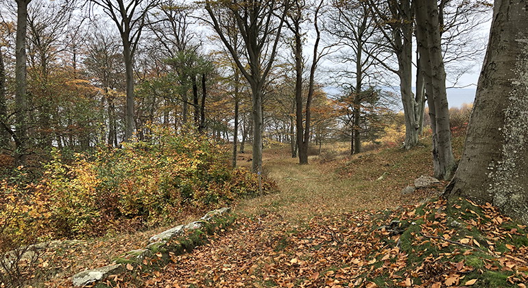
Foto: Carina Zätterström -
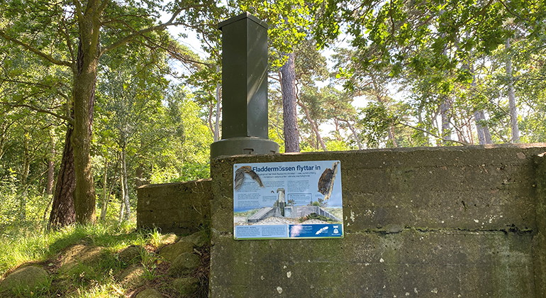
Kustvärn som blev hem för fladdermöss.
Foto: Carina Zätterström -

-

Kulla Gunnarstorp, Naturreservat
- Naturreservat
- Amt: Skåne län
Handlinger
Beskrivelse
Kulla Gunnarstorp (Kulla-Gunnarstorp) offers beautiful views and cooling baths in the Sound. Several paths lead you around through forest, pasture and along the coast. Don't miss the viewing streets just to the west of the castle, which create little slices or paintings of the strait. Even the rocky outcrop, the so-called landborgen, is special with its water-slicked slopes along the shoreline. Swimming is best just north of Hittarp, where the beach is sandy.
Landborgen and its steep slope
The nature reserve is located on the northern parts of Landborgen. Its steep slopes down to the sea were formed 4000-7000 years ago by waves and currents when the sea level was up to six to seven meters higher than it is today. Up on the plateau, 20 to 40 meters above sea level, lies the flat agricultural landscape. Streams have cut deep into the land and formed stream channels.
Castle environments and viewing streets
The castle that lies just next to the reserve was built in the 16th century on the crest of the castle. A little higher up and more visible is the new castle built in the 1860s. The reserve is a continuation of the castle park, which is private. In the reserve you are greeted by the large wide-crowned trees, paths and viewpoints.
To the west of the castle are three special viewpoints called "vistorna". The free viewing paths create a slice of nature showing the sea, the boats and the Danish coast. In the "tavla" in the far south, Kronborg Castle or "Hamlet's Castle" is enthroned. These same 'paintings' could be seen by visitors to the castle as early as the 19th century. They are described in lyrical terms in the book Skånska herrgårdar, which was published at the time.
Flying birds of prey and meandering honeysuckle
In the fall and spring, keep an eye out for migrating birds of prey. Lots of buzzards and bees pass by, along with the occasional osprey, lark falcon and barn owl.
The reserve's rather species-poor beech and oak forests are home to sorrel, squirrelberry and wild star. The meandering honeysuckle is a characteristic species of the area.
Outdoor life
The Kulla Gunnarstorp nature reserve runs along the coast from Hittarp in the south, via Domsten, to Kristinelund in the north. The large parking lot is in Hittarp, but you can also get here by bus. There are plenty of hiking trails in the area. Just north of Hittarp there is a nice sandy beach for those who are keen on swimming. If you go further north, you will come to rocky beaches with pebble fields.
Don't miss the viewing streets just west of the castle, which create small sections or paintings of the strait. Even the rocky outcrop, the so-called landborgen, is special with its water-slicked, steep slopes along the shoreline. Please note that the fireplaces have been removed and that fires are now prohibited throughout the reserve. Remember to take your rubbish home.
In English
Welcome to Kulla Gunnarstorp Nature Reserve
A visit to Kulla Gunnarstorp offers a great opportunity for hiking, cycling and horse-riding. And why not finish your trip with a dip in the sea from the sandy beach just north of Hittarp? Look out over the sea from the top of the escarpment through specially-cut viewing corridors where the woodland forms a frame around the view of the water and Denmark in the background.
Cliff Landscape
The nature reserve is located in an area that encompasses the northern parts of the escarpment. These steep slopes down to the sea were created 4000-7000 years ago by waves and currents, when the sea-level was as much as six to seven meters higher. Up on the plateau, 20-40 meters above the sea, there is a flat agricultural landscape. Streams have cut deep into the escarpment, forming ravines.
The moated castle that lies close to the reserve on the brow of the escarpment was built in the 16th century. A little higher up and more visible is the new castle that was built in the 1860s. The reserve is a continuation of the castle grounds, which has large, broad-crowned trees, footpaths and view-points. This site was settled long before the 16th century and lying just north of the castle, there is a graveyard with several burial mounds from the Bronze Age (c. 3,500 years ago).
Peepshow in the Woodland
West of the castle, there is a very special form of view-point. From a bench in the park, you can look out through three viewing corridors cut out of the woodland. They create slices of nature, showing the sea, boats and the Danish coast. The same "pictures" could be seen by the promenading guests at the castle back in the 19th century. They are described lyrically in the book Skånska herrgårdar (Skåne's Manor Houses), which was published at the time.
Sand and Stone at the Edge of the Sea
The best place to swim is just north of Hittarp, where you'll find a lovely sandy beach. If you then go further north, you'll come to a rockier coastline with a pebble beach, where there are a couple of meter-high, vertical, sandstone ledges from which spring water runs. The reserve continues out into the sea until it is three meters deep. Past that point, there is the municipal nature reserve Grollegrund, a protected area of the marine environment with valuable underwater habitats.
Woodland
The woodland is mainly beech and oak on heathland. It is rich in flowering plants including Wood Sorrel, False Lily of the Valley and Chickweed Wintergreen. Sweet-scented Goat-Leaf Honeysuckle is one of the woodland's characteristic species, wrapping itself around trees and bushes. In the ravines formed by streams south of the castle, there is more nutrient-rich soil which means the flora is more abundant.
Migrating birds of prey
In autumn and spring you should be on the look-out for migrating birds of prey. Large numbers of Common Buzzard and European Honey Buzzard migrate through the area, together with occasional Osprey, Hobby and Rough-Legged Buzzard.
Regulations
The regulations which apply in the reserves are set out on the notices displayed at the entrances and in swedish on this web page.
Funded by the European Union
Aktiviteter og faciliteter
- Naturreservat
Fakta
Founded: 1982
Size: 159 hectares
Municipality: Helsingborg
Manager: County Administrative Board of Skåne
Type of protection: Nature reserve
Rutevejledning
Kulla-Gunnarstorp nature reserve is located just over half a mile north of Helsingborg. It stretches along the coast between Hittarp and Domsten and then turns inland up to Kristinelund. Parking is available at the beach north of Hittarp (southern part of the reserve). There are also good opportunities to get to the reserve by bus. From bus stops in Hittarp, Domsten and at Kulla-Gunnarstorp Castle you can easily walk to the reserve.
Regler
**Within the area, special rules and restrictions apply to the right of public access.
For example, it is forbidden to:
- keeping dogs unleashed
- make fires other than with open-air stoves
- camping
- setting up a motorhome/caravan
- driving or launching a jet ski or similar craft
- ride a bicycle
It is important to note that this is only a selection of the rules.
Full regulations for visitors
South and west of road 111 (157 ha) the following applies:
In addition to the provisions and prohibitions of other laws and regulations, it is prohibited to:
- remove, dig, drill, paint or otherwise damage soil, stone, stone walls, natural objects, bedrock, cultural remains or the seabed,
- camp, or set up a caravan, motorhome or similar,
- make a fire other than with an outdoor kitchen,
- cycling other than on roads or designated cycle paths,
- ride/drive a horse other than on a road or designated riding trail,
- deliberately disturbing grazing animals
- deliberately disturbing marine mammals or seabirds such as following individuals or groups, or driving between pairs or groups of individuals
- bringing dogs or other pets that are not kept on a physical leash
- removing dead wood, breaking twigs, felling or otherwise damaging living or dead standing or lying trees and shrubs
- place or put up a board, poster, sign, poster, signpost, orientation control or similar other than temporarily, for a maximum of ten days,
- park other than in designated parking spaces,
- drive or launch a jet ski or similar craft,
- moor a boat or other vessel for more than one day
- planting or sowing plants or introducing animals
- dumping garden waste,
Furthermore, it is prohibited without the permission of the County Administrative Board
16. catch insects, spiders, snails or other invertebrates other than by scooping, hand picking or other selective method with subsequent release within the nature reserve. The requirement for re-release does not apply to single specimens of difficult-to-determine species of each species, provided that the findings are registered in the Species Portal, or equivalent database for endangered species, and that the collection does not violate the conservation regulations.
Northeast of road 111 (4 ha) the following applies:
In addition to regulations and prohibitions in other laws and regulations, it is prohibited to:
- cycling other than on public roads
- bring an unleashed dog or a dog on a lead longer than 5 m
- digging or otherwise damaging solid natural objects or surface formations
- digging up plants
- light fires except in specially designated places during periods when there is no fire ban
- ride horses other than on designated trails
- camping and setting up caravans and camper vans
- drive motorized vehicles other than on designated roads and places
- use a radio, tape recorder or similar device in a disruptive manner
- affixing a board, placard, sign, poster, inscription or similar device.
Kontakt
Adresse
Under LÄNKAR kommer du till aktuell reservatssida på Länsstyrelsens webbplats, med fördjupande information som kartor, broschyrer och hänvisning till relevanta aktörer. Här finns även en rapportfunktion för dig som vill lämna uppgifter om naturreservaten som vi förvaltar.
E-mailadresse
Organisationens logotype

Jeg har været her
Jeg vil gerne derhen 3


Spørgsmål og svar
Stil et spørgsmål til andre Naturkartan-brugere.
Anmeldelser
0 anmeldelser
- 5 :
- 4 :
- 3 :
- 2 :
- 1 :
Brugernes billeder
Der er endnu ingen brugerbilleder. Vær den første til at dele et!
