
-
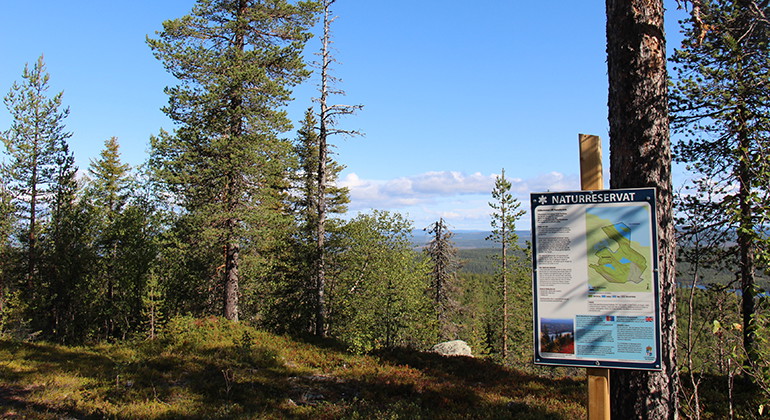
Utsikt från Ruotevare.
Foto: Länsstyrelsen Norrbotten -
Ruoutevare
- Naturreservat
- Amt: Norrbottens län
Handlinger
I øjeblikket
The road up to the top is quite bad, rocky and with potholes (2023).
Beskrivelse
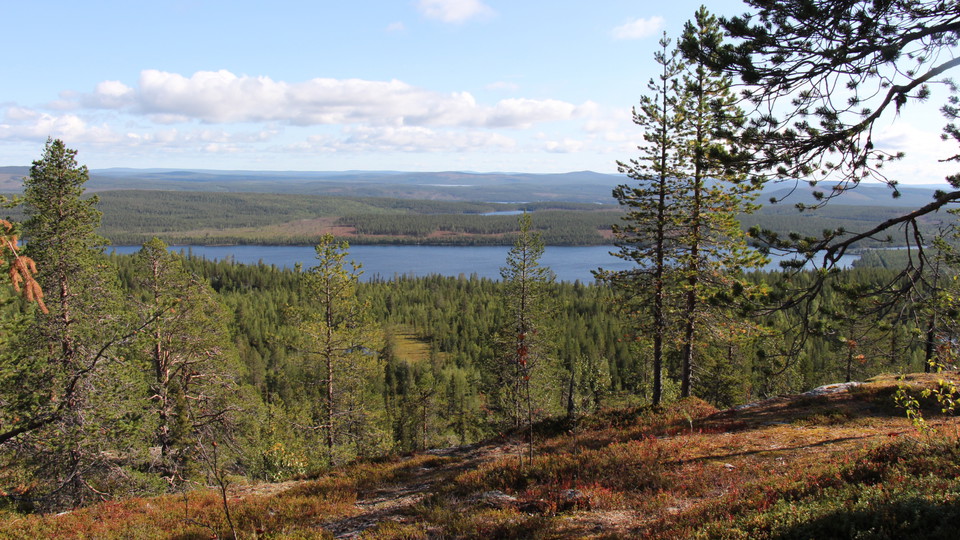
From Ruotevare mountain you have vast panorama in every direction. A large TV transmitter stands on the summit. The forest is old and pleasant to walk in. Slightly below the summit, in a curve on the logging road, a trail begins which leads eastwards to the old mining area, where iron ore was extracted in the 17th and 18th century and more recently, quartz and feldspar. The area is 2.2 square kilometres in size.
Aktiviteter og faciliteter
- Naturreservat
Fakta
Municipality: Jokkmokk
Year of formation: 2011
Size: 2.2 square kilometers
Administrator: County Administrative Board
Form of protection: Nature reserve
Parkering
There is parking at the summit.
Kommunikation
The reserve lies about 6.5 kilometres south of Jokkmokk, right on the Arctic Circle.
Rutevejledning
South of Jokkmokk, about 6.5 kilometers, right by the Arctic Circle, the reserve is located.
Regler
All regulations can be found in the reserve decision. It is permitted to: - camp - hike - make a small fire - drive a snowmobile on well snow-covered ground - pick berries and edible mushrooms - fish and hunt in accordance with applicable laws
It is not allowed to litter or damage plant and animal life. Remember the right of public access and protect nature!
Kontakt
E-mailadresse
Länsstyrelsen Norrbotten
Organisationens logotype

Jeg har været her 9

Jeg vil gerne derhen 5
Spørgsmål og svar
Stil et spørgsmål til andre Naturkartan-brugere.
Anmeldelser
0 anmeldelser
- 5 :
- 4 :
- 3 :
- 2 :
- 1 :
Brugernes billeder
Der er endnu ingen brugerbilleder. Vær den første til at dele et!
