Bästa vandringslederna i Västervik

Västervik

Naturkartan samlar de vandringslederna i Västervik som är populärast bland våra användare.

Billeder

Kort

66 Bästa vandringslederna i Västervik

Vandring

Gränsöleden

  • Kommune: Västervik
  • 6857.24 km fra dig
  • 12.0 km

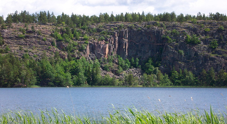
The trail runs through the nature reserve on the Gränsö peninsula. The bare cliffs combined with the grazed oak pastures of the manor landscape offer a varied and beautiful recreational environment. Gränsö nature reserve is within walking distance of Väster…

Vandring

Ankarsrumsslingan, Tjustleden

  • Kommune: Västervik
  • 6843.54 km fra dig
  • 11.9 km

**Ankarsrumsslingan is intended both for circular walks and as a connection to longer walks on the Tjustleden. If you go to Isgölen on the Ankarsrum trail, after just a few hundred meters you will find the foundation walls (of cinder block) after "Isgöhlest…

Vandring

Holmsjöleden

  • Kommune: Västervik
  • 6824.10 km fra dig
  • 9.0 km
  • Sværhedsgrad: Blå

Holmsjöleden is a trail, which mainly runs in woodland around Holmsjön. It is located west and southwest of Överum. It has a connection to the Tjustleden stage 8. Holmsjöleden is a 10-kilometer loop, which starts on the outskirts of Överum at a gravel field…

Vandring

Loftaleden

  • Kommune: Västervik
  • 6836.75 km fra dig
  • 20.0 km

**The Lofta Trail starts and ends at Lofta Church and is 20 km long. It passes through varied landscapes in partly hilly terrain with mountain slopes through a living agricultural and forestry landscape. The trail starts at Lofta Church, which dates from 18…

Vandring

Hälsans stig - Västervik

  • Kommune: Västervik
  • 6855.59 km fra dig
  • 5.1 km

There are 130 different Hälsans stig, easily accessible and well-signposted walking trails around Sweden. What the trails have in common is that they are easy to get around on and run in a loop that is usually between 3 and 6 kilometers. In Västervik, Hälsa…

Vandring

Gladhammarslederna, blå led

  • Kommune: Västervik
  • 6848.78 km fra dig
  • 9.0 km

**The three Gladhammar trails, which total around 28 km, start from Lund village. The red trail is a historical trail to Gladhammar's deserted mines, the blue and green trails are nature walks with historical elements. The blue trail starts on the old road…

Vandring

Mörtfors - Getterum - Getgölen. Tjustleden etapp 1

  • Kommune: Västervik
  • 6848.06 km fra dig
  • 19.0 km
  • Sværhedsgrad: Grøn

**The first stage of the Tjust Trail runs between Mörtfors and Getgölen and starts about 1 kilometer south of Mörtfors. The stage is about 19 kilometers long. **Stage description, from south to north (Mörtfors to Getgölen) The trail follows the shore of Sto…

Vandring

Gladhammarslederna, grön led

  • Kommune: Västervik
  • 6847.02 km fra dig
  • 13.0 km
  • Sværhedsgrad: Blå

Från Lunds by utgår de tre Gladhammarslederna, som sammanlagt är cirka 28 km. Den röda leden är en historisk led till Gladhammars ödegruvor, den blå och den gröna leden är naturvandringar med historiska inslag. Den gröna leden har samma sträckning som den b…

Vandring

Getgölen – Hjorted – Svarteström, Tjustleden etapp 2

  • Kommune: Västervik
  • 6845.12 km fra dig
  • 18.0 km
  • Sværhedsgrad: Grøn

The second stage of the Tjust Trail runs from Getgölen in the south to Svarteström in the north. Here you pass, among other things, Hjorted and the opportunity to connect to Ankarsrumsslingan. Stage description, from south to north (Getgölen to Svarteström)…

Vandring

Svarteström – Lunds by – Valstad kvarn, Tjustleden etapp 3

  • Kommune: Västervik
  • 6846.99 km fra dig
  • 18.0 km
  • Sværhedsgrad: Blå

**The third stage is about 20 km long and runs through forests, clearings and on mountain ridges, passing several large ancient monuments. Stage description 3, from south to north: The stage is about 18 kilometers long and starts at Svarteström's shelter. N…

Vandring

Valstad kvarn - Hjorten - Törnsfall, Tjustleden etapp 4

  • Kommune: Västervik
  • 6843.93 km fra dig
  • 14.0 km
  • Sværhedsgrad: Grøn

Stage 4 is about 14 kilometers via Törnsfall to the shelter at Mjösjön.Just before Törnsfall, a connection to Västervik at Marsbäcken, about 8 kilometers. If you enter the northern connection to Västervik (extended to Marsbäcken), you get a total of about 2…

Vandring

Törnsfall – Almvik – Hallingeberg, Tjustleden etapp 5

  • Kommune: Västervik
  • 6830.75 km fra dig
  • 21.0 km
  • Sværhedsgrad: Blå

Stage 5 crosses over between two northwest/southeast rift valleys. At the beginning and end of the stage, you therefore pass open, built-up cultural land at, for example, Blekhem, while the middle part consists of large unbroken forest areas where you hardl…

Vandring

Hallingeberg – Karrum – Odensvi, Tjustleden etapp 6

  • Kommune: Västervik
  • 6821.64 km fra dig
  • 21.0 km
  • Sværhedsgrad: Blå

**Stage 6 of the Just Trail between Hallingeberg and Odensvi takes you past sights such as Hallingeberg church, Hängesten and bathing spots at Sixgö and Kyrksjön. Stage description, from south to north (Hallingeberg to Odensvi): Stage 6 starts north of Hall…

Vandring

Hummelstadleden

  • Kommune: Västervik
  • 6835.39 km fra dig
  • 5.2 km

The Hummelstad Trail starts at the old school in Hummelstad and is about 6.3 km long. The trail goes through the landscape and up several viewing mountains. For the Hummelstad Trail, you start the hike on the oldest country road, which dates from the 1600s.…

Vandring

Odensvi – Dalhem – Björndalen, Tjustleden etapp 7

  • Kommune: Västervik
  • 6817.43 km fra dig
  • 20.0 km
  • Sværhedsgrad: Blå

**The seventh stage of the Tjust Trail between Odensvi and Björndalen is about 20 km long and runs through the deciduous forest from Kyrksjön. **Stage description, from south to north (Odensvi to Björndalen) Stage 7 starts at the shelter in the northwestern…

Bästa vandringslederna i Västervik

Naturkartan samlar de vandringslederna i Västervik som är populärast bland våra användare.

Naturkartan

Åbn dette i appen
