Bästa vandringslederna i Älmhult

Älmhult

Naturkartan samlar de vandringslederna i Älmhult som är populärast bland våra användare.

Billeder

Kort

46 Bästa vandringslederna i Älmhult

Vandring

Sjöastabygd - På gårdagens stigar

  • Kommune: Älmhult
  • 6788.04 km fra dig
  • 5.7 km
  • Sværhedsgrad: Blå

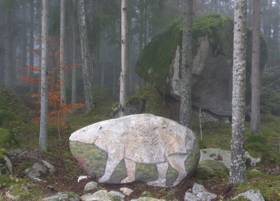
Along a cultural trail of six kilometers you can see interesting remains from old buildings and forgotten activities. During the 19th century, meager agriculture made it difficult for the locals in the southern Pjätteryd parish to support themselves. Large…

Vandring

Norra Grytleden

  • Kommune: Älmhult
  • 6817.86 km fra dig
  • 5.4 km
  • Sværhedsgrad: Blå

This hiking trail of about 5 km takes you around Norra Grytsjön. The trail goes on a path in the forest but also on gravel and forest roads in parts. There are several places to stop to watch the bird life in the lake or just enjoy the silence. Remember to…

Vandring

Konstslingan i Spjutaretorp

  • Kommune: Älmhult
  • 13.3 km
  • Sværhedsgrad: Grøn

This trail is a digital experience and must be followed in Naturkartan using GPS guidance. There are no physical markers or signs in the landscape. Some of the artworks are located very close to one another, so you may need to zoom in within the app to dist…

Vandring

Taxås vandringsled, blå

  • Kommune: Älmhult
  • 6790.19 km fra dig
  • 2.1 km

Click on the nature reserve's border or symbol in the map to read more about the reserve and what can be seen and done here.

Vandring

Östra Tångarne vandringsled, blå

  • Kommune: Älmhult
  • 6791.09 km fra dig
  • 2.6 km

Click on the nature reserve's border or symbol in the map to read more about the reserve and what can be seen and done here.

Vandring

Vandringsled, Vakö myr

  • Kommune: Älmhult
  • 6799.67 km fra dig
  • 2.0 km

Click on the nature reserve's border or symbol in the map to read more about the reserve and what can be seen and done here.

Vandring

Vandringsled, Kronan

  • Kommune: Älmhult
  • 6790.84 km fra dig
  • 1.1 km

Click on the nature reserve's border or symbol in the map to read more about the reserve and what can be seen and done here.

Vandring

Vandringsled, Göteryd

  • Kommune: Älmhult
  • 6778.33 km fra dig
  • 3.0 km

Please check out the information about the Göteryds Nature Reserve to read about the area.

Vandring

Höö vandringsled, blå

  • Kommune: Älmhult
  • 6789.18 km fra dig
  • 2.6 km

Click on the nature reserve's border or symbol in the map to read more about the reserve and what can be seen and done here.

Vandring

Delary kultur- och naturstig

  • Kommune: Älmhult
  • 6783.92 km fra dig
  • 2.3 km
  • Sværhedsgrad: Grøn

In Delary there is a walking trail with information signs about interesting cultural and natural history along the path. There is also a ramp that allows a wheelchair to come out a bit over the rushing river, when the water is released from the dam. The pa…

Vandring

Hallaryd naturstig

  • Kommune: Älmhult
  • 6783.55 km fra dig
  • 3.5 km
  • Sværhedsgrad: Grøn

In Hallaryd there is a scenic nature trail that leads the hiker along the Helge river and through forest. Along the loop there are several countertops suitable for a packed lunch. The loop is marked with yellow arrows and marks on the trees so it is easy to…

Vandring

Taxås vandringsled, gul och orange

  • Kommune: Älmhult
  • 6790.40 km fra dig
  • 2.0 km

In Taxås nature reserve there is a certain hill to reach. This hill overlooking Lake Möckeln is perfect for a picnic. Taxås consists of deciduous forest and old agricultural landscape. Here you will also find rare flowers such as blue anemone, spring onion,…

Vandring

Höö vandringsled, gul

  • Kommune: Älmhult
  • 6789.18 km fra dig
  • 1.2 km

Click on the nature reserve's border or symbol in the map to read more about the reserve and what can be seen and done here.

Vandring

Vandringsled, Hökhult

  • Kommune: Älmhult
  • 6790.92 km fra dig
  • 0.4 km

Click on the nature reserve's border or symbol in the map to read more about the reserve and what can be seen and done here.

Vandring

Sikareveln vandringsstig

  • Kommune: Älmhult
  • 6789.17 km fra dig
  • 1.6 km

Sikareveln extends straight out into Möckeln lake and has a fantastic shoreline on both sides. Here you can enjoy the impressive surroundings that were created by the ice sheet! Sikareveln is a glacial formation and is a popular resting place and overnight…

Bästa vandringslederna i Älmhult

Naturkartan samlar de vandringslederna i Älmhult som är populärast bland våra användare.

Naturkartan

Åbn dette i appen