
-
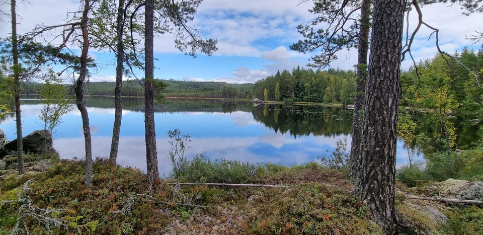
Foto: Christer Lindström
Björktjärnsrundan
- Vandring
- Trail-løb
- Vejledende beskrivelse: Falu kommun
- 6641.19 km fra dig
Ruteoplysninger
- Længde 7.3 km
Handlinger
I øjeblikket
Due to Storm Johannes, there are trees overhanging the trail, which may make it difficult to access parts of the area. Work is underway to fix this, but it may take some time before the trail is fully accessible. Watch out for fallen trees, leaning trunks, hanging branches and other signs of instability in the forest.
Beskrivelse
Björktjärnsrundan starts at the water tower in Rönndalen (Enviken) and partly follows the electric light trail and the 7 km trail, but also goes on trails for some of its own stretches. Go to the right of the snowmobile garage at the starting point to begin the hike.
Björktjärnsrundan is a circular trail of about 7.5 km in easy terrain and up at Björktjärn you can stop and have a coffee at a shelter.
Park your car at the water tower and follow the orange markings anticlockwise (recommended).
Aktiviteter og faciliteter
- Vandring
- Trail-løb
Fakta
The trail is marked with orange trail markings and is managed by Envikens hembygdsförening.
Downloads
Kontakt
E-mailadresse
Kontaktcenter Falu kommun
Organisationens logo

Jeg har været her 4

Jeg vil gerne derhen 10

Spørgsmål og svar
Stil et spørgsmål til andre Naturkartan-brugere.
Anmeldelser
1 anmeldelse
- 5 :
- 4 :
- 3 :
- 2 :
- 1 :
Brugernes billeder
Der er endnu ingen brugerbilleder. Vær den første til at dele et!

Beskrivning över sträckan stämmer bra. En trevlig runda med varierande terräng. Några få partier var lite blöta men det var inga problem att gå rundan med gymnastikskor.