
-
Ingeborg May -
Vitsåravinen
- Teren rekreacyjny
- Województwo: Stockholms län
Akcje
Opis
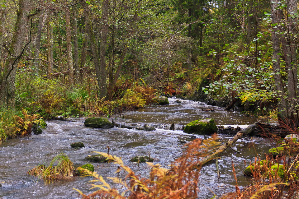
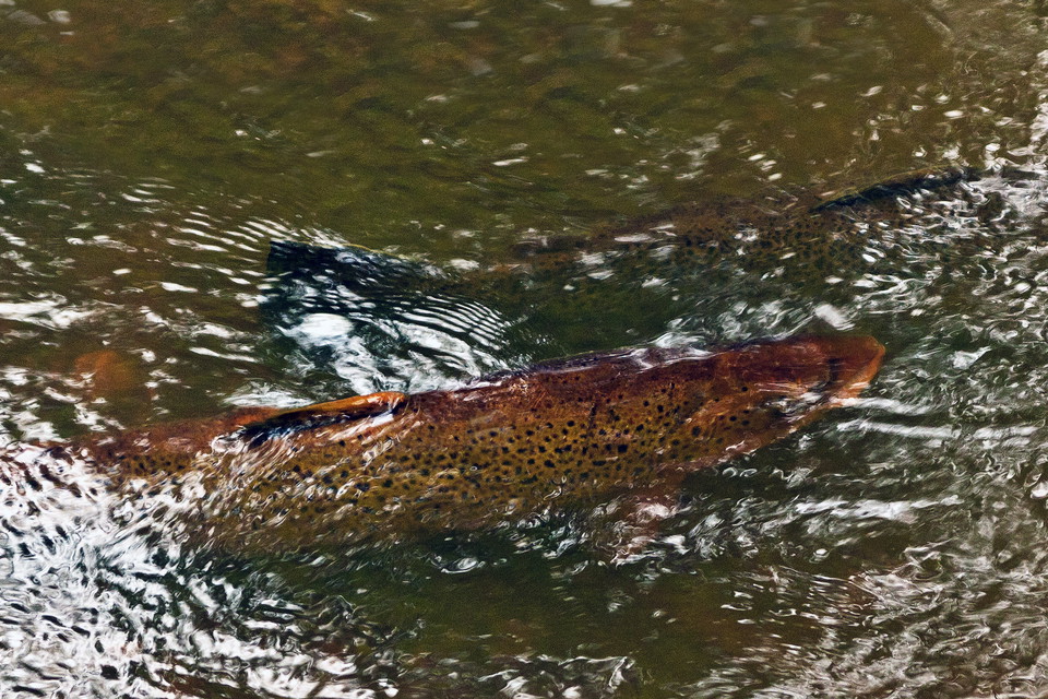
Near its outlet at Berga, Vitsån has formed a very beautiful stream gorge with flowing water. An almost primeval spruce forest grows along the edges of the ravine, with elements of deciduous trees. There is a lot of dead wood, where rare beetles have been found. The ravine is one of the few primeval forest areas left in the municipality. In winter, the common tern is usually found by the stream, and in summer beautiful blue damselflies dance over the water. In the fall, you can see sea trout as they make their way up the stream to spawn. They spawn here in the gravel of the stream channel. A former dam at the small bridge in the southern part was removed in 2017-2018. The bottom of the watercourse closest to the bridge has been given new gravel and boulders. Now fish and other aquatic animals can freely migrate up the watercourse again.
Vitsån's water comes all the way from Tornberget Nature Reserve and the lakes Öran and Långsjön in Hanveden. It flows through Tungelsta and past Fors on its way down to Berga and Horsfjärden in the Baltic Sea. During rain and snowmelt, there is a lot of water here.
Along the eastern side of the ravine there is a grassy gravel road (the one on the map) from which you can look down towards the ravine and also hear the rushing roar of the stream at high tide. The gravel road is about 400 meters long. From it, you can descend to the stream in some places and follow game trails that follow the water's edge. Wildlife trails can also be followed down to the water on the west side of the river. The gravel road is closed to car traffic and there is no parking.
Działania i udogodnienia
- Teren rekreacyjny
Wskazówki dojazdu
Autobus 846 z Västerhaninge, wyjazd na most Berga. Wejście na południe od skrzyżowania / Årsta Havsbadsvägen.
Kontakt
Adres
Kontakta oss om du har frågor om Haninges Naturkarta.
Adres e-mail
Należy pamiętać, że niektóre z tych tekstów zostały przetłumaczone automatycznie.
Byłam tu 4

Chcę tu iść 11
Pytania i Odpowiedzi
Zadaj pytanie innym użytkownikom Naturkartan.
Opinie
0 recenzji
- 5 :
- 4 :
- 3 :
- 2 :
- 1 :
Zdjęcia użytkowników
Nie ma jeszcze żadnych zdjęć użytkowników. Bądź pierwszym, który je udostępni!
