
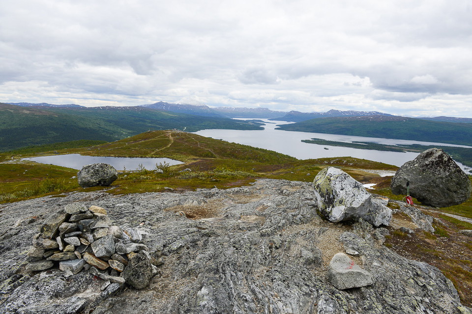
Laxfjället från Kanahobbsvägen
- Vandring
- Amt: Västerbottens län
- 6372.38 km fra dig
Ruteoplysninger
- Længde 1.4 km
Handlinger
Beskrivelse
Aktiviteter og faciliteter
- Vandring
Fakta
Three options to get up
- Laxfjället from Tärnaby Fjällby. From the valley station of the cable car, a path leads up to the top of the cable car. The path is steep in places. Length: 4 km round trip. Height difference 370 m. Time: 2-3 hours.
- Laxfjället from Tärnaby Fjällhotell. The trail starts at the hotel and from Ingemarbacken's parking lot and continues via Ringbranten up to the top of the cable car. Length: 4 km round trip. Height difference: 370 m Time: 3-4 hours.
- Laxfjället from Fjällvägen. Follow the road past the campsite at Tärnaån to the parking lot at the end of the road, 4 kilometers. From the parking lot there are two options; either the short and relatively steep path up to Kanahobben and the top of Anjaliften, or the slightly flatter but also wetter path over the marshes (starts right next to the notice board). Length: 2 km round trip. Height difference: 150 m to the top. Time: 1-2 hours.
Parkering
There is a large parking lot at the end of Fjällvägen. The trail starts directly adjacent to the parking lot.
Rutevejledning
Follow the road (Fjällvägen) past Tärnaby camping to the parking lot at the end of the road, four kilometers.
Kontakt
Adresse
+46 (0)954-140 33
E-mailadresse
Turistinformation Hemavan Tärnaby
Jeg har været her 35






Jeg vil gerne derhen 20

Anmeldelser
—
0 anmeldelser
- 5 :
- 4 :
- 3 :
- 2 :
- 1 :
Spørgsmål og svar
Stil et spørgsmål til andre Naturkartan-brugere.
Brugernes billeder
Del dine billeder fra stedet!
