
-
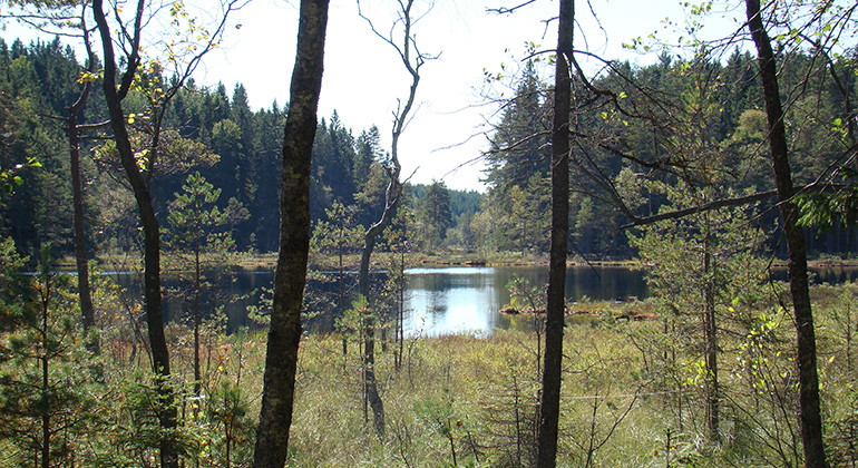
Utsikt mot tjärn. Foto Jenny Sander.
Kesebotten, Naturreservat
- Naturreservat
- Amt: Värmlands län
Handlinger
Beskrivelse
The abundance of coarse deciduous trees and dead wood means that the area is home to a large number of species that are otherwise hard pressed in today's forest landscape.
Each old-growth forest bears the mark of its history. In the Kesebotten nature reserve, it is primarily fire and man that have affected the forest. The area consists partly of old coniferous forest with relatively little impact from modern forestry, but with clear traces of several older fires. However, parts of Kesebotten have been subject to more or less extensive forestry measures. These parts are to be restored to more natural forest-like conditions. This means that the stock of dead wood in all forms must be increased, as well as the proportion of old and coarse trees, and that a development towards layered and uneven-aged stands with gaps in the canopy must be promoted.
The reserve was established to preserve the area's natural forest qualities and a number of threatened species. The area is part of the EU's Natura 2000 network of valuable nature sites. The EU's Life-Nature fund has part-financed the information and protection of this Natura 2000 site. The area also contains the remains of old settlements.
Directions to the area
Appropriate directions are missing. Before new directions are ready, please search at http://www.hitta.se/Route.aspx Type "Kesebotten nature reserve" in the "Where are you going?" field. Press the button "Find there" and you will get directions with a map. From the barrier it is about 3 kilometers to the reserve.
NOTE! The barrier down by the "big road" is closed all year round. Do not enter if the barrier is open as it may be locked when you leave.
Aktiviteter og faciliteter
- Naturreservat
Fakta
Established: 1998
Size: 192 hectares
Landowners: State and private
Manager: County Administrative Board in Värmland County
Rutevejledning
Location: Värmland county, Årjäng municipality, about 12 km NNW Karlanda church, by the lakes Mögsjön and Yxnetjärn. Suitable directions are missing. Before new directions are ready, please search at http://www.hitta.se/Route.aspx Write "nature reserve Kesebotten" in the field "Where are you going?". Click on the "Find there" button and you will get directions with a map. NOTE! The barrier down by the "big road" is closed all year round. Do not enter if the barrier is open as it may be locked when you leave. From the gate it is about 3 kilometers to the reserve.
Regler
It is prohibited to:
- capture, disturb or injure mammals, birds, frogs and reptiles, as well as damage their nests and breeding sites or collect eggs
- bring dogs or cats that are not kept on a leash
- driving vehicles or riding horses
- collecting invertebrates, such as beetles or land snails
- breaking twigs or branches, damaging or removing trees or shrubs, including dead wood such as dry trees or dry branches
- picking or digging up vascular plants, mosses, lichens or wood fungi
- start a fire
- damaging or removing any natural object or surface formation or damaging the ground cover
- pitching tents, hiding places or similar
- marking out tracks, organizing orienteering checks or holding competitions
- putting up a board, sign, inscription, poster or similar.
Without the permission of the county administrative board, it is forbidden to:
- make organized use of the area (tourism, teaching, etc.)
- carry out scientific or other research.
Kontakt
E-mailadresse
Maila Länsstyrelsen Värmland
Organisationens logotype

Jeg har været her
Jeg vil gerne derhen
Spørgsmål og svar
Stil et spørgsmål til andre Naturkartan-brugere.
Anmeldelser
0 anmeldelser
- 5 :
- 4 :
- 3 :
- 2 :
- 1 :
Brugernes billeder
Der er endnu ingen brugerbilleder. Vær den første til at dele et!
