
-
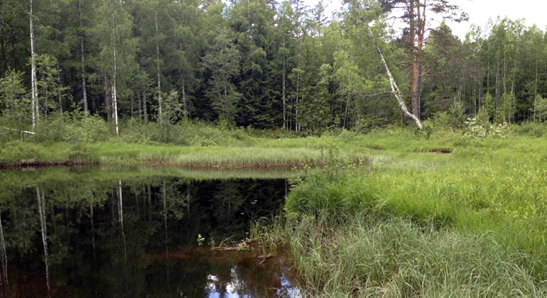
Dansarbacken, Kaljoxadalen.
Foto: Elisabeth Karlsson -
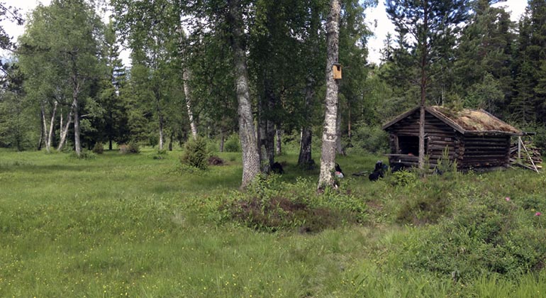
Dansarbacken, Kaljoxadalen.
Foto: Elisabeth Karlsson -
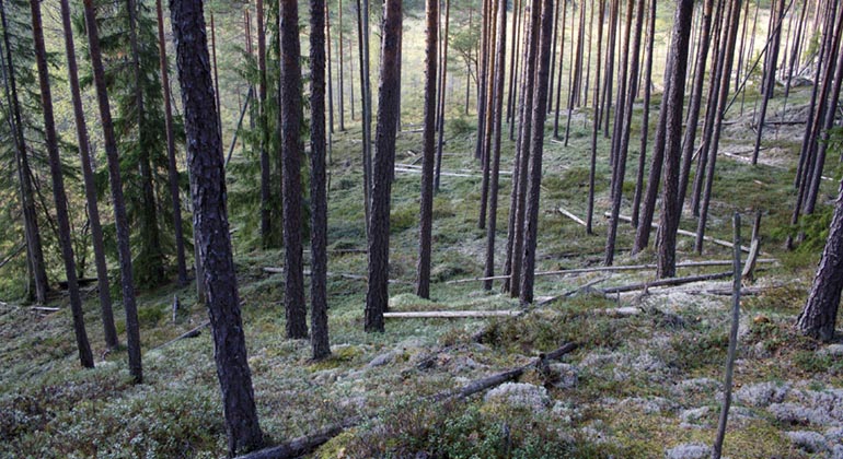
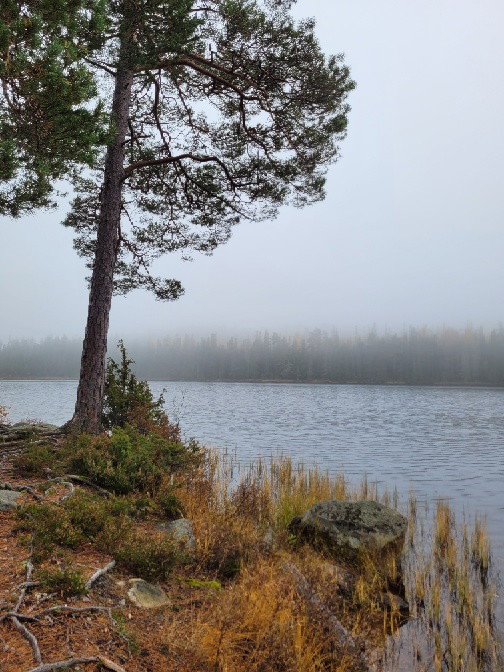
Komoramossen, Kaljoxadalen.
Foto: Kjell Store
Kaljoxadalen, Naturreservat
- Naturreservat
- Amt: Örebro län
Handlinger
Beskrivelse
The Kaljoxadalen nature reserve is one of Örebro County's largest protected wilderness areas. It borders the Nittälvsbrännan reserve to the north and together the reserves have an area of just over 700 hectares. Kaljoxadalen is a varied landscape with mountains and forests as well as moors and marshes. This means that the reserve also has a rich plant and animal life.
Nature reserves in Nittälvsdalen
A large, continuous wilderness area with many nature reserves extends along the Nittälven river.
Varied landscape
The Kaljoxa Valley offers a wide range of habitats. In the far northwest, three forested mountain heights rise with inaccessible slopes and precipices. To the east of the mountains, the landscape changes to small bogs and heath forests. The pine moors end to the east in a steep slope with tall mixed forest. A flood zone then takes over with old hay meadows next to the unregulated Nittälven meandering watercourse. On the other side of the river, a vast bog spreads out with islets and ridges. It also contains some of the most natural forest areas. Most of the reserve's more pristine forests are in the inaccessible mountainous area in the northwest.
Forests shaped by fires
The influence of natural forest fires on the landscape largely ceased at the beginning of the last century. However, the composition of the northern county's most pristine coniferous forests is largely the result of repeated fires in the past. The forest cover in the Kaljoxa valley is dominated by fire-affected pine and coniferous mixed forest. It also includes spruce forests in neglected, naturally fire-free locations. In parts of the mountain slopes, there are deciduous mixed spruce forests and deciduous fires. These contain mainly aspen and birch. In some ravines with mixed forest there are single lime trees. Throughout the reserve there are scattered traces of fire in old stumps and living pines. These pines are often 200-350 years old. A few trees are even over 400 years old. Many of the oldest pines are found at the highest altitudes. In some places there are plenty of dead standing or fallen trees, which are of great importance for certain fungi and beetles, for example.
Forestry
A large part of the forest in the Nittälven valley has been used by man over the last 400 years. Mining in particular required a lot of wood for the production of charcoal. There are several remains of charcoal kilns in the area, in the form of charcoal bunkers. When mining became unprofitable at the end of the 19th century, the forest was used instead to extract timber. The timber was floated down the Nittälven river and towed across Lake Ljusnaren to Skärets sawmill. At this time, dimensional felling of pine was common, which meant that only the largest and best trees were cut down and used as sawlogs. There are scattered, more or less well-preserved, older felling stumps throughout the Nittälven valley.
There has also been charcoal burning and dimensional felling in the Kaljoxa Valley nature reserve, but neither the older nor modern forest utilization has been as comprehensive here. The topography in parts of the area has been an obstacle to transportation and road building. The most unaffected forest is on the northern and eastern slopes of Peter-Nilsberget and Uttertjärnsberget.
In some areas with more easily accessible forest, thinning and clear felling were carried out in the early 1980s, for example on the high plateaus of Peter-Nilsberget and in Kaljoxadal. The young forests that have grown up after these clear-cuts contain a large proportion of deciduous trees, as clearing has only been carried out to a small extent. They are also compartmentalized and surrounded by older forest and therefore have good conditions for transitioning to natural mixed forest over time.
Mire mowing
There was a great need for hay in the area at the end of the 19th and beginning of the 20th centuries, as the area's iron and copper production required many draught animals. The banks of the Nittälven and the surrounding marshes were therefore often used as hayfields. Today, at best, only remnants of the timber-framed barns that once existed along the river and by the marshes remain. The barn at Dansarbacken has been moved there from another location.
Wolves and wood fungi
The size of the area, the mix of habitats and the relatively untouched forests mean that many different species of plants and animals thrive here. In recent years, almost 60 signal species (plant and animal species typical of forests worthy of protection) have been recorded among mosses, lichens and fungi. Examples include wood bustard, aspen yellow lichen, ring lichen, violet-grey thorn lichen, border thorn and star thorn. Birds and mammals of particular interest in the county include the barn owl, three-toed woodpecker, lynx and wolf.
Internationally valuable Ramsar site
Sweden has designated the Nittälven River as a Ramsar site, which includes the Kaljoxa Valley nature reserve. The Ramsar Convention is an international agreement aimed at achieving conservation and sustainable use of wetlands. Among other things, the countries that have signed the convention must designate the most valuable wetland and aquatic environments in the country as Ramsar sites and ensure that they are preserved.
Fire as nature conservation management
In the past, forest fires were a common occurrence in our forests, here and there in the reserve you will find traces of old pine trees after older forest fires. Fire is a necessity for a large number of plants and animals, which over the millennia have adapted to the habitat provided by fire. In order to benefit and preserve the area's fire-favoring species, the County Administrative Board carries out controlled conservation burns in the nature reserve.
More information about conservation burning
Completed conservation burns
In June 2023, a conservation burn was carried out in an area from Dansarbacken in the Kaljoxadalen nature reserve to the southwestern part of the Nittälvsbrännan nature reserve
Life2Taiga
During the years 2022-2028, parts of the area are included in a project with conservation burning in focus, Life2Taiga.
Accessibility
Several marked trails and the Post Trail run through the nature reserve. Along these there are also four shelters where you can spend the night. During the summer there are plenty of gnats and mosquitoes, so don't forget mosquito nets! At several of the shelters there are fireplaces with associated wood storage. Remember to burn in moderation, so that there is enough wood for future visitors. We regularly replenish firewood but cannot guarantee availability at all times. If you want to be sure to be able to make a fire - bring your own firewood (it is not allowed to burn twigs and branches from the forest in the nature reserve).
Frode's hut
The log cabin is reached via a marked path in the reserve and the Post Trail and can accommodate 4 beds. Please note that the cabin cannot be booked, so it is important to get along with any guests already on site or connecting. Please note that it is forbidden to drive cars or other motorized vehicles to the cabin. (The cabin replaces the previously burned down Eskil's hut that stood on the same site).
Sign interpreted information
Aktiviteter og faciliteter
- Naturreservat
Fakta
Municipality: Ljusnarsberg, Hällefors
Year established: 2005
Area: 598 hectares
Landowner: Swedish Environmental Protection Agency
Manager: County Administrative Board
Reserve creator: County Administrative Board
Natura 2000: parts of the area are part of the EU's network of protected nature, SE0240160 Uttertjärnsberget
Ramsar: the area is included in the global nature conservation convention Ramsar
Rutevejledning
Kaljoxadalen is located in the Nittälvsdalen valley on both sides of the Nittälven river about 15 km NW of Kopparberg and 10 km NW of Bredsjö. Go from Kopparberg towards Skäret and further about 4 km northwest. Turn left and after about 400 m left again towards Kolbron and Havsjön. After you have passed Kolbron over Nittälven, turn off the first road to the right (north) towards Dansarbacken. Follow this for about 4 km.
Regler
In the nature reserve it is forbidden to:
- remove or damage dead trees or parts of trees
- collecting mosses, lichens and fungi that grow on trees
- make a fire other than in the designated place
Kontakt
E-mailadresse
Organisationens logotype
Jeg har været her 5

Jeg vil gerne derhen 14



Spørgsmål og svar
Stil et spørgsmål til andre Naturkartan-brugere.
Anmeldelser
0 anmeldelser
- 5 :
- 4 :
- 3 :
- 2 :
- 1 :
Brugernes billeder
Der er endnu ingen brugerbilleder. Vær den første til at dele et!
