
Brändknösarna
- Naturreservat
- Amt: Norrbottens län
Handlinger
Beskrivelse
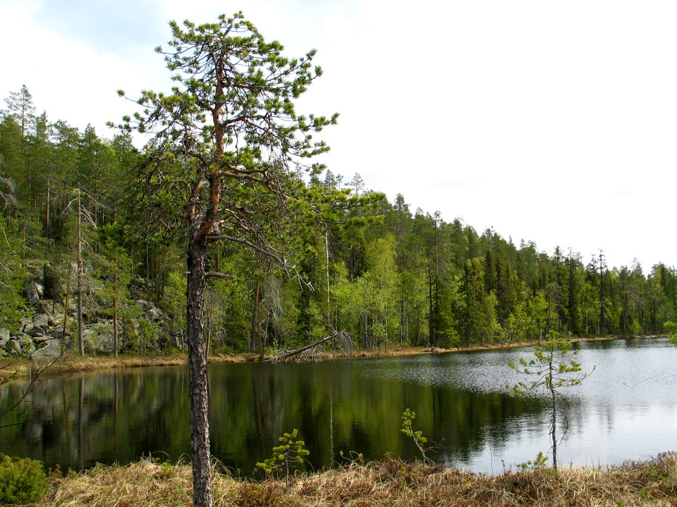
Here you find undisturbed old coniferous forests with many rare species, for example the little wood-living polypore skeletocutis odora. In the southern part lies Lake Furuträsket and in the northwest lies the small lake Märkbergstjärnen. The area is 1.6 square kilometres.
Aktiviteter og faciliteter
- Naturreservat
Fakta
Municipality: Överkalix
Founded: 2009
Size: 1.6 square kilometers
Administrator: County Administrative Board
Form of protection: Nature reserve
Kommunikation
Brändknösarna is situated east of the Kalix river, about 30 kilometres north of Överkalix community. From Överkalix, road 392 runs north alongside the Kalix river. At Mjölaskatan, you turn off eastwards on a road that leads up to the reserve.
Rutevejledning
Brändknösarna is located east of the Kalix River about 30 kilometers north of Överkalix. From Överkalix, road 392 runs north along the Kalix River. At Mjölaskatan there is a turn-off to the east that leads up to the reserve.
Regler
All regulations can be found in the reserve decision. It is allowed to:
- hiking - camping - making fires - picking berries and edible mushrooms - driving snowmobiles on snow-covered ground - fishing and hunting in accordance with the laws in force
It is not allowed to damage plant and animal life. Remember the right of public access and protect nature!
Text
Kontakt
E-mailadresse
Länsstyrelsen Norrbotten
Organisationens logotype

Jeg har været her 1

Jeg vil gerne derhen 2
Spørgsmål og svar
Stil et spørgsmål til andre Naturkartan-brugere.
Anmeldelser
0 anmeldelser
- 5 :
- 4 :
- 3 :
- 2 :
- 1 :
Brugernes billeder
Der er endnu ingen brugerbilleder. Vær den første til at dele et!
