-
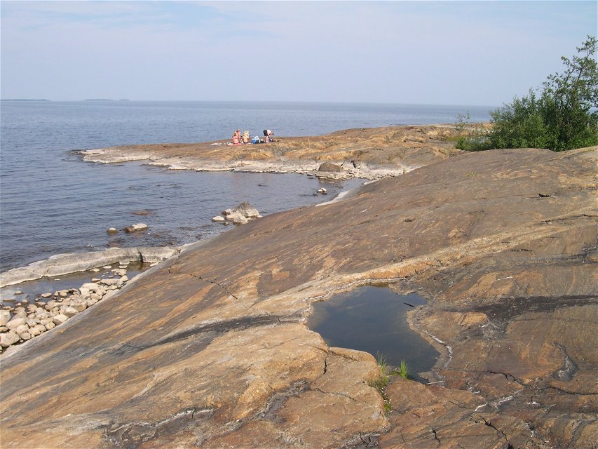
Foto: Länsstyrelsen Västerbotten -
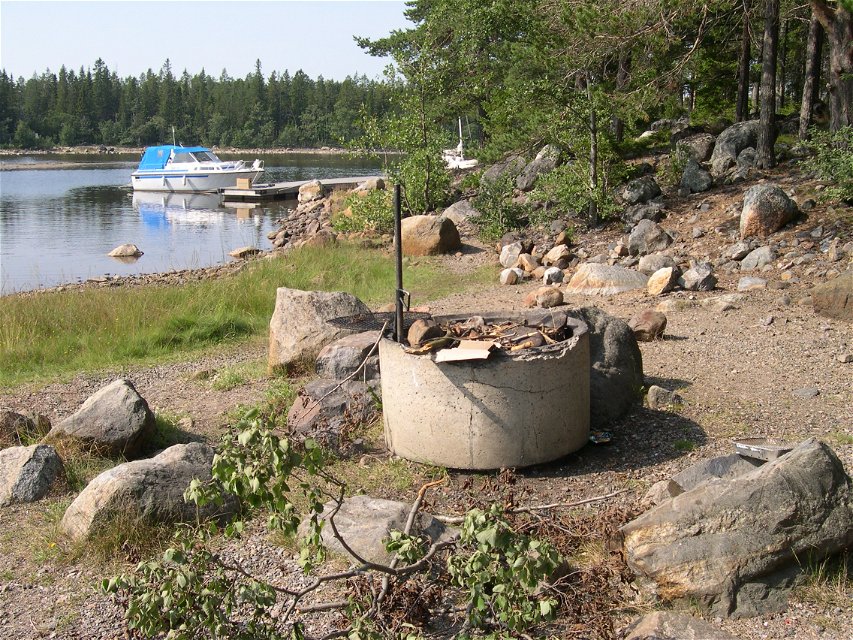
Foto: Länsstyrelsen Västerbotten

Burehällorna
Naturschutzgebiet
- Landkreis: Västerbottens län
- 6680.67 km von Ihnen entfernt
Aktionen
Beschreibung
The impact of the sea and the wind on Burehällorna is clear. Along the north-western coast you can find beautifully abraded flat rocks. And there are also delightful sandy beaches in the north and south.
By boat
Burehällorna is an important destination for anyone with a boat. Along the south-western beach there is a natural harbour, jetties and several facilities to support life in the great outdoors. The flat rocks were previously an island in the archipelago area, but due to the rising land, they are now connected to the mainland.
Messages on the cliffs
On the rocks you can find loads of messages engraved by previous visitors. The outermost rock is known as Trappman’s Rock, and was named after an exciting and tragic story. “A soldier called Trappman from Uttersjön ran aground on the rock one stormy night in 1863. His boat sank and the man clambered up onto the land. However, he froze to death and was found kneeling with his hands clasped in prayer”.
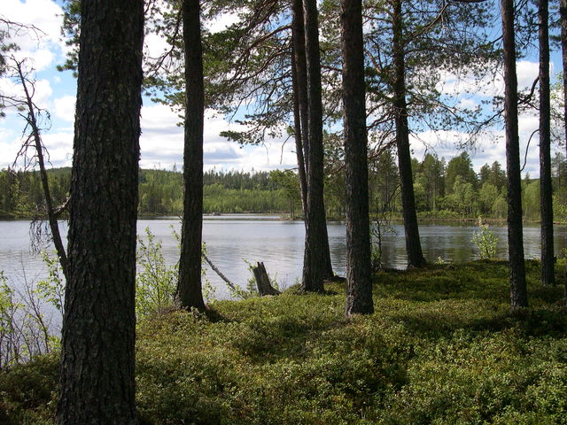
Forest and shingle
Apart from the wonderful sandy beaches in the north and south, there is plenty of shingle, which is typical for the coast of Västerbotten. Pine forest also grows in Burehällorna. The existence of a forest so close to the sea is important for plant and animal life. It is made even better by the dead trees that are allowed to remain in the area.
Aktivitäten und Einrichtungen
-
Naturschutzgebiet
Anleitung
Burehällorna ligger utanför Tällön på Burekusten söder om Skellefteå.
Kontakt
E-Mail-Adresse
Länsstyrelsen Västerbotten
Logotyp der Organisation
![]()
Fragen & Antworten
Stellen Sie eine Frage an andere Naturkartan-Nutzer.
Bewertungen
Das könnte Sie auch interessieren