-

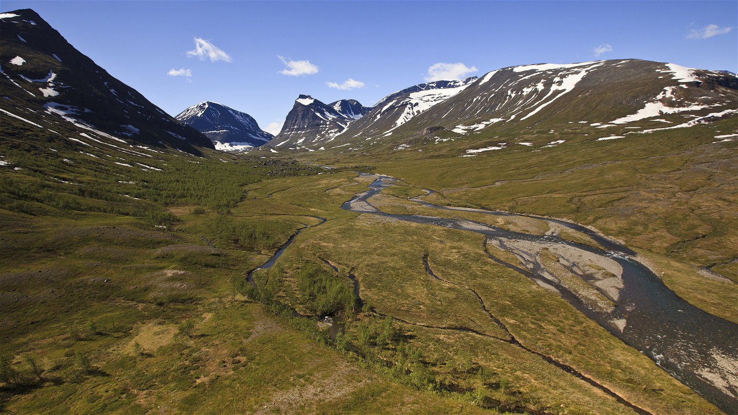
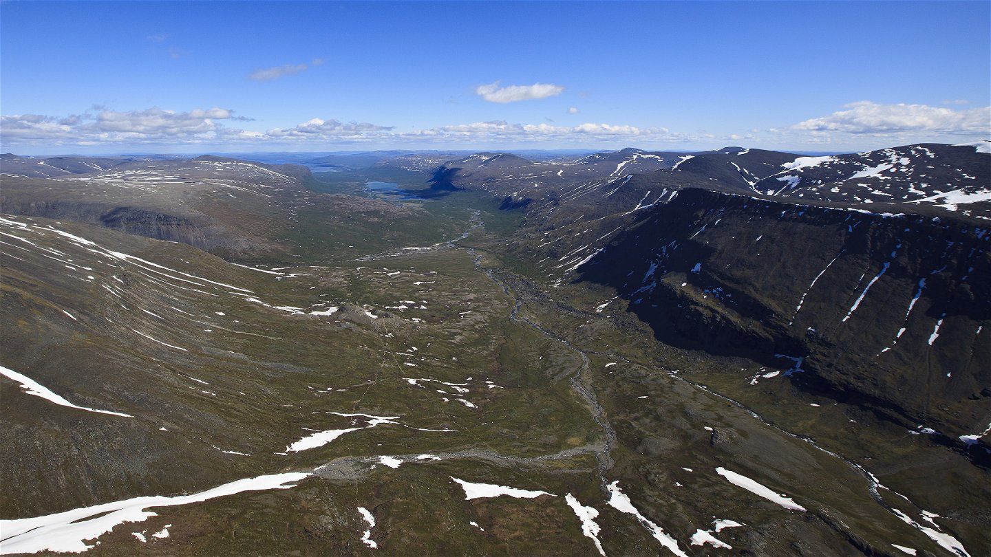
Láddjuvággi med utsikt västerut mot Kebnekaise och Duolbagorni.
Foto: Jan-Erik Nilsson/Länsstyrelsen -
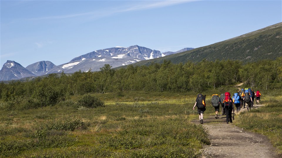
Vandrare på leden mellan Nikkaluokta och Kebnekaise.
Foto: Jan-Erik Nilsson/Länsstyrelsen -
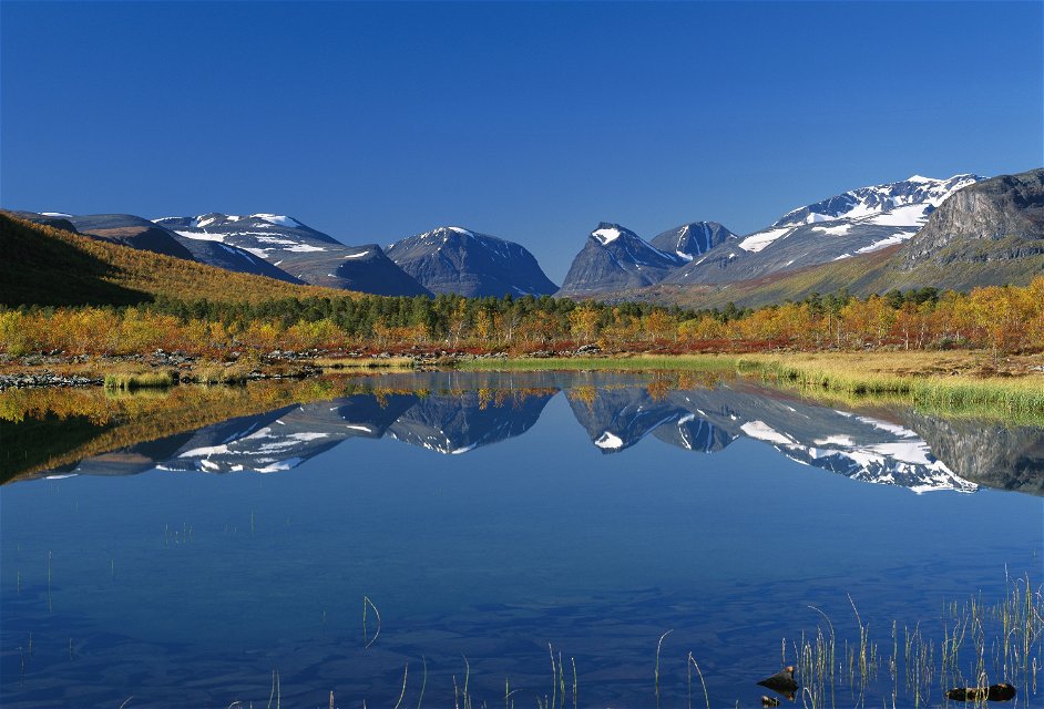
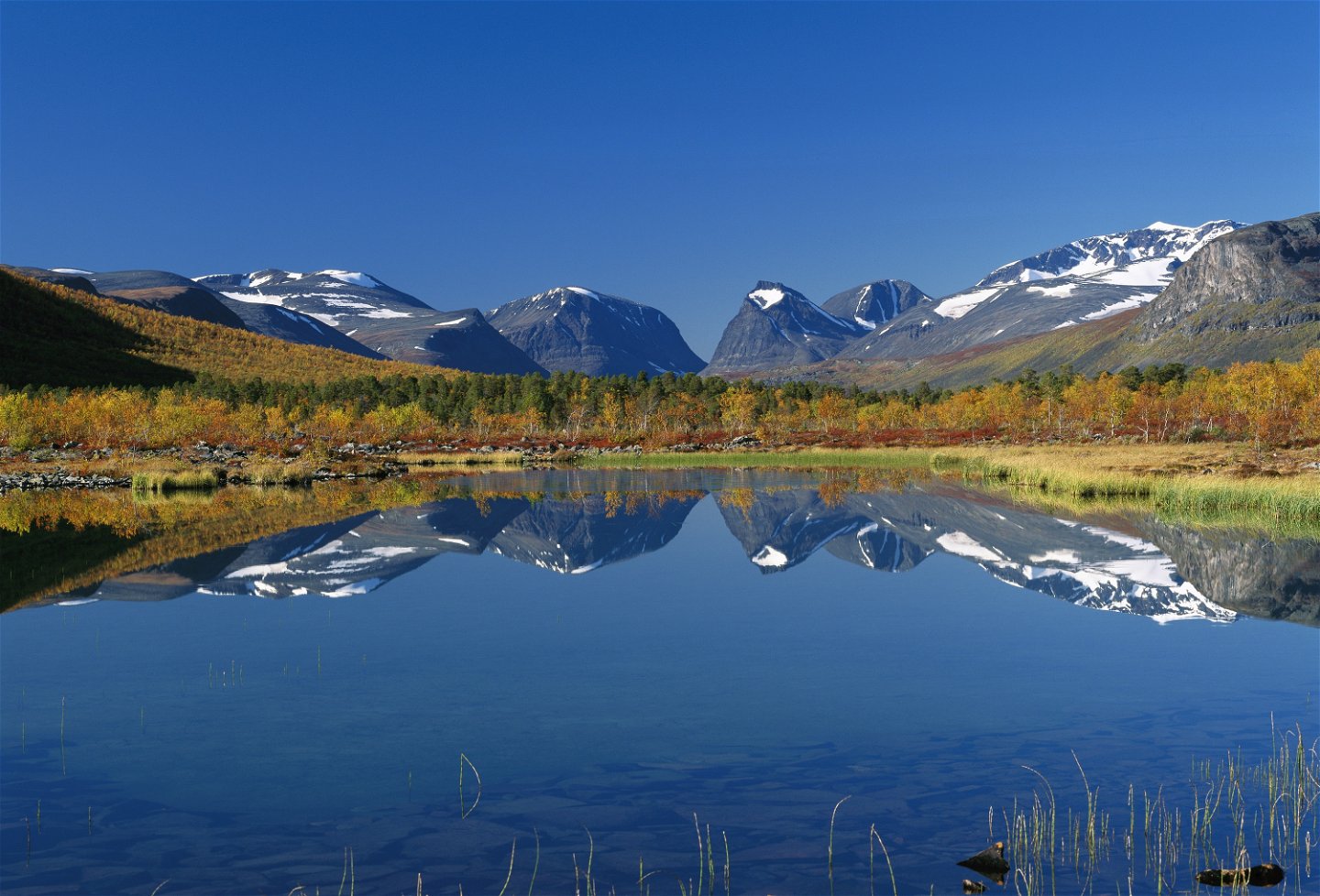
Sjön Láddjujávri med vy mot Kebnekaise och Duolbagorni.
Foto: Håkan Hjort/Johnér -

Láddjuvággi österut mot Nikkaluokta.
Foto: Jan-Erik Nilsson/Länsstyrelsen


Kebnekaise fjällstation-Nikkaluokta
Wandern
- Landkreis: Länsstyrelsen Norrbottens län
- 6397.58 km von Ihnen entfernt
Details zum Weg
- Länge 19.0 km
Aktionen
Aktuell
July 7th 2023: Along the Nikkaluokta-Kebnekaise mountain station, the trail has previously been eroded by high flows. The Norrbotten County Administrative Board has built temporary footbridges across the most affected places. At present, the route is easy to walk, but hikers can expect a little waterier hiking than usual in the event of rainy seasons
June 26 2023: Limited access to the trail: Parts of the trail have eroded due to high water flow and rain. The situation for hikers is difficult about three kilometres from Nikkaluokta, before the bridge over Čievrrajohka. The County Administrative Board of Norrbotten is working to solve the problem as soon as possible.
Beschreibung
The hike begins above the tree line, but fairly soon you will again see the verdant mountain birch forest. Take the opportunity to turn back now and then to admire the beauty of the Kebnekaise massif. After a kilometre from Kebnekaise mountain station you come to a suspension bridge over the Darfáljohka Canyon. Here there is a latrine and possible tent pitch. The stream’s water is made turbid by stone particles and minerals from the glaciers in the Kebnekaise massif. Further down in the valley that glacial sludge forms the delta in the turquoise coloured Lake Láddjujávri.
After Darfáljohka you follow an easy downward slope to the mountain birch forest. The path is stony and can therefore feel a little difficult. Apart from King’s Trail hikers you will meet many hikers intent on climbing to the highest summit of Kebnekaise.
After 8 kilometres you reach a place where the boat calls, the upper boat landing. From here you can shorten your hike by 6 km by taking the boat across Láddjujávri. From June until September the boat keeps to a timetable, and the trip takes 20 – 30 minutes. Where the boat stops at the lower boat landing there is a restaurant and accomodation (Enoks). From here you have breathtaking view across the glacial lake, with the Kebnekaise massif as the centrepiece. If you choose to hike instead of taking the boat, you take a fairly hilly and partially stony path that follows Lake Láddjujávri.
The remaining hike to Nikkaluokta is easy and on a broad path. With roughly 3 km remaining to Nikkaluokta you come to the suspension bridge over the stream Čievrrajohka, which is a good spot for a rest. There are good tent pitching sites practically everywhere along this stretch.
In Nikkaluokta there is accomodation, a restaurant an a small shop at [Nikkaluokta Sarri] (http://nikkaluokta.com/en/).
Duration: 5–6 hours
Aktivitäten und Einrichtungen
-
Wandern
Oberfläche
The trail is relatively easy to walk, with stonier sections between the Tarfala bridge and the lower boat landing.
Kommunikation
Nikkaluokta lies about 70 km from Kiruna. There is a road all the way and the simplest way to get here is by bus, unless you are driving.
Hörvalls Trafik operates the bus route. For more information, see Nikkaluoktaexpressen website.
Kontakt
E-Mail-Adresse
Länsstyrelsen Norrbotten
Logotyp der Organisation
![]()
Fragen & Antworten
Stellen Sie eine Frage an andere Naturkartan-Nutzer.